Friday, April 7, 2023

THE SIXTH SEAL: NEW YORK CITY (REV 6:12)


Earthquake activity in the New York City area


Wikipedia
Although the eastern United States is not as seismically active as regions near plate boundaries, large and damaging earthquakes do occur there. Furthermore, when these rare eastern U.S. earthquakes occur, the areas affected by them are much larger than for western U.S. earthquakes of the same magnitude. Thus, earthquakes represent at least a moderate hazard to East Coast cities, including New York City and adjacent areas of very high population density.
Seismicity in the vicinity of New York City. Data are from the U.S. Geological Survey (Top, USGS) and the National Earthquake Information Center (Bottom, NEIC). In the top figure, closed red circles indicate 1924-2006 epicenters and open black circles indicate locations of the larger earthquakes that occurred in 1737, 1783 and 1884. Green lines indicate the trace of the Ramapo fault.
As can be seen in the maps of earthquake activity in this region(shown in the figure), seismicity is scattered throughout most of the New York City area, with some hint of a concentration of earthquakes in the area surrounding Manhattan Island. The largest known earthquake in this region occurred in 1884 and had a magnitude of approximately 5.For this earthquake, observations of fallen bricks and cracked plaster were reported from eastern Pennsylvania to central Connecticut, and the maximum intensity reported was at two sites in western Long Island (Jamaica, New York and Amityville, New York). Two other earthquakes of approximately magnitude 5 occurred in this region in 1737 and 1783. The figure on the right shows maps of the distribution of earthquakes of magnitude 3 and greater that occurred in this region from 1924 to 2010, along with locations of the larger earthquakes that occurred in 1737, 1783 and 1884.

Background

The NYC area is part of the geologically complex structure of the Northern Appalachian Mountains. This complex structure was formed during the past half billion years when the Earth’s crust underlying the Northern Appalachians was the site of two major geological episodes, each of which has left its imprint on the NYC area bedrock. Between about 450 million years ago and about 250 million years ago, the Northern Appalachian region was affected by a continental collision, in which the ancient African continent collided with the ancient North American continent to form the supercontinent Pangaea. Beginning about 200 million years ago, the present-day Atlantic ocean began to form as plate tectonic forces began to rift apart the continent of Pangaea. The last major episode of geological activity to affect the bedrock in the New York area occurred about 100 million years ago, during the Mesozoic era, when continental rifting that led to the opening of the present-day Atlantic ocean formed the Hartford and Newark Mesozoic rift basins.
Earthquake rates in the northeastern United States are about 50 to 200 times lower than in California, but the earthquakes that do occur in the northeastern U.S. are typically felt over a much broader region than earthquakes of the same magnitude in the western U.S.This means the area of damage from an earthquake in the northeastern U.S. could be larger than the area of damage caused by an earthquake of the same magnitude in the western U.S. The cooler rocks in the northeastern U.S. contribute to the seismic energy propagating as much as ten times further than in the warmer rocks of California. A magnitude 4.0 eastern U.S. earthquake typically can be felt as far as 100 km (60 mi) from its epicenter, but it infrequently causes damage near its source. A magnitude 5.5 eastern U.S. earthquake, although uncommon, can be felt as far as 500 km (300 mi) from its epicenter, and can cause damage as far away as 40 km (25 mi) from its epicenter. Earthquakes stronger than about magnitude 5.0 generate ground motions that are strong enough to be damaging in the epicentral area.
At well-studied plate boundaries like the San Andreas fault system in California, scientists can often make observations that allow them to identify the specific fault on which an earthquake took place. In contrast, east of the Rocky Mountains this is rarely the case.  The NYC area is far from the boundaries of the North American plate, which are in the center of the Atlantic Ocean, in the Caribbean Sea, and along the west coast of North America. The seismicity of the northeastern U.S. is generally considered to be due to ancient zones of weakness that are being reactivated in the present-day stress field. In this model, pre-existing faults that were formed during ancient geological episodes persist in the intraplate crust, and the earthquakes occur when the present-day stress is released along these zones of weakness. The stress that causes the earthquakes is generally considered to be derived from present-day rifting at the Mid-Atlantic ridge.

Earthquakes and geologically mapped faults in the Northeastern U.S.

The northeastern U.S. has many known faults, but virtually all of the known faults have not been active for perhaps 90 million years or more. Also, the locations of the known faults are not well determined at earthquake depths. Accordingly, few (if any) earthquakes in the region can be unambiguously linked to known faults. Given the current geological and seismological data, it is difficult to determine if a known fault in this region is still active today and could produce a modern earthquake. As in most other areas east of the Rocky Mountains, the best guide to earthquake hazard in the northeastern U.S. is probably the locations of the past earthquakes themselves.

The Ramapo fault and other New York City area faults

The Ramapo Fault, which marks the western boundary of the Newark rift basin, has been argued to be a major seismically active feature of this region,but it is difficult to discern the extent to which the Ramapo fault (or any other specific mapped fault in the area) might be any more of a source of future earthquakes than any other parts of the region. The Ramapo Fault zone spans more than 185 miles (300 kilometers) in New York, New Jersey, and Pennsylvania. It is a system of faults between the northern Appalachian Mountains and Piedmont areas to the east. This fault is perhaps the best known fault zone in the Mid-Atlantic region, and some small earthquakes have been known to occur in its vicinity. Recently, public knowledge about the fault has increased – especially after the 1970s, when the fault’s proximity to the Indian Point nuclear plant in New York was noticed.
There is insufficient evidence to unequivocally demonstrate any strong correlation of earthquakes in the New York City area with specific faults or other geologic structures in this region. The damaging earthquake affecting New York City in 1884 was probably not associated with the Ramapo fault because the strongest shaking from that earthquake occurred on Long Island (quite far from the trace of the Ramapo fault). The relationship between faults and earthquakes in the New York City area is currently understood to be more complex than any simple association of a specific earthquake with a specific mapped fault.
A 2008 study argued that a magnitude 6 or 7 earthquake might originate from the Ramapo fault zone, which would almost definitely spawn hundreds or even thousands of fatalities and billions of dollars in damage. Studying around 400 earthquakes over the past 300 years, the study also argued that there was an additional fault zone extending from the Ramapo Fault zone into southwestern Connecticut. As can be seen in the above figure of seismicity, earthquakes are scattered throughout this region, with no particular concentration of activity along the Ramapo fault, or along the hypothesized fault zone extending into southwestern Connecticut.
Just off the northern terminus of the Ramapo fault is the Indian Point Nuclear Power Plant, built between 1956 and 1960 by Consolidated Edison Company. The plant began operating in 1963, and it has been the subject of a controversy over concerns that an earthquake from the Ramapo fault will affect the power plant. Whether or not the Ramapo fault actually does pose a threat to this nuclear power plant remains an open question.

Thursday, April 6, 2023

History Says Expect The Sixth Seal In New York (Revelation 6:12)

         image-8


According to the New York Daily News, Lynn Skyes, lead author of a recent study by seismologists at the Lamont-Doherty Earth Observatory adds that a magnitude-6 quake hits the area about every 670 years, and magnitude-7 every 3,400 years.
A 5.2-magnitude quake shook New York City in 1737 and another of the same severity hit in 1884.
Tremors were felt from Maine to Virginia.
There are several fault lines in the metro area, including one along Manhattan’s 125th St. – which may have generated two small tremors in 1981 and may have been the source of the major 1737 earthquake, says Armbruster.
“The problem here comes from many subtle faults,” explained Skyes after the study was published.
He adds: “We now see there is earthquake activity on them. Each one is small, but when you add them up, they are probably more dangerous than we thought.”
Armbruster says a 5.0-magnitude earthquake today likely would result in casualties and hundreds of millions of dollars in damage.
“I would expect some people to be killed,” he notes.
The scope and scale of damage would multiply exponentially with each additional tick on the Richter scale. (ANI)

Wednesday, April 5, 2023

Nostradamus and the Sixth Seal


Completed February 5, 2008
Les Propheties
(Century 1 Quatrain 27)
Michel de Nostredame Earth-shaking fire from the center of the earth.Will cause the towers around the New City to shake,Two great rocks for a long time will make war, And then Arethusa will color a new river red.(And then areth USA will color a new river red.) Earth-shaking fire from the center of the earth.Will cause the towers around the New City to shake,Two great rocks for a long time will make war
There is recent scientific evidence from drill core sampling in Manhattan, that the southern peninsula is overlapped by several tectonic plates. Drill core sampling has been taken from regions south of Canal Street including the Trade Towers’ site. Of particular concern is that similar core samples have been found across the East River in Brooklyn. There are also multiple fault lines along Manhattancorrelating with north-northwest and northwest trending neo-tectonic activity. And as recently as January and October of 2001, New York City has sustained earthquakes along these plates. For there are “two great rocks” or tectonic plates that shear across Manhattan in a northwestern pattern. And these plates “for a longtime will make war”, for they have been shearing against one other for millions of years. And on January 3 of 2010, when they makewar with each other one last time, the sixth seal shall be opened, and all will know that the end is near.
And then Arethusa will color a new river red.
Arethusa is a Greek mythological figure, a beautiful huntress and afollower of the goddess Artemis. And like Artemis, Arethusa would have nothing to do with me; rather she loved to run and hunt in the forest. But one day after an exhausting hunt, she came to a clear crystal stream and went in it to take a swim. She felt something from beneath her, and frightened she scampered out of the water. A voice came from the water, “Why are you leaving fair maiden?” She ran into the forest to escape, for the voice was from Alpheus, the god of the river. For he had fallen in love with her and became a human to give chase after her. Arethusa in exhaustion called out to Artemis for help, and the goddess hid her by changing her into a spring.But not into an ordinary spring, but an underground channel that traveled under the ocean from Greece to Sicily. But Alpheus being the god of the river, converted back into water and plunged downthe same channel after Arethusa. And thus Arethusa was captured by Artemis, and their waters would mingle together forever. And of great concern is that core samples found in train tunnels beneath the Hudson River are identical to those taken from southern Manhattan. Furthermore, several fault lines from the 2001 earthquakes were discovered in the Queen’s Tunnel Complex, NYC Water Tunnel #3. And a few years ago, a map of Manhattan drawn up in 1874 was discovered, showing a maze of underground waterways and lakes. For Manhattan was once a marshland and labyrinth of underground streams. Thus when the sixth seal is broken, the subways of the New City shall be flooded be Arethusa:the waters from the underground streams and the waters from the sea. And Arethusa shall be broken into two. And then Arethusa will color a new river red.
And then areth USA will color a new river red.
For Arethusa broken into two is areth USA. For areth (αρετη) is the Greek word for values. But the values of the USA are not based on morality, but on materialism and on wealth. Thus when the sixth seal is opened, Wall Street and our economy shall crash and “arethUSA”, the values of our economy shall fall “into the red.” “Then the kings of the earth and the great men and the commanders and the rich and the strong and every slave and free man hid themselves in the caves and among the rocks of the mountains; and they said to the mountains and to the rocks, ‘Fall on us and hide us from the presence of Him who sits on the throne, and from the wrath of the Lamb; for the great day of their wrath has come, and who is able to stand?’” (Revelation 6:15-17)

Tuesday, April 4, 2023

Columbia University Warns Of Sixth Seal (Revelation 6:12)


Earthquakes May Endanger New York More Than Thought, Says Study
A study by a group of prominent seismologists suggests that a pattern of subtle but active faults makes the risk of earthquakes to the New York City area substantially greater than formerly believed. Among other things, they say that the controversial Indian Point nuclear power plants, 24 miles north of the city, sit astride the previously unidentified intersection of two active seismic zones. The paper appears in the current issue of the Bulletin of the Seismological Society of America.
Many faults and a few mostly modest quakes have long been known around New York City, but the research casts them in a new light. The scientists say the insight comes from sophisticated analysis of past quakes, plus 34 years of new data on tremors, most of them perceptible only by modern seismic instruments. The evidence charts unseen but potentially powerful structures whose layout and dynamics are only now coming clearer, say the scientists. All are based at Columbia University’s Lamont-Doherty Earth Observatory, which runs the network of seismometers that monitors most of the northeastern United States.
Lead author Lynn R. Sykes said the data show that large quakes are infrequent around New Yorkcompared to more active areas like California and Japan, but that the risk is high, because of the overwhelming concentration of people and infrastructure. “The research raises the perception both of how common these events are, and, specifically, where they may occur,” he said. “It’s an extremely populated area with very large assets.” Sykes, who has studied the region for four decades, is known for his early role in establishing the global theory of plate tectonics.
The authors compiled a catalog of all 383 known earthquakes from 1677 to 2007 in a 15,000-square-mile area around New York City. Coauthor John Armbruster estimated sizes and locations of dozens of events before 1930 by combing newspaper accounts and other records. The researchers say magnitude 5 quakes—strong enough to cause damage–occurred in 1737, 1783 and 1884. There was little settlement around to be hurt by the first two quakes, whose locations are vague due to a lack of good accounts; but the last, thought to be centered under the seabed somewhere between Brooklyn and Sandy Hook, toppled chimneys across the city and New Jersey, and panicked bathers at Coney Island. Based on this, the researchers say such quakes should be routinely expected, on average, about every 100 years. “Today, with so many more buildings and people, a magnitude 5 centered below the city would be extremely attention-getting,” said Armbruster. “We’d see billions in damage, with some brick buildings falling. People would probably be killed.”
Starting in the early 1970s Lamont began collecting data on quakes from dozens of newly deployed seismometers; these have revealed further potential, including distinct zones where earthquakes concentrate, and where larger ones could come. The Lamont network, now led by coauthor Won-Young Kim, has located hundreds of small events, including a magnitude 3 every few years, which can be felt by people at the surface, but is unlikely to cause damage. These small quakes tend to cluster along a series of small, old faults in harder rocks across the region. Many of the faults were discovered decades ago when subways, water tunnels and other excavations intersected them, but conventional wisdom said they were inactive remnants of continental collisions and rifting hundreds of millions of years ago. The results clearly show that they are active, and quite capable of generating damaging quakes, said Sykes.
One major previously known feature, the Ramapo Seismic Zone, runs from eastern Pennsylvania to the mid-Hudson Valley, passing within a mile or two northwest of Indian Point. The researchers found that this system is not so much a single fracture as a braid of smaller ones, where quakes emanate from a set of still ill-defined faults. East and south of the Ramapo zone—and possibly more significant in terms of hazard–is a set of nearly parallel northwest-southeast faults. These include Manhattan’s 125th Street fault, which seems to have generated two small 1981 quakes, and could have been the source of the big 1737 quake; the Dyckman Street fault, which carried a magnitude 2 in 1989; the Mosholu Parkway fault; and the Dobbs Ferry fault in suburban Westchester, which generated the largest recent shock, a surprising magnitude 4.1, in 1985. Fortunately, it did no damage. Given the pattern, Sykes says the big 1884 quake may have hit on a yet-undetected member of this parallel family further south.
The researchers say that frequent small quakes occur in predictable ratios to larger ones, and so can be used to project a rough time scale for damaging events. Based on the lengths of the faults, the detected tremors, and calculations of how stresses build in the crust, the researchers say that magnitude 6 quakes, or even 7—respectively 10 and 100 times bigger than magnitude 5–are quite possible on the active faults they describe. They calculate that magnitude 6 quakes take place in the area about every 670 years, and sevens, every 3,400 years. The corresponding probabilities of occurrence in any 50-year period would be 7% and 1.5%. After less specific hints of these possibilities appeared in previous research, a 2003 analysis by The New York City Area Consortium for Earthquake Loss Mitigation put the cost of quakes this size in the metro New York area at $39 billion to $197 billion. A separate 2001 analysis for northern New Jersey’s Bergen County estimates that a magnitude 7 would destroy 14,000 buildings and damage 180,000 in that area alone. The researchers point out that no one knows when the last such events occurred, and say no one can predict when they next might come.
“We need to step backward from the simple old model, where you worry about one large, obvious fault, like they do in California,” said coauthor Leonardo Seeber. “The problem here comes from many subtle faults. We now see there is earthquake activity on them. Each one is small, but when you add them up, they are probably more dangerous than we thought. We need to take a very close look.” Seeber says that because the faults are mostly invisible at the surface and move infrequently, a big quake could easily hit one not yet identified. “The probability is not zero, and the damage could be great,” he said. “It could be like something out of a Greek myth.”
The researchers found concrete evidence for one significant previously unknown structure: an active seismic zone running at least 25 miles from Stamford, Conn., to the Hudson Valley town of Peekskill, N.Y., where it passes less than a mile north of the Indian Point nuclear power plant. The Stamford-Peekskill line stands out sharply on the researchers’ earthquake map, with small events clustered along its length, and to its immediate southwest. Just to the north, there are no quakes, indicating that it represents some kind of underground boundary. It is parallel to the other faults beginning at 125th Street, so the researchers believe it is a fault in the same family. Like the others, they say it is probably capable of producing at least a magnitude 6 quake. Furthermore, a mile or so on, it intersects the Ramapo seismic zone.
Sykes said the existence of the Stamford-Peekskill line had been suggested before, because the Hudson takes a sudden unexplained bend just ot the north of Indian Point, and definite traces of an old fault can be along the north side of the bend. The seismic evidence confirms it, he said. “Indian Point is situated at the intersection of the two most striking linear features marking the seismicity and also in the midst of a large population that is at risk in case of an accident,” says the paper. “This is clearly one of the least favorable sites in our study area from an earthquake hazard and risk perspective.”
The findings comes at a time when Entergy, the owner of Indian Point, is trying to relicense the two operating plants for an additional 20 years—a move being fought by surrounding communities and the New York State Attorney General. Last fall the attorney general, alerted to the then-unpublished Lamont data, told a Nuclear Regulatory Commission panel in a filing: “New data developed in the last 20 years disclose a substantially higher likelihood of significant earthquake activity in the vicinity of [Indian Point] that could exceed the earthquake design for the facility.” The state alleges that Entergy has not presented new data on earthquakes past 1979. However, in a little-noticed decision this July 31, the panel rejected the argument on procedural grounds. A source at the attorney general’s office said the state is considering its options.
The characteristics of New York’s geology and human footprint may increase the problem. Unlike in California, many New York quakes occur near the surface—in the upper mile or so—and they occur not in the broken-up, more malleable formations common where quakes are frequent, but rather in the extremely hard, rigid rocks underlying Manhattan and much of the lower Hudson Valley. Such rocks can build large stresses, then suddenly and efficiently transmit energy over long distances. “It’s like putting a hard rock in a vise,” said Seeber. “Nothing happens for a while. Then it goes with a bang.” Earthquake-resistant building codes were not introduced to New York City until 1995, and are not in effect at all in many other communities. Sinuous skyscrapers and bridges might get by with minimal damage, said Sykes, but many older, unreinforced three- to six-story brick buildings could crumble.
Art Lerner-Lam, associate director of Lamont for seismology, geology and tectonophysics, pointed out that the region’s major highways including the New York State Thruway, commuter and long-distance rail lines, and the main gas, oil and power transmission lines all cross the parallel active faults, making them particularly vulnerable to being cut. Lerner-Lam, who was not involved in the research, said that the identification of the seismic line near Indian Point “is a major substantiation of a feature that bears on the long-term earthquake risk of the northeastern United States.” He called for policymakers to develop more information on the region’s vulnerability, to take a closer look at land use and development, and to make investments to strengthen critical infrastructure.
“This is a landmark study in many ways,” said Lerner-Lam. “It gives us the best possible evidence that we have an earthquake hazard here that should be a factor in any planning decision. It crystallizes the argument that this hazard is not random. There is a structure to the location and timing of the earthquakes. This enables us to contemplate risk in an entirely different way. And since we are able to do that, we should be required to do that.”
New York Earthquake Briefs and Quotes:
Existing U.S. Geological Survey seismic hazard maps show New York City as facing more hazard than many other eastern U.S. areas. Three areas are somewhat more active—northernmost New York State, New Hampshire and South Carolina—but they have much lower populations and fewer structures. The wider forces at work include pressure exerted from continuing expansion of the mid-Atlantic Ridge thousands of miles to the east; slow westward migration of the North American continent; and the area’s intricate labyrinth of old faults, sutures and zones of weakness caused by past collisions and rifting.
Due to New York’s past history, population density and fragile, interdependent infrastructure, a 2001 analysis by the Federal Emergency Management Agency ranks it the 11th most at-risk U.S. city for earthquake damage. Among those ahead: Los Angeles, San Francisco, Seattle and Portland. Behind: Salt Lake City, Sacramento, Anchorage.
New York’s first seismic station was set up at Fordham University in the 1920s. Lamont-Doherty Earth Observatory, in Palisades, N.Y., has operated stations since 1949, and now coordinates a network of about 40.
Dozens of small quakes have been felt in the New York area. A Jan. 17, 2001 magnitude 2.4, centered  in the Upper East Side—the first ever detected in Manhattan itself–may have originated on the 125th Street fault. Some people thought it was an explosion, but no one was harmed.
The most recent felt quake, a magnitude 2.1 on July 28, 2008, was centered near Milford, N.J. Houses shook and a woman at St. Edward’s Church said she felt the building rise up under her feet—but no damage was done.
Questions about the seismic safety of the Indian Point nuclear power plant, which lies amid a metropolitan area of more than 20 million people, were raised in previous scientific papers in 1978 and 1985.
Because the hard rocks under much of New York can build up a lot strain before breaking, researchers believe that modest faults as short as 1 to 10 kilometers can cause magnitude 5 or 6 quakes.
In general, magnitude 3 quakes occur about 10 times more often than magnitude fours; 100 times more than magnitude fives; and so on. This principle is called the Gutenberg-Richter relationship.

Monday, April 3, 2023

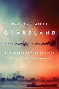
Quakeland: On the Road to America’s Next Devastating Earthquake: Revelation 6


Quakeland: On the Road to America’s Next Devastating Earthquake
Roger BilhamQuakeland: New York and the Sixth Seal (Revelation 6:12)
Given recent seismic activity — political as well as geological — it’s perhaps unsurprising that two books on earthquakes have arrived this season. One is as elegant as the score of a Beethoven symphony; the other resembles a diary of conversations overheard during a rock concert. Both are interesting, and both relate recent history to a shaky future.
Journalist Kathryn Miles’s Quakeland is a litany of bad things that happen when you provoke Earth to release its invisible but ubiquitous store of seismic-strain energy, either by removing fluids (oil, water, gas) or by adding them in copious quantities (when extracting shale gas in hydraulic fracturing, also known as fracking, or when injecting contaminated water or building reservoirs). To complete the picture, she describes at length the bad things that happen during unprovoked natural earthquakes. As its subtitle hints, the book takes the form of a road trip to visit seismic disasters both past and potential, and seismologists and earthquake engineers who have first-hand knowledge of them. Their colourful personalities, opinions and prejudices tell a story of scientific discovery and engineering remedy.
Miles poses some important societal questions. Aside from human intervention potentially triggering a really damaging earthquake, what is it actually like to live in neighbourhoods jolted daily by magnitude 1–3 earthquakes, or the occasional magnitude 5? Are these bumps in the night acceptable? And how can industries that perturb the highly stressed rocks beneath our feet deny obvious cause and effect? In 2015, the Oklahoma Geological Survey conceded that a quadrupling of the rate of magnitude-3 or more earthquakes in recent years, coinciding with a rise in fracking, was unlikely to represent a natural process. Miles does not take sides, but it’s difficult for the reader not to.
She visits New York City, marvelling at subway tunnels and unreinforced masonry almost certainly scheduled for destruction by the next moderate earthquake in the vicinity. She considers the perils of nuclear-waste storage in Nevada and Texas, and ponders the risks to Idaho miners of rock bursts — spontaneous fracture of the working face when the restraints of many million years of confinement are mined away. She contemplates the ups and downs of the Yellowstone Caldera — North America’s very own mid-continent supervolcano — and its magnificently uncertain future. Miles also touches on geothermal power plants in southern California’s Salton Sea and elsewhere; the vast US network of crumbling bridges, dams and oil-storage farms; and the magnitude 7–9 earthquakes that could hit California and the Cascadia coastline of Oregon and Washington state this century. Amid all this doom, a new elementary school on the coast near Westport, Washington, vulnerable to inbound tsunamis, is offered as a note of optimism. With foresight and much persuasion from its head teacher, it was engineered to become an elevated safe haven.
Miles briefly discusses earthquake prediction and the perils of getting it wrong (embarrassment in New Madrid, Missouri, where a quake was predicted but never materialized; prison in L’Aquila, Italy, where scientists failed to foresee a devastating seismic event) and the successes of early-warning systems, with which electronic alerts can be issued ahead of damaging seismic waves. Yes, it’s a lot to digest, but most of the book obeys the laws of physics, and it is a engaging read. One just can’t help wishing that Miles’s road trips had taken her somewhere that wasn’t a disaster waiting to happen.
Catastrophic damage in Anchorage, Alaska, in 1964, caused by the second-largest earthquake in the global instrumental record.
In The Great Quake, journalist Henry Fountain provides us with a forthright and timely reminder of the startling historical consequences of North America’s largest known earthquake, which more than half a century ago devastated southern Alaska. With its epicentre in Prince William Sound, the 1964 quake reached magnitude 9.2, the second largest in the global instrumental record. It released more energy than either the 2004 Sumatra–Andaman earthquake or the 2011 Tohoku earthquake off Japan; and it generated almost as many pages of scientific commentary and description as aftershocks. Yet it has been forgotten by many.
The quake was scientifically important because it occurred at a time when plate tectonics was in transition from hypothesis to theory. Fountain expertly traces the theory’s historical development, and how the Alaska earthquake was pivotal in nailing down one of the most important predictions. The earthquake caused a fjordland region larger than England to subside, and a similarly huge region of islands offshore to rise by many metres; but its scientific implications were not obvious at the time. Eminent seismologists thought that a vertical fault had slipped, drowning forests and coastlines to its north and raising beaches and islands to its south. But this kind of fault should have reached the surface, and extended deep into Earth’s mantle. There was no geological evidence of a monster surface fault separating these two regions, nor any evidence for excessively deep aftershocks. The landslides and liquefied soils that collapsed houses, and the tsunami that severely damaged ports and infrastructure, offered no clues to the cause.
“Previous earthquakes provide clear guidance about present-day vulnerability.” The hero of The Great Quake is the geologist George Plafker, who painstakingly mapped the height reached by barnacles lifted out of the intertidal zone along shorelines raised by the earthquake, and documented the depths of drowned forests. He deduced that the region of subsidence was the surface manifestation of previously compressed rocks springing apart, driving parts of Alaska up and southwards over the Pacific Plate. His finding confirmed a prediction of plate tectonics, that the leading edge of the Pacific Plate plunged beneath the southern edge of Alaska along a gently dipping thrust fault. That observation, once fully appreciated, was applauded by the geophysics community.
Fountain tells this story through the testimony of survivors, engineers and scientists, interweaving it with the fascinating history of Alaska, from early discovery by Europeans to purchase from Russia by the United States in 1867, and its recent development. Were the quake to occur now, it is not difficult to envisage that with increased infrastructure and larger populations, the death toll and price tag would be two orders of magnitude larger than the 139 fatalities and US$300-million economic cost recorded in 1964.
What is clear from these two books is that seismicity on the North American continent is guaranteed to deliver surprises, along with unprecedented economic and human losses. Previous earthquakes provide clear guidance about the present-day vulnerability of US infrastructure and populations. Engineers and seismologists know how to mitigate the effects of future earthquakes (and, in mid-continent, would advise against the reckless injection of waste fluids known to trigger earthquakes). It is merely a matter of persuading city planners and politicians that if they are tempted to ignore the certainty of the continent’s seismic past, they should err on the side of caution when considering its seismic future.

Sunday, April 2, 2023

Indian Point Pipeline is NOT Safe (Revelation 6:12)


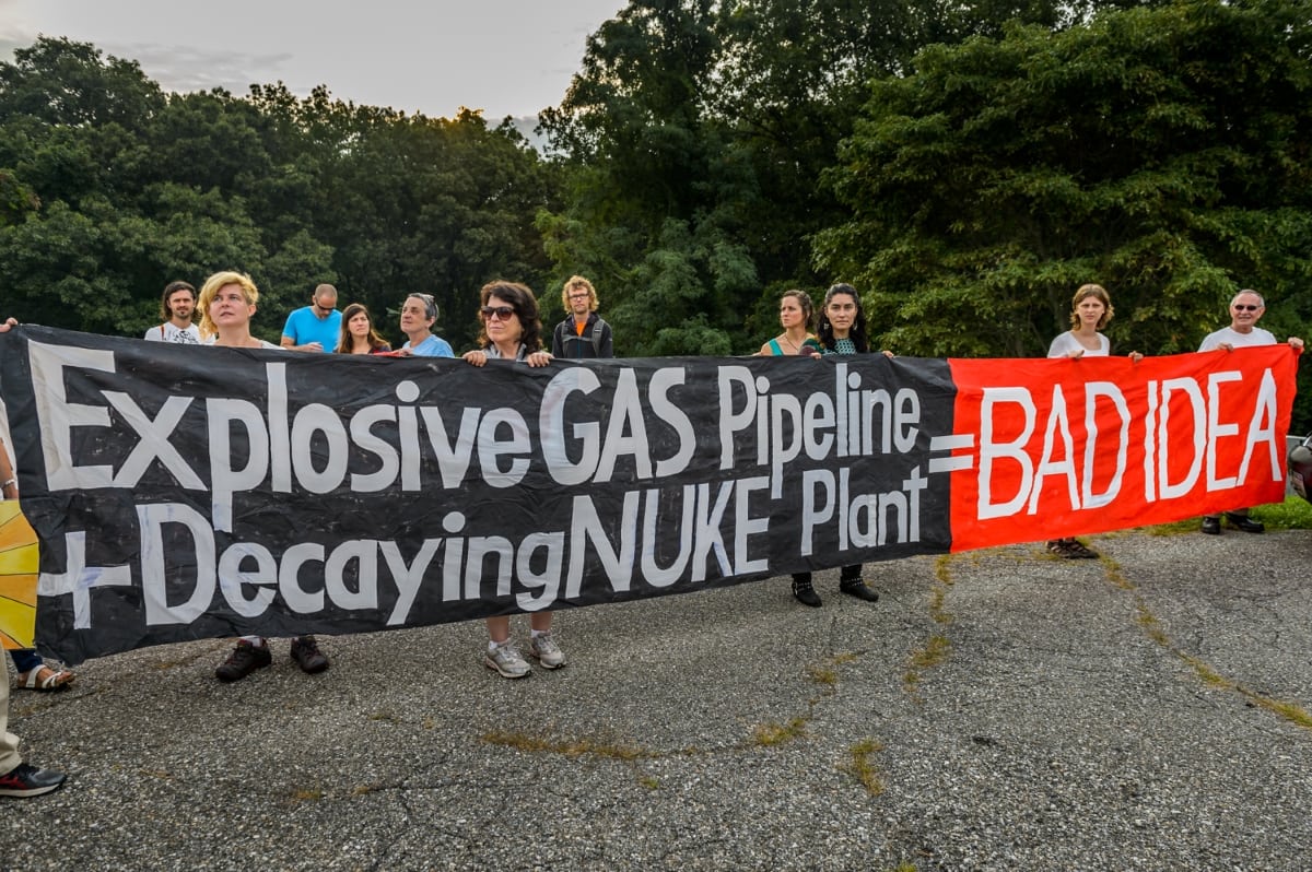
Demonstrators protest the pipeline near Indian Point in August 2016. (Photo by Erik McGregor)
In February 2016, New York Gov. Andrew Cuomo commissioned a study of the risks of running a gas pipeline through the Indian Point nuclear plant site. Seven months later, the state told the consulting firm preparing the $275,000 assessment to complete it by Dec. 31, 2016.
More than a year after that deadline, the study hasn’t been released and its status remains unclear. [Editor’s note: In June the state released the executive summary of the report.]
After repeated efforts to pry loose the document through Freedom of Information Law requests, activists are urging Cuomo and local officials to do something. Stop the Algonquin Pipeline Expansion (SAPE), formed as the pipeline plans took shape, is among the groups that will take part in an “interfaith climate vigil” for Feb. 25 outside Cuomo’s Mount Kisco home.
Known as the Algonquin Incremental Market (AIM) project, the 42-inch pipeline began operation in January 2017 despite opposition from environmentalists and scientists who argued that a high-pressure pipe cannot be safely snaked through 2,300 feet of a nuclear power complex, much less one, like Indian Point, in an earthquake fault.
Although Indian Point is scheduled to close by spring 2021, critics contend that dangers of a pipeline accident will remain because spent radioactive fuel will be stored at the facility indefinitely.
Constructed by Spectra Energy, AIM is a link in a system to carry natural gas from the Marcellus Shale formation in Pennsylvania into New York, beneath the Hudson River, and across Putnam County into Connecticut, Massachusetts and Rhode Island. The Federal Energy Regulatory Commission approved the pipeline, although critics contend that its decision was based on erroneous data.
On Feb. 1, Philipstown resident Paula Clair asked the Town Board to call for the study to be released, saying that “we who live close to the nuclear plant have a right to know” of the hazards. Clair, who sits on the town’s Zoning Board of Appeals, said that the proximity of the gas pipeline to spent nuclear fuel means that “if there was an explosion or a fire, it would be a catastrophe.”
A draft resolution she proposed noted that a radioactive release caused by an explosion could “render Philipstown uninhabitable for generations.”
Philipstown Supervisor Richard Shea agreed that the study, paid for with taxpayer funds, should be released, and promised that the board would consider passing a measure soon. “I don’t think it’s going to be a problem” approving it, he said.
Susan Van Dolsen, co-founder of SAPE, said her organization has been attempting to get a copy of the study through FOIL and other means since mid-2016, without success. Instead of the study, the state sent stacks of emails and other items, often of dubious relevance, she said, with large portions blacked out.
Sandy Galef, who represents Philipstown and Beacon in the state Assembly and serves on the task force looking at the impact of Indian Point’s closure, also wants the assessment released.
In a Jan. 19 letter to Cuomo, she reminded the governor that she had previously asked to see the document, which, she said, becomes especially important as the task force looks at possible re-uses of Indian Point after its nuclear operations cease. “I don’t think we can move forward without all possible information,” she wrote.
As of Thursday (Feb. 22), the governor’s office had not responded to questions posed a week earlier by The Current about the study. The state Office of General Services, which oversaw the contract for the study, on Feb. 14 referred inquiries to the state Division of Homeland Security and Emergency Services, which also did not respond.