The prophecy is more than seeing into the future. For the prophecy sees without the element of time. For the prophecy sees things as they were, as they are, and as they always shall be.
Tuesday, July 14, 2026
History Says Expect The Sixth Seal In New York (Revelation 6:12)
New York is America’s Next Major Quake (Revelation 6)
The devastation wrought in Mexico City by a recent massive earthquake may have rattled more than a few nerves along the Wasatch Front. Salt Lake City is, of course, overdue for a significant seismic event. So are other places in the United States, such as Los Angeles, the Pacific Northwest, even New York City. In a new book, science writer Kathryn Miles tours the country in search of the latest research on America’s next big earthquake and what’s being done to address the threat. She joins us Wednesday to talk about it.
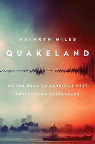
Kathryn Miles is the author of several books, including her newest, Quakeland: On the Road to America’s Next Devastating Earthquake [Independent bookstores|Amazon|Audible].
Learn more about predicting earthquakes in Utah and how well the state’s buildings could stand-up to a great shake from KUER’s news team.
Monday, July 13, 2026
The Sixth Seal in New York City (Revelation 6:12)
NEW
YORK IS 40 YEARS OVERDUE A MAJOR EARTHQUAKE AND AMERICA ISN'T PROPERLY
PREPARED, 'QUAKELAND' AUTHOR KATHRYN MILES TELLS TREVOR NOAHBY TUFAYEL AHMED ON 9/27/17 AT 9:28 AM
Updated | An earthquake is long overdue to hit New York and America isn’t prepared, author and environmental theorist Kathryn Miles told Trevor Noah on Tuesday’s Daily Show.
Miles is the author of a new book, Quakeland, which investigates how imminently an earthquake is expected in the U.S. and how well-prepared the country is to handThe Sixth Seal in New York City (Revelation 6:12)le it. The answer to those questions: Very soon and not very well.
“We know it will, that’s inevitable, but we don’t know when,” said Miles when asked when to expect another earthquake in the U.S.
She warned that New York is in serious danger of being the site of the next one, surprising considering that the West Coast sits along the San Andreas fault line.
“New York is 40 years overdue for a significant earthquake...Memphis, Seattle, Washington D.C.—it’s a national problem,” said Miles.
Miles told Noah that though the U.S. is “really good at responding to natural disasters,” like the rapid response to the hurricanes in Texas and Florida, the country and its government is, in fact, lagging behind in its ability to safeguard citizens before an earthquake hits.
“We’re really bad at the preparedness side,” Miles responded when Noah asked how the infrastructure in the U.S. compares to Mexico’s national warning system, for example.
“Whether it’s the literal infrastructure, like our roads and bridges, or the metaphoric infrastructure, like forecasting, prediction, early warning systems. Historically, we’ve underfunded those and as a result we’re way behind even developing nations on those fronts.”
Part of the problem, Miles says, is that President Donald Trump and his White House are not concerned with warning systems that could prevent the devastation of natural disasters.
“We can invest in an early warning system. That’s one thing we can definitely do. We can invest in better infrastructures, so that when the quake happens, the damage is less,” said the author.
“The scientists, the emergency managers, they have great plans in place. We have the technology for an early warning system, we have the technology for tsunami monitoring. But we don’t have a president that is currently interested in funding that, and that’s a problem.”
This article has been updated to reflect that Miles said New York is the possible site of an upcoming earthquake, and not the likeliest place to be next hit by one.
The Year of the Sixth Seal (Revelation 6:12)
Sloshing of Earth’s core may spike major earthquakes
The number of major earthquakes, like the magnitude-7 one that devastated Haiti in 2010, seems to be correlated with minute fluctuations in day length.
SEATTLE—The world doesn’t stop spinning. But every so often, it slows down. For decades, scientists have charted tiny fluctuations in the length of Earth’s day: Gain a millisecond here, lose a millisecond there. Last week at the annual meeting of the Geological Society of America here, two geophysicists argued that these minute changes could be enough to influence the timing of major earthquakes—and potentially help forecast them.
During the past 100 years, Earth’s slowdowns have correlated surprisingly well with periods with a global increase in magnitude-7 and larger earthquakes, according to Roger Bilham of the University of Colorado (CU) in Boulder and Rebecca Bendick at the University of Montana in Missoula. Usefully, the spike, which adds two to five more quakes than typical, happens well after the slow-down begins. “The Earth offers us a 5-years heads up on future earthquakes, which is remarkable,” says Bilham, who presented the work.
Most seismologists agree that earthquake prediction is a minefield. And so far, Bilham and Bendick have only fuzzy, hard-to-test ideas about what might cause the pattern they found. But the finding is too provocative to ignore, other researchers say. “The correlation they’ve found is remarkable, and deserves investigation,” says Peter Molnar, a geologist also at CU.
The research started as a search for synchrony in earthquake timing. Individual oscillators, be they fireflies, heart muscles, or metronomes, can end up vibrating in synchrony as a result of some kind of cross-talk—or some common influence. To Bendick, it didn’t seem a far jump to consider the faults that cause earthquakes, with their cyclical buildup of strain and violent discharge, as “really noisy, really crummy oscillators,” she says. She and Bilham dove into the data, using the only complete earthquake catalog for the past 100 years: magnitude-7 and larger earthquakes.
In work published in August in Geophysical Research Letters they reported two patterns: First, major quakes appeared to cluster in time
—although not in space. And second, the number of large earthquakes seemed to peak at 32-year intervals. The earthquakes could be somehow talking to each other, or an external force could be nudging the earth into rupture.
Exploring such global forces, the researchers eventually discovered the match with the length of day. Although weather patterns such as El Nino can drive day length to vary back and forth by a millisecond over a year or more, a periodic, decades-long fluctuation of several milliseconds—in particular, its point of peak slow down about every three decades or so—lined up with the quake trend perfectly. "Of course that seems sort of crazy," Bendick says. But maybe it isn’t. When day length changes over decades, Earth’s magnetic field also develops a temporary ripple. Researchers think slight changes in the flow of the molten iron of the outer core may be responsible for both effects. Just what happens is uncertain—perhaps a bit of the molten outer core sticks to the mantle above. That might change the flow of the liquid metal, altering the magnetic field, and transfer enough momentum between the mantle and the core to affect day length.
Seismologists aren’t used to thinking about the planet’s core, buried 2900 kilometers beneath the crust where quakes happen. But they should, Bilham said during his talk here. The core is “quite close to us. It’s closer than New York from here,” he said.
At the equator, Earth spins 460 meters per second. Given this high velocity, it’s not absurd to think that a slight mismatch in speed between the solid crust and mantle and the liquid core could translate into a force somehow nudging quakes into synchrony, Molnar says. Of course, he adds, “It might be nonsense.” But the evidence for some kind of link is compelling, says geophysicist Michael Manga of the University of California, Berkeley. “I’ve worked on earthquakes triggered by seasonal variation, melting snow. His correlation is much better than what I’m used to seeing.”
One way or another, says James Dolan, a geologist at the University of Southern California in Los Angeles, “we’re going to know in 5 years.” That’s because Earth’s rotation began a periodic slow-down 4-plus years ago. Beginning next year, Earth should expect five more major earthquakes a year than average—between 17 to 20 quakes, compared with the anomalously low four so far this year. If the pattern holds, it will put a new spin on earthquake forecasting.
doi:10.1126/science.aar3598
Saturday, July 11, 2026
A Closer Look At The Sixth Seal of NYC (March 3, 2026)
On the Road to America’s Next Devastating Earthquake NYC: March 3, 2026

Thursday, July 9, 2026
Columbia University Warns Of Sixth Seal (Revelation 6:12)
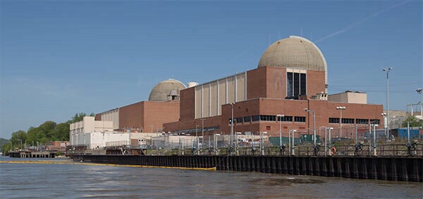
A study by a group of prominent seismologists suggests that a pattern of subtle but active faults makes the risk of earthquakes to the New York City area substantially greater than formerly believed. Among other things, they say that the controversial Indian Point nuclear power plants, 24 miles north of the city, sit astride the previously unidentified intersection of two active seismic zones. The paper appears in the current issue of the Bulletin of the Seismological Society of America.
Many faults and a few mostly modest quakes have long been known around New York City, but the research casts them in a new light. The scientists say the insight comes from sophisticated analysis of past quakes, plus 34 years of new data on tremors, most of them perceptible only by modern seismic instruments. The evidence charts unseen but potentially powerful structures whose layout and dynamics are only now coming clearer, say the scientists. All are based at Columbia University’s Lamont-Doherty Earth Observatory, which runs the network of seismometers that monitors most of the northeastern United States.
Lead author Lynn R. Sykes said the data show that large quakes are infrequent around New Yorkcompared to more active areas like California and Japan, but that the risk is high, because of the overwhelming concentration of people and infrastructure. “The research raises the perception both of how common these events are, and, specifically, where they may occur,” he said. “It’s an extremely populated area with very large assets.” Sykes, who has studied the region for four decades, is known for his early role in establishing the global theory of plate tectonics.
The authors compiled a catalog of all 383 known earthquakes from 1677 to 2007 in a 15,000-square-mile area around New York City. Coauthor John Armbruster estimated sizes and locations of dozens of events before 1930 by combing newspaper accounts and other records. The researchers say magnitude 5 quakes—strong enough to cause damage–occurred in 1737, 1783 and 1884. There was little settlement around to be hurt by the first two quakes, whose locations are vague due to a lack of good accounts; but the last, thought to be centered under the seabed somewhere between Brooklyn and Sandy Hook, toppled chimneys across the city and New Jersey, and panicked bathers at Coney Island. Based on this, the researchers say such quakes should be routinely expected, on average, about every 100 years. “Today, with so many more buildings and people, a magnitude 5 centered below the city would be extremely attention-getting,” said Armbruster. “We’d see billions in damage, with some brick buildings falling. People would probably be killed.”
Starting in the early 1970s Lamont began collecting data on quakes from dozens of newly deployed seismometers; these have revealed further potential, including distinct zones where earthquakes concentrate, and where larger ones could come. The Lamont network, now led by coauthor Won-Young Kim, has located hundreds of small events, including a magnitude 3 every few years, which can be felt by people at the surface, but is unlikely to cause damage. These small quakes tend to cluster along a series of small, old faults in harder rocks across the region. Many of the faults were discovered decades ago when subways, water tunnels and other excavations intersected them, but conventional wisdom said they were inactive remnants of continental collisions and rifting hundreds of millions of years ago. The results clearly show that they are active, and quite capable of generating damaging quakes, said Sykes.
One major previously known feature, the Ramapo Seismic Zone, runs from eastern Pennsylvania to the mid-Hudson Valley, passing within a mile or two northwest of Indian Point. The researchers found that this system is not so much a single fracture as a braid of smaller ones, where quakes emanate from a set of still ill-defined faults. East and south of the Ramapo zone—and possibly more significant in terms of hazard–is a set of nearly parallel northwest-southeast faults. These include Manhattan’s 125th Street fault, which seems to have generated two small 1981 quakes, and could have been the source of the big 1737 quake; the Dyckman Street fault, which carried a magnitude 2 in 1989; the Mosholu Parkway fault; and the Dobbs Ferry fault in suburban Westchester, which generated the largest recent shock, a surprising magnitude 4.1, in 1985. Fortunately, it did no damage. Given the pattern, Sykes says the big 1884 quake may have hit on a yet-undetected member of this parallel family further south.
The researchers say that frequent small quakes occur in predictable ratios to larger ones, and so can be used to project a rough time scale for damaging events. Based on the lengths of the faults, the detected tremors, and calculations of how stresses build in the crust, the researchers say that magnitude 6 quakes, or even 7—respectively 10 and 100 times bigger than magnitude 5–are quite possible on the active faults they describe. They calculate that magnitude 6 quakes take place in the area about every 670 years, and sevens, every 3,400 years. The corresponding probabilities of occurrence in any 50-year period would be 7% and 1.5%. After less specific hints of these possibilities appeared in previous research, a 2003 analysis by The New York City Area Consortium for Earthquake Loss Mitigation put the cost of quakes this size in the metro New York area at $39 billion to $197 billion. A separate 2001 analysis for northern New Jersey’s Bergen County estimates that a magnitude 7 would destroy 14,000 buildings and damage 180,000 in that area alone. The researchers point out that no one knows when the last such events occurred, and say no one can predict when they next might come.
“We need to step backward from the simple old model, where you worry about one large, obvious fault, like they do in California,” said coauthor Leonardo Seeber. “The problem here comes from many subtle faults. We now see there is earthquake activity on them. Each one is small, but when you add them up, they are probably more dangerous than we thought. We need to take a very close look.” Seeber says that because the faults are mostly invisible at the surface and move infrequently, a big quake could easily hit one not yet identified. “The probability is not zero, and the damage could be great,” he said. “It could be like something out of a Greek myth.”
The researchers found concrete evidence for one significant previously unknown structure: an active seismic zone running at least 25 miles from Stamford, Conn., to the Hudson Valley town of Peekskill, N.Y., where it passes less than a mile north of the Indian Point nuclear power plant. The Stamford-Peekskill line stands out sharply on the researchers’ earthquake map, with small events clustered along its length, and to its immediate southwest. Just to the north, there are no quakes, indicating that it represents some kind of underground boundary. It is parallel to the other faults beginning at 125th Street, so the researchers believe it is a fault in the same family. Like the others, they say it is probably capable of producing at least a magnitude 6 quake. Furthermore, a mile or so on, it intersects the Ramapo seismic zone.
Sykes said the existence of the Stamford-Peekskill line had been suggested before, because the Hudson takes a sudden unexplained bend just ot the north of Indian Point, and definite traces of an old fault can be along the north side of the bend. The seismic evidence confirms it, he said. “Indian Point is situated at the intersection of the two most striking linear features marking the seismicity and also in the midst of a large population that is at risk in case of an accident,” says the paper. “This is clearly one of the least favorable sites in our study area from an earthquake hazard and risk perspective.”
The findings comes at a time when Entergy, the owner of Indian Point, is trying to relicense the two operating plants for an additional 20 years—a move being fought by surrounding communities and the New York State Attorney General. Last fall the attorney general, alerted to the then-unpublished Lamont data, told a Nuclear Regulatory Commission panel in a filing: “New data developed in the last 20 years disclose a substantially higher likelihood of significant earthquake activity in the vicinity of [Indian Point] that could exceed the earthquake design for the facility.” The state alleges that Entergy has not presented new data on earthquakes past 1979. However, in a little-noticed decision this July 31, the panel rejected the argument on procedural grounds. A source at the attorney general’s office said the state is considering its options.
The characteristics of New York’s geology and human footprint may increase the problem. Unlike in California, many New York quakes occur near the surface—in the upper mile or so—and they occur not in the broken-up, more malleable formations common where quakes are frequent, but rather in the extremely hard, rigid rocks underlying Manhattan and much of the lower Hudson Valley. Such rocks can build large stresses, then suddenly and efficiently transmit energy over long distances. “It’s like putting a hard rock in a vise,” said Seeber. “Nothing happens for a while. Then it goes with a bang.” Earthquake-resistant building codes were not introduced to New York City until 1995, and are not in effect at all in many other communities. Sinuous skyscrapers and bridges might get by with minimal damage, said Sykes, but many older, unreinforced three- to six-story brick buildings could crumble.
Art Lerner-Lam, associate director of Lamont for seismology, geology and tectonophysics, pointed out that the region’s major highways including the New York State Thruway, commuter and long-distance rail lines, and the main gas, oil and power transmission lines all cross the parallel active faults, making them particularly vulnerable to being cut. Lerner-Lam, who was not involved in the research, said that the identification of the seismic line near Indian Point “is a major substantiation of a feature that bears on the long-term earthquake risk of the northeastern United States.” He called for policymakers to develop more information on the region’s vulnerability, to take a closer look at land use and development, and to make investments to strengthen critical infrastructure.
“This is a landmark study in many ways,” said Lerner-Lam. “It gives us the best possible evidence that we have an earthquake hazard here that should be a factor in any planning decision. It crystallizes the argument that this hazard is not random. There is a structure to the location and timing of the earthquakes. This enables us to contemplate risk in an entirely different way. And since we are able to do that, we should be required to do that.”
New York Earthquake Briefs and Quotes:
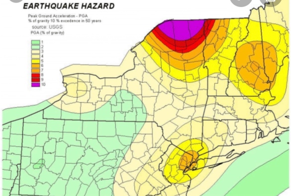
Existing U.S. Geological Survey seismic hazard maps show New York City as facing more hazard than many other eastern U.S. areas. Three areas are somewhat more active—northernmost New York State, New Hampshire and South Carolina—but they have much lower populations and fewer structures. The wider forces at work include pressure exerted from continuing expansion of the mid-Atlantic Ridge thousands of miles to the east; slow westward migration of the North American continent; and the area’s intricate labyrinth of old faults, sutures and zones of weakness caused by past collisions and rifting.
Due to New York’s past history, population density and fragile, interdependent infrastructure, a 2001 analysis by the Federal Emergency Management Agency ranks it the 11th most at-risk U.S. city for earthquake damage. Among those ahead: Los Angeles, San Francisco, Seattle and Portland. Behind: Salt Lake City, Sacramento, Anchorage.
New York’s first seismic station was set up at Fordham University in the 1920s. Lamont-Doherty Earth Observatory, in Palisades, N.Y., has operated stations since 1949, and now coordinates a network of about 40.
Dozens of small quakes have been felt in the New York area. A Jan. 17, 2001 magnitude 2.4, centered in the Upper East Side—the first ever detected in Manhattan itself–may have originated on the 125th Street fault. Some people thought it was an explosion, but no one was harmed.
The most recent felt quake, a magnitude 2.1 on July 28, 2008, was centered near Milford, N.J. Houses shook and a woman at St. Edward’s Church said she felt the building rise up under her feet—but no damage was done.
Questions about the seismic safety of the Indian Point nuclear power plant, which lies amid a metropolitan area of more than 20 million people, were raised in previous scientific papers in 1978 and 1985.
Because the hard rocks under much of New York can build up a lot strain before breaking, researchers believe that modest faults as short as 1 to 10 kilometers can cause magnitude 5 or 6 quakes.
In general, magnitude 3 quakes occur about 10 times more often than magnitude fours; 100 times more than magnitude fives; and so on. This principle is called the Gutenberg-Richter relationship.
We really are due for the sixth seal: MARCH 3, 2026

Opinion/Al Southwick: Could an earthquake really rock New England? We are 265 years overdue
On Nov. 8, a 3.6 magnitude earthquake struck Buzzard’s Bay off the coast of New Bedford. Reverberations were felt up to 100 miles away, across Massachusetts, Rhode Island, and parts of Connecticut and New York. News outlets scrambled to interview local residents who felt the ground shake their homes. Seismologists explained that New England earthquakes, while uncommon and usually minor, are by no means unheard of.
The last bad one we had took place on Nov. 18, 1755, a date long remembered.
It’s sometimes called the Boston Earthquake and sometimes the Cape Ann Earthquake. Its epicenter is thought to have been in the Atlantic Ocean about 25 miles east of Gloucester. Estimates say that it would have registered between 6.0 and 6.3 on the modern Richter scale. It was an occasion to remember as chronicled by John E. Ebel, director of the Weston observatory of Boston College:
“At about 4:30 in the morning on 18 November, 1755, a strong earthquake rocked the New England area. Observers reported damage to chimneys, brick buildings and stone walls in coastal communities from Portland, Maine to south of Boston … Chimneys were also damaged as far away as Springfield, Massachusetts, and New Haven, Connecticut. The earthquake was felt at Halifax, Nova Scotia to the northeast, Lake Champlain to the northwest, and Winyah, South Carolina to the southwest. The crew of a ship in deep water about 70 leagues east of Boston thought it had run aground and only realized it had felt an earthquake after it arrived at Boston later that same day.
“The 1755 earthquake rocked Boston, with the shaking lasting more than a minute. According to contemporary reports, as many as 1,500 chimneys were shattered or thrown down in part, the gable ends of about 15 brick buildings were broken out, and some church steeples ended up tilted due to the shaking. Falling chimney bricks created holes in the roofs of some houses. Some streets, particularly those on manmade ground along the water, were so covered with bricks and debris that passage by horse-drawn carriage was impossible. Many homes lost china and glassware that was thrown from shelves and shattered. A distiller’s cistern filled with liquor broke apart and lost its contents.”
We don’t have many details of the earthquake’s impact here, there being no newspaper in Worcester County at that time. We do know that one man, Christian Angel, working in a “silver” mine in Sterling, was buried alive when the ground shook. He is the only known fatality in these parts. We can assume that, if the quake shook down chimneys in Springfield and New Haven, it did even more damage hereabouts. We can imagine the cries of alarm and the feeling of panic as trees swayed violently, fields and meadows trembled underfoot and pottery fell off shelves and crashed below.
The Boston Earthquake was an aftershock from the gigantic Lisbon Earthquake that had leveled Lisbon, Portugal, a few days before. That cataclysm, estimated as an 8 or 9 on the modern Richter scale, was the most devastating natural catastrophe to hit western Europe since Roman times. The first shock struck on Nov. 1, at about 9 in the morning.
According to one account: ”Suddenly the city began to shudder violently, its tall medieval spires waving like a cornfield in the breeze … In the ancient cathedral, the Basilica de Santa Maria, the nave rocked and the massive chandeliers began swinging crazily. . . . Then came a second, even more powerful shock. And with it, the ornate façade of every great building in the square … broke away and cascaded forward.”
Until that moment, Lisbon had been one of the leading cities in western Europe, right up there with London and Paris. With 250,000 people, it was a center of culture, financial activity and exploration. Within minutes it was reduced to smoky, dusty rubble punctuated by human groans and screams. An estimated 60,000 to 100,000 lost their lives.
Since then, New England has been mildly shaken by quakes from time to time. One series of tremors on March 1, 1925, was felt throughout Worcester County, from Fitchburg to Worcester, and caused a lot of speculation.
What if another quake like that in 1755 hit New England today? What would happen? That question was studied 15 years ago by the Massachusetts Civil Defense Agency. Its report is sobering:
“The occurrence of a Richter magnitude 6.25 earthquake off Cape Ann, Massachusetts … would cause damage in the range of 2 to 10 billion dollars … in the Boston metropolitan area (within Route 128) due to ground shaking, with significant additional losses due to secondary effects such as soil liquefaction failures, fires and economic interruptions. Hundreds of deaths and thousands of major and minor injuries would be expected … Thousands of people could be displaced from their homes … Additional damage may also be experienced outside the 128 area, especially closer to the earthquake epicenter.”
So even if we don’t worry much about volcanoes, we know that hurricanes and tornadoes are always possible. As for earthquakes, they may not happen in this century or even in this millennium, but it is sobering to think that if the tectonic plates under Boston and Gloucester shift again, we could see a repeat of 1755.
Quakeland: On the Road to America’s Next Devastating Earthquake on 3/3/26: Revelation 6

Sunday, July 5, 2026
New York at Risk for an Earthquake