Showing posts with label preparedness. Show all posts

Monday, May 4, 2020

The Ramapo Fault and the Sixth Seal (Revelation 6:12)

http://www.ldeo.columbia.edu/news/2004/images/ramapo_factsheet_img_0.gif

Living on the Fault Line

Posted June 15, 2010 by Wayne J. Guglielmo
The couple checked with Burns’s parents, who live in nearby Basking Ridge, and they, too, had heard and felt something, which they thought might have been an earthquake. A call by Burns some 20 minutes later to the Bernardsville Police Department—one of many curious and occasionally panicky inquiries that Sunday morning, according to the officer in charge, Sergeant John Remian—confirmed their suspicion: A magnitude 2.6 earthquake, its epicenter in Peapack/Gladstone, about seven miles from Bernardsville, had hit the area. A smaller aftershock followed about two and a half hours later.
After this year’s epic earthquakes in Haiti, Chile, Mexico, Indonesia, and China, the 2.6 quake and aftershock that shook parts of New Jersey in February may seem minor league, even to the Somerset County residents who experienced them. On the exponential Richter Scale, a magnitude 7.0 quake like the one that hit Haiti in January is almost 4 million times stronger than a quake of 2.6 magnitude. But comparisons of magnitude don’t tell the whole story.
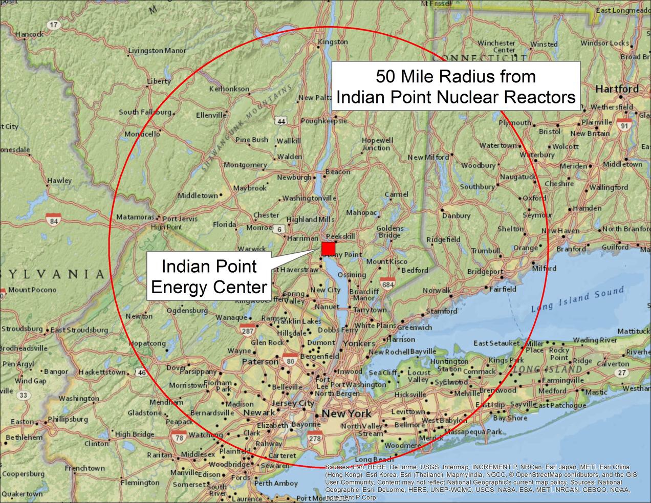
Northern New Jersey straddles the Ramapo Fault, a significant ancient crack in the earth’s crust. The longest fault in the Northeast, it begins in Pennsylvania and moves into New Jersey, trending northeast through Hunterdon, Somerset, Morris, Passaic, and Bergen counties before terminating in New York’s Westchester County, not far from the Indian Point Energy Center, a nuclear power plant. And though scientists dispute how active this roughly 200 million-year-old fault really is, many earthquakes in the state’s surprisingly varied seismic history are believed to have occurred on or near it. The fault line is visible at ground level and likely extends as deep as nine miles below the surface.
During the past 230 years or so, New Jersey has been at the epicenter of nearly 170 earthquakes, according to data compiled by the New Jersey Geological Survey, part of the United States Department of Environmental Protection. The largest known quake struck in 1783, somewhere west of New York City, perhaps in Sussex County. It’s typically listed as 5.3 in magnitude, though that’s an estimate by seismologists who are quick to point out that the concept of magnitude—measuring the relative size of an earthquake—was not introduced until 1935 by Charles Richter and Beno Gutenberg. Still, for quakes prior to that, scientists are not just guessing.
“We can figure out the damage at the time by going back to old records and newspaper accounts,” says Won-Young Kim, a senior research scientist at Columbia University’s Lamont-Doherty Earth Observatory in Palisades, New York, directly across the New Jersey border. “Once the amount and extent of contemporary damage has been established,” Kim says, “we’re then able to gauge the pattern of ground shaking or intensity of the event—and from there extrapolate its probable magnitude.”
Other earthquakes of magnitude 5 or higher have been felt in New Jersey, although their epicenters laying near New York City. One—which took place in 1737 and was said to have been felt as far north as Boston and as far south as northern Delaware—was probably in the 5 to 5.5 range. In 1884, an earthquake of similar magnitude occurred off New York’s Rockaway Beach. This well-documented event pulled houses off their foundations and caused steeples to topple as far west as Rahway. The shock wave, scientists believe, was felt over 70,000 square miles, from Vermont to Maryland.
Among the largest sub-5 magnitude earthquakes with epicenters in New Jersey, two (a 3.8 and a 4.0) took place on the same day in 1938 in the Lakehurst area in Ocean County. On August 26, 2003, a 3.5 magnitude quake shook the Frenchtown/Milford area in Hunterdon County. On February 3 of last year, a 3.0 magnitude quake occurred in the Morris County town of Mendham. “A lot of people felt this one because of the intense shaking, although the area of intensity wasn’t very wide,” says Lamont-Doherty’s Kim, who visited the site after the event.
After examining the known historical and geological record, Kim and other seismologists have found no clear evidence that an earthquake of greater than 5.3 to 5.5 magnitude has taken place in this area going back to 1737. This doesn’t mean, of course, that one did not take place in the more remote past or that one will not occur in the future; it simply means that a very large quake is less likely to occur here than in other places in the east where the seismic hazard is greater, including areas in South Carolina and northeastern New York State.
Given this low-hazard, high-vulnerability scenario, how far along are scientists in their efforts to predict larger magnitude earthquakes in the New Jersey area? The answer is complex, complicated by the state’s geographical position, its unique geological history, the state of seismology itself, and the continuing debate over the exact nature and activity of the Ramapo Fault.
Over millions of years, New Jersey developed four distinct physiographic provinces or regions, which divide the state into a series of diagonal slices, each with its own terrain, rock type, and geological landforms.
The northernmost slice is the Valley and Ridge, comprising major portions of Sussex and Warren counties. The southernmost slice is the Coastal Plain, a huge expanse that covers some three-fifths of the state, including all of the Shore counties. Dividing the rest of the state are the Highlands, an area for the most part of solid but brittle rock right below the Valley and Ridge, and the lower lands of the Piedmont, which occupy all of Essex, Hudson, and Union counties, most of Bergen, Hunterdon, and Somerset, and parts of Middlesex, Morris, and Passaic.
For earthquake monitors and scientists, the formation of these last two provinces—the Highlands and the Piedmont—are of special interest. To understand why, consider that prior to the appearance of the Atlantic Ocean, today’s Africa was snuggled cozily up against North America and surrounded by a single enormous ocean. “At that point, you could have had exits off the New Jersey Turnpike for Morocco,” says Alexander Gates, professor of geology and chair of the department of Earth and Environmental Sciences at Rutgers-Newark.
Under the pressure of circulating material within the Earth’s super-hot middle layer, or mantle, what was once a single continent—one that is thought to have included today’s other continents as well—began to stretch and eventually break, producing numerous cracks or faults and ultimately separating to form what became the Atlantic Ocean. In our area, the longest and most active of these many cracks was the Ramapo Fault, which, through a process known as normal faulting, caused one side of the earth’s crust to slip lower—the Piedmont—relative to the other side—the Highlands. “All this occurred about 225 million years ago,” says Gates. “Back then, you were talking about thousands of feet between the Highlands and the Piedmont and a very active Ramapo Fault.”
The Earth’s crust, which is 20 to 25 miles thick, is not a single, solid shell, but is broken into seven vast tectonic plates, which drift atop the soft, underlying mantle. Although the northeast-trending Ramapo Fault neatly divides two of New Jersey’s four physiographic provinces, it does not form a so-called plate boundary, as does California’s infamous San Andreas Fault. As many Californians know all too well, this giant fault forms the boundary between two plates—to the west, the Pacific Plate, and to the east, the North American Plate; these rub up against each other, producing huge stresses and a regularly repeating pattern of larger earthquakes.
This second bit of uncertainty is especially troubling for some people, including some in the media who want a neat story. To get around it, they ignore the differences between plate settings and link all of New Jersey’s earthquakes, either directly or implicitly, to the Ramapo Fault. In effect, such people want the Ramapo Fault “to look like the San Andreas Fault,” says Gates. “They want to be able to point to one big fault that’s causing all of our earthquakes.”
Gates does not think that’s the case, and he has been working with colleagues for a number of years to prove it. “What we have found is that there are smaller faults that generally cut from east to west across the northeast-trending Ramapo Fault,” he explains. “These much smaller faults are all over the place, and they’re actually the ones that are the active faults in the area.”
But what mechanisms are responsible for the formation of these apparently active auxiliary faults? One such mechanism, say scientists, is the westward pressure the Atlantic Ocean exerts on the North American Plate, which for the most part resists any movement. “I think we are in an equilibrium state most of the time,” says Lamont-Doherty’s Kim.
Still, that continuous pressure on the plate we sit on causes stress, and when that stress builds up sufficiently, the earth’s crust has a tendency to break around any weak zones. In our area, the major weak zone is the Ramapo Fault—“an ancient zone of weakness,” as Kim calls it. That zone of weakness exacerbates the formation of auxiliary faults, and thereby the series of minor earthquakes the state has experienced over the years.
All this presupposes, of course, that any intraplate stress in this area will continue to be released gradually, in a series of relatively minor earthquakes or releases of energy. But what if that were not the case? What if the stress continued to build up, and the release of large amounts of energy came all at once? In crude terms, that’s part of the story behind the giant earthquakes that rocked what is now New Madrid, Missouri, between 1811 and 1812. Although estimates of their magnitude have been revised downward in recent years to less than magnitude 8, these earthquakes are generally regarded as among the largest intraplate events to have occurred in the continental United States.
For a number of reasons—including the relatively low odds that the kind of stored energy that unleashed the New Madrid events could ever build up here—earthquakes of plus-6 magnitude are probably not in our future. Still, says Kim, even a magnitude 6 earthquake in certain areas of the state could do considerable damage, especially if its intensity or ground shaking was of sufficient strength. In a state as geologically diverse and densely populated as New Jersey, this is a crucial wild card.
Part of the job of the experts at the New Jersey Geological Survey is to assess the seismic hazards in different parts of the state. To do this, they use a computer-simulation model developed under the direction of the Federal Emergency Management Agency, known as HAZUS, for Hazards US. To assess the amount of ground shaking likely to occur in a given county during events ranging in magnitude from 5 to 7 on the Richter Scale, NJGS scientists enter three features of a county’s surface geology into their computer model. Two of these features relate to the tendency of soil in a given area to lose strength, liquefy, or slide downhill when shaken. The third and most crucial feature has to do with the depth and density of the soil itself and the type of bedrock lying below it; this is a key component in determining a region’s susceptibility to ground shaking and, therefore, in estimating the amount of building and structural damage that’s likely to occur in that region. Estimates for the various counties—nine to date have been studied—are sent to the New Jersey Office of Emergency Management, which provided partial funding for the project.
To appreciate why this element of ground geology is so crucial to earthquake modelers, consider the following: An earthquake’s intensity—which is measured on something called the Modified Mercalli Scale—is related to a number of factors. The amount of energy released or the magnitude of an event is clearly a big factor. But two earthquakes of the same magnitude can have very different levels of intensity; in fact, it’s quite possible for a lower magnitude event to generate more ground shaking than a higher magnitude one.
In addition to magnitude, other factors that affect intensity are the distance of the observer or structure from the epicenter, where intensity is the greatest; the depth beneath the surface of the initial rupture, with shallower ruptures producing more ground shaking than deeper ones; and, most significantly, the ground geology or material that the shock wave generated by the earthquake must pass through.
As a rule, softer materials like sand and gravel shake much more intensely than harder materials, because the softer materials are comparatively inefficient energy conductors, so whatever energy is released by the quake tends to be trapped, dispersing much more slowly. (Think of a bowl of Jell-O on a table that’s shaking.)
In contrast, harder materials, like the solid rock found widely in the Highlands, are brittle and break under pressure, but conduct energy well, so that even big shock waves disperse much more rapidly through them, thereby weakening the amount of ground shaking. “If you’ve read any stories about the 1906 earthquake in San Francisco, you know the most intense damage was in those flat, low areas by the Bay, where the soil is soft, and not in the hilly, rocky areas above,” says Karl Muessig, state geologist and NJGS head.
The map that accompanies the online version of the NJGS’s Earthquake Loss Estimation Study divides the state’s surface geology into five seismic soil classes, ranging from Class A, or hard rock, to Class E, or soft soil (state.nj.us/dep/njgs/enviroed/hazus.htm).
Although the weakest soils are scattered throughout the state, including the Highlands, which besides harder rock also contains areas of glacial lakes, clays, and wetlands, they are most evident in the Piedmont and the Coastal Plain. “The largest expanses of them are in coastal areas where you have salt marshes or large glacial lakes, as in parts of the Passaic River basin,” says Scott Stanford, a research scientist with NJGS and lead author of the estimate. Some of the very weakest soils, Stanford adds, are in areas of filled marshland, including places along the Hudson waterfront, around Newark Bay and the Meadowlands, and along the Arthur Kill.
Faults in these areas—and in the coastal plain generally—are far below the ground, perhaps several hundred to a thousand feet down, making identification difficult. “There are numerous faults upon which you might get earthquake movement that we can’t see, because they’re covered by younger sediments,” Stanford says.
This combination of hidden faults and weak soils worries scientists, who are all too aware that parts of the coastal plain and Piedmont are among the most densely populated and developed areas in the state. (The HAZUS computer model also has a “built environment” component, which summarizes, among other things, types of buildings in a given area.) For this reason, such areas would be in the most jeopardy in the event of a large earthquake.
For example, in the study’s loss estimate for Essex County, which includes Newark, the state’s largest city, a magnitude 6 event would result in damage to 81,600 buildings, including almost 10,000 extensively or completely; 36,000 people either displaced from their homes or forced to seek short-term shelter; almost $9 million in economic losses from property damage and business interruption; and close to 3,300 injuries and 50 fatalities. (The New York City Area Consortium for Earthquake Loss Mitigation has conducted a similar assessment for New York City, at nycem.org.)
All of this suggests the central irony of New Jersey geology: The upland areas that are most prone to earthquakes—the counties in or around the Ramapo Fault, which has spawned a network of splays, or auxiliary faults—are much less densely populated and sit, for the most part, on good bedrock. These areas are not invulnerable, certainly, but, by almost all measures, they would not sustain very severe damage, even in the event of a higher magnitude earthquake. The same can’t be said for other parts of the state, where the earthquake hazard is lower but the vulnerability far greater. Here, the best we can do is to prepare—both in terms of better building codes and a constantly improving emergency response.
Meanwhile, scientists like Rutgers’s Gates struggle to understand the Earth’s quirky seismic timetable: “The big thing with earthquakes is that you can commonly predict where they are going to occur,” Gates says. “When they’re going to come, well, we’re nowhere near being able to figure that out.”
***********************
For the men and women of the state police who manage and support the New Jersey Office of Emergency Management (OEM), the response to some events, like hurricanes, can be marshalled in advance. But an earthquake is what responders call a no-notice event.
In New Jersey, even minor earthquakes—like the one that shook parts of Somerset County in February—attract the notice of local, county, and OEM officials, who continuously monitor events around the state from their Regional Operations and Intelligence Center (The ROIC) in West Trenton, a multimillion dollar command-and-control facility that has been built to withstand 125 mph winds and a 5.5 magnitude earthquake. In the event of a very large earthquake, during which local and county resources are apt to become quickly overwhelmed, command and control authority would almost instantly pass to West Trenton.
Here, officials from the state police, representatives of a galaxy of other state agencies, and a variety of communications and other experts would assemble in the cavernous and ultra-high tech Emergency Operations Center to oversee the state’s response. “A high-level earthquake would definitely cause the governor to declare a state of emergency,” says OEM public information officer Nicholas J. Morici. “And once that takes place, our emergency operations plan would be put in motion.”
Emergency officials have modeled that plan—one that can be adapted to any no-notice event, including a terrorist attack—on response methodologies developed by the Federal Emergency Management Agency (FEMA), part of the U.S. Department of Homeland Security. At its core is a series of seventeen emergency support functions, ranging from transportation to firefighting, debris removal, search and rescue, public health, and medical services. A high-magnitude event would likely activate all of these functions, says Morici, along with the human and physical resources needed to carry them out—cranes and heavy trucks for debris removal, fire trucks and teams for firefighting, doctors and EMTs for medical services, buses and personnel carriers for transportation, and so on.
This is where an expert like Tom Rafferty comes in. Rafferty is a Geographic Information Systems Specialist attached to the OEM. His job during an emergency is to keep track electronically of which resources are where in the state, so they can be deployed quickly to where they are needed. “We have a massive database called the Resource Directory Database in which we have geolocated municipal, county, and state assets to a very detailed map of New Jersey,” Rafferty says. “That way, if there is an emergency like an earthquake going on in one area, the emergency managers can quickly say to me, for instance, ‘We have major debris and damage on this spot of the map. Show us the location of the nearest heavy hauler. Show us the next closest location,’ and so on.”
A very large quake, Rafferty says, “could overwhelm resources that we have as a state.” In that event, OEM has the authority to reach out to FEMA for additional resources and assistance. It can also call upon the private sector—the Resource Directory has been expanded to include non-government assets—and to a network of volunteers. “No one has ever said, ‘We don’t want to help,’” Rafferty says. New Jersey officials can also request assistance through the Emergency Management Assistance Compact (EMAC), an agreement among the states to help each other in times of extreme crisis.
“You always plan for the worst,” Rafferty says, “and that way when the worst doesn’t happen, you feel you can handle it if and when it does.”
Contributing editor Wayne J. Guglielmo lives in Mahwah, near the Ramapo Fault.

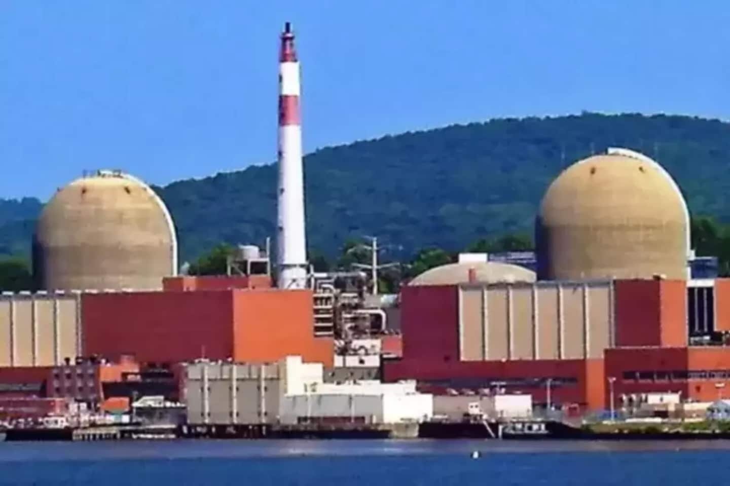
Indian Point’s Unit 2 reactor shuts off but NOT Unit 3

Indian Point’s Unit 2 reactor under construction in 1968.
Photo courtesy of Entergy
In recent weeks, climate scientists like James Hansen decried the reactor’s shutdown, saying it was a mistake to eliminate a source of clean energy from the state’s power grid. Hansen and others predict that natural gas will fill the energy gap left when Indian Point shuts down next year.
“Many people will die because of the stupidity of this action, in which a nuclear power plant is closed before all fossil fuel power plants have been closed,” Hansen told The Journal News/lohud.com two weeks ago.
Entergy cited reduced revenues linked to the cheap price of natural gas as a major factor in its decision to close the plant.
On Friday morning, natural gas and dual fuel — natural gas or other fossil fuels — were contributing about 31%of the state’s energy needs. Hydropower coming from upstate New York near Niagara  Falls was contributing 33%, while renewables like wind and solar power were a little over 4%.
The Cuomo administration wants the state to rely on renewables for 70% of its energy needs in 10 years.

Sunday, December 8, 2019

The Ramapo Fault and the Sixth Seal (Revelation 6:12)

http://www.ldeo.columbia.edu/news/2004/images/ramapo_factsheet_img_0.gif

Living on the Fault Line

Posted June 15, 2010 by Wayne J. Guglielmo
The couple checked with Burns’s parents, who live in nearby Basking Ridge, and they, too, had heard and felt something, which they thought might have been an earthquake. A call by Burns some 20 minutes later to the Bernardsville Police Department—one of many curious and occasionally panicky inquiries that Sunday morning, according to the officer in charge, Sergeant John Remian—confirmed their suspicion: A magnitude 2.6 earthquake, its epicenter in Peapack/Gladstone, about seven miles from Bernardsville, had hit the area. A smaller aftershock followed about two and a half hours later.
After this year’s epic earthquakes in Haiti, Chile, Mexico, Indonesia, and China, the 2.6 quake and aftershock that shook parts of New Jersey in February may seem minor league, even to the Somerset County residents who experienced them. On the exponential Richter Scale, a magnitude 7.0 quake like the one that hit Haiti in January is almost 4 million times stronger than a quake of 2.6 magnitude. But comparisons of magnitude don’t tell the whole story.
Northern New Jersey straddles the Ramapo Fault, a significant ancient crack in the earth’s crust. The longest fault in the Northeast, it begins in Pennsylvania and moves into New Jersey, trending northeast through Hunterdon, Somerset, Morris, Passaic, and Bergen counties before terminating in New York’s Westchester County, not far from the Indian Point Energy Center, a nuclear power plant. And though scientists dispute how active this roughly 200 million-year-old fault really is, many earthquakes in the state’s surprisingly varied seismic history are believed to have occurred on or near it. The fault line is visible at ground level and likely extends as deep as nine miles below the surface.
During the past 230 years or so, New Jersey has been at the epicenter of nearly 170 earthquakes, according to data compiled by the New Jersey Geological Survey, part of the United States Department of Environmental Protection. The largest known quake struck in 1783, somewhere west of New York City, perhaps in Sussex County. It’s typically listed as 5.3 in magnitude, though that’s an estimate by seismologists who are quick to point out that the concept of magnitude—measuring the relative size of an earthquake—was not introduced until 1935 by Charles Richter and Beno Gutenberg. Still, for quakes prior to that, scientists are not just guessing.
“We can figure out the damage at the time by going back to old records and newspaper accounts,” says Won-Young Kim, a senior research scientist at Columbia University’s Lamont-Doherty Earth Observatory in Palisades, New York, directly across the New Jersey border. “Once the amount and extent of contemporary damage has been established,” Kim says, “we’re then able to gauge the pattern of ground shaking or intensity of the event—and from there extrapolate its probable magnitude.”
Other earthquakes of magnitude 5 or higher have been felt in New Jersey, although their epicenters laying near New York City. One—which took place in 1737 and was said to have been felt as far north as Boston and as far south as northern Delaware—was probably in the 5 to 5.5 range. In 1884, an earthquake of similar magnitude occurred off New York’s Rockaway Beach. This well-documented event pulled houses off their foundations and caused steeples to topple as far west as Rahway. The shock wave, scientists believe, was felt over 70,000 square miles, from Vermont to Maryland.
Among the largest sub-5 magnitude earthquakes with epicenters in New Jersey, two (a 3.8 and a 4.0) took place on the same day in 1938 in the Lakehurst area in Ocean County. On August 26, 2003, a 3.5 magnitude quake shook the Frenchtown/Milford area in Hunterdon County. On February 3 of last year, a 3.0 magnitude quake occurred in the Morris County town of Mendham. “A lot of people felt this one because of the intense shaking, although the area of intensity wasn’t very wide,” says Lamont-Doherty’s Kim, who visited the site after the event.
After examining the known historical and geological record, Kim and other seismologists have found no clear evidence that an earthquake of greater than 5.3 to 5.5 magnitude has taken place in this area going back to 1737. This doesn’t mean, of course, that one did not take place in the more remote past or that one will not occur in the future; it simply means that a very large quake is less likely to occur here than in other places in the east where the seismic hazard is greater, including areas in South Carolina and northeastern New York State.
Given this low-hazard, high-vulnerability scenario, how far along are scientists in their efforts to predict larger magnitude earthquakes in the New Jersey area? The answer is complex, complicated by the state’s geographical position, its unique geological history, the state of seismology itself, and the continuing debate over the exact nature and activity of the Ramapo Fault.
Over millions of years, New Jersey developed four distinct physiographic provinces or regions, which divide the state into a series of diagonal slices, each with its own terrain, rock type, and geological landforms.
The northernmost slice is the Valley and Ridge, comprising major portions of Sussex and Warren counties. The southernmost slice is the Coastal Plain, a huge expanse that covers some three-fifths of the state, including all of the Shore counties. Dividing the rest of the state are the Highlands, an area for the most part of solid but brittle rock right below the Valley and Ridge, and the lower lands of the Piedmont, which occupy all of Essex, Hudson, and Union counties, most of Bergen, Hunterdon, and Somerset, and parts of Middlesex, Morris, and Passaic.
For earthquake monitors and scientists, the formation of these last two provinces—the Highlands and the Piedmont—are of special interest. To understand why, consider that prior to the appearance of the Atlantic Ocean, today’s Africa was snuggled cozily up against North America and surrounded by a single enormous ocean. “At that point, you could have had exits off the New Jersey Turnpike for Morocco,” says Alexander Gates, professor of geology and chair of the department of Earth and Environmental Sciences at Rutgers-Newark.
Under the pressure of circulating material within the Earth’s super-hot middle layer, or mantle, what was once a single continent—one that is thought to have included today’s other continents as well—began to stretch and eventually break, producing numerous cracks or faults and ultimately separating to form what became the Atlantic Ocean. In our area, the longest and most active of these many cracks was the Ramapo Fault, which, through a process known as normal faulting, caused one side of the earth’s crust to slip lower—the Piedmont—relative to the other side—the Highlands. “All this occurred about 225 million years ago,” says Gates. “Back then, you were talking about thousands of feet between the Highlands and the Piedmont and a very active Ramapo Fault.”
The Earth’s crust, which is 20 to 25 miles thick, is not a single, solid shell, but is broken into seven vast tectonic plates, which drift atop the soft, underlying mantle. Although the northeast-trending Ramapo Fault neatly divides two of New Jersey’s four physiographic provinces, it does not form a so-called plate boundary, as does California’s infamous San Andreas Fault. As many Californians know all too well, this giant fault forms the boundary between two plates—to the west, the Pacific Plate, and to the east, the North American Plate; these rub up against each other, producing huge stresses and a regularly repeating pattern of larger earthquakes.
This second bit of uncertainty is especially troubling for some people, including some in the media who want a neat story. To get around it, they ignore the differences between plate settings and link all of New Jersey’s earthquakes, either directly or implicitly, to the Ramapo Fault. In effect, such people want the Ramapo Fault “to look like the San Andreas Fault,” says Gates. “They want to be able to point to one big fault that’s causing all of our earthquakes.”
Gates does not think that’s the case, and he has been working with colleagues for a number of years to prove it. “What we have found is that there are smaller faults that generally cut from east to west across the northeast-trending Ramapo Fault,” he explains. “These much smaller faults are all over the place, and they’re actually the ones that are the active faults in the area.”
But what mechanisms are responsible for the formation of these apparently active auxiliary faults? One such mechanism, say scientists, is the westward pressure the Atlantic Ocean exerts on the North American Plate, which for the most part resists any movement. “I think we are in an equilibrium state most of the time,” says Lamont-Doherty’s Kim.
Still, that continuous pressure on the plate we sit on causes stress, and when that stress builds up sufficiently, the earth’s crust has a tendency to break around any weak zones. In our area, the major weak zone is the Ramapo Fault—“an ancient zone of weakness,” as Kim calls it. That zone of weakness exacerbates the formation of auxiliary faults, and thereby the series of minor earthquakes the state has experienced over the years.
All this presupposes, of course, that any intraplate stress in this area will continue to be released gradually, in a series of relatively minor earthquakes or releases of energy. But what if that were not the case? What if the stress continued to build up, and the release of large amounts of energy came all at once? In crude terms, that’s part of the story behind the giant earthquakes that rocked what is now New Madrid, Missouri, between 1811 and 1812. Although estimates of their magnitude have been revised downward in recent years to less than magnitude 8, these earthquakes are generally regarded as among the largest intraplate events to have occurred in the continental United States.
For a number of reasons—including the relatively low odds that the kind of stored energy that unleashed the New Madrid events could ever build up here—earthquakes of plus-6 magnitude are probably not in our future. Still, says Kim, even a magnitude 6 earthquake in certain areas of the state could do considerable damage, especially if its intensity or ground shaking was of sufficient strength. In a state as geologically diverse and densely populated as New Jersey, this is a crucial wild card.
Part of the job of the experts at the New Jersey Geological Survey is to assess the seismic hazards in different parts of the state. To do this, they use a computer-simulation model developed under the direction of the Federal Emergency Management Agency, known as HAZUS, for Hazards US. To assess the amount of ground shaking likely to occur in a given county during events ranging in magnitude from 5 to 7 on the Richter Scale, NJGS scientists enter three features of a county’s surface geology into their computer model. Two of these features relate to the tendency of soil in a given area to lose strength, liquefy, or slide downhill when shaken. The third and most crucial feature has to do with the depth and density of the soil itself and the type of bedrock lying below it; this is a key component in determining a region’s susceptibility to ground shaking and, therefore, in estimating the amount of building and structural damage that’s likely to occur in that region. Estimates for the various counties—nine to date have been studied—are sent to the New Jersey Office of Emergency Management, which provided partial funding for the project.
To appreciate why this element of ground geology is so crucial to earthquake modelers, consider the following: An earthquake’s intensity—which is measured on something called the Modified Mercalli Scale—is related to a number of factors. The amount of energy released or the magnitude of an event is clearly a big factor. But two earthquakes of the same magnitude can have very different levels of intensity; in fact, it’s quite possible for a lower magnitude event to generate more ground shaking than a higher magnitude one.
In addition to magnitude, other factors that affect intensity are the distance of the observer or structure from the epicenter, where intensity is the greatest; the depth beneath the surface of the initial rupture, with shallower ruptures producing more ground shaking than deeper ones; and, most significantly, the ground geology or material that the shock wave generated by the earthquake must pass through.
As a rule, softer materials like sand and gravel shake much more intensely than harder materials, because the softer materials are comparatively inefficient energy conductors, so whatever energy is released by the quake tends to be trapped, dispersing much more slowly. (Think of a bowl of Jell-O on a table that’s shaking.)
In contrast, harder materials, like the solid rock found widely in the Highlands, are brittle and break under pressure, but conduct energy well, so that even big shock waves disperse much more rapidly through them, thereby weakening the amount of ground shaking. “If you’ve read any stories about the 1906 earthquake in San Francisco, you know the most intense damage was in those flat, low areas by the Bay, where the soil is soft, and not in the hilly, rocky areas above,” says Karl Muessig, state geologist and NJGS head.
The map that accompanies the online version of the NJGS’s Earthquake Loss Estimation Study divides the state’s surface geology into five seismic soil classes, ranging from Class A, or hard rock, to Class E, or soft soil (state.nj.us/dep/njgs/enviroed/hazus.htm).
Although the weakest soils are scattered throughout the state, including the Highlands, which besides harder rock also contains areas of glacial lakes, clays, and wetlands, they are most evident in the Piedmont and the Coastal Plain. “The largest expanses of them are in coastal areas where you have salt marshes or large glacial lakes, as in parts of the Passaic River basin,” says Scott Stanford, a research scientist with NJGS and lead author of the estimate. Some of the very weakest soils, Stanford adds, are in areas of filled marshland, including places along the Hudson waterfront, around Newark Bay and the Meadowlands, and along the Arthur Kill.
Faults in these areas—and in the coastal plain generally—are far below the ground, perhaps several hundred to a thousand feet down, making identification difficult. “There are numerous faults upon which you might get earthquake movement that we can’t see, because they’re covered by younger sediments,” Stanford says.
This combination of hidden faults and weak soils worries scientists, who are all too aware that parts of the coastal plain and Piedmont are among the most densely populated and developed areas in the state. (The HAZUS computer model also has a “built environment” component, which summarizes, among other things, types of buildings in a given area.) For this reason, such areas would be in the most jeopardy in the event of a large earthquake.
For example, in the study’s loss estimate for Essex County, which includes Newark, the state’s largest city, a magnitude 6 event would result in damage to 81,600 buildings, including almost 10,000 extensively or completely; 36,000 people either displaced from their homes or forced to seek short-term shelter; almost $9 million in economic losses from property damage and business interruption; and close to 3,300 injuries and 50 fatalities. (The New York City Area Consortium for Earthquake Loss Mitigation has conducted a similar assessment for New York City, at nycem.org.)
All of this suggests the central irony of New Jersey geology: The upland areas that are most prone to earthquakes—the counties in or around the Ramapo Fault, which has spawned a network of splays, or auxiliary faults—are much less densely populated and sit, for the most part, on good bedrock. These areas are not invulnerable, certainly, but, by almost all measures, they would not sustain very severe damage, even in the event of a higher magnitude earthquake. The same can’t be said for other parts of the state, where the earthquake hazard is lower but the vulnerability far greater. Here, the best we can do is to prepare—both in terms of better building codes and a constantly improving emergency response.
Meanwhile, scientists like Rutgers’s Gates struggle to understand the Earth’s quirky seismic timetable: “The big thing with earthquakes is that you can commonly predict where they are going to occur,” Gates says. “When they’re going to come, well, we’re nowhere near being able to figure that out.”
***********************
For the men and women of the state police who manage and support the New Jersey Office of Emergency Management (OEM), the response to some events, like hurricanes, can be marshalled in advance. But an earthquake is what responders call a no-notice event.
In New Jersey, even minor earthquakes—like the one that shook parts of Somerset County in February—attract the notice of local, county, and OEM officials, who continuously monitor events around the state from their Regional Operations and Intelligence Center (The ROIC) in West Trenton, a multimillion dollar command-and-control facility that has been built to withstand 125 mph winds and a 5.5 magnitude earthquake. In the event of a very large earthquake, during which local and county resources are apt to become quickly overwhelmed, command and control authority would almost instantly pass to West Trenton.
Here, officials from the state police, representatives of a galaxy of other state agencies, and a variety of communications and other experts would assemble in the cavernous and ultra-high tech Emergency Operations Center to oversee the state’s response. “A high-level earthquake would definitely cause the governor to declare a state of emergency,” says OEM public information officer Nicholas J. Morici. “And once that takes place, our emergency operations plan would be put in motion.”
Emergency officials have modeled that plan—one that can be adapted to any no-notice event, including a terrorist attack—on response methodologies developed by the Federal Emergency Management Agency (FEMA), part of the U.S. Department of Homeland Security. At its core is a series of seventeen emergency support functions, ranging from transportation to firefighting, debris removal, search and rescue, public health, and medical services. A high-magnitude event would likely activate all of these functions, says Morici, along with the human and physical resources needed to carry them out—cranes and heavy trucks for debris removal, fire trucks and teams for firefighting, doctors and EMTs for medical services, buses and personnel carriers for transportation, and so on.
This is where an expert like Tom Rafferty comes in. Rafferty is a Geographic Information Systems Specialist attached to the OEM. His job during an emergency is to keep track electronically of which resources are where in the state, so they can be deployed quickly to where they are needed. “We have a massive database called the Resource Directory Database in which we have geolocated municipal, county, and state assets to a very detailed map of New Jersey,” Rafferty says. “That way, if there is an emergency like an earthquake going on in one area, the emergency managers can quickly say to me, for instance, ‘We have major debris and damage on this spot of the map. Show us the location of the nearest heavy hauler. Show us the next closest location,’ and so on.”
A very large quake, Rafferty says, “could overwhelm resources that we have as a state.” In that event, OEM has the authority to reach out to FEMA for additional resources and assistance. It can also call upon the private sector—the Resource Directory has been expanded to include non-government assets—and to a network of volunteers. “No one has ever said, ‘We don’t want to help,’” Rafferty says. New Jersey officials can also request assistance through the Emergency Management Assistance Compact (EMAC), an agreement among the states to help each other in times of extreme crisis.
“You always plan for the worst,” Rafferty says, “and that way when the worst doesn’t happen, you feel you can handle it if and when it does.”
Contributing editor Wayne J. Guglielmo lives in Mahwah, near the Ramapo Fault.

Saturday, November 10, 2018

Indian Point is NOT radiologically ready for the Sixth Seal


Recent series of Indian Point shutdowns worst in years
Ernie Garcia, elgarcia@lohud.com
BUCHANAN — Four unplanned reactor shutdowns over a two-month period at Indian Point are the most setbacks the nuclear power plant has experienced in years.
A review of unplanned shutdowns from January 2012 to the present showed this year’s events happened within a short time frame, between May 7 and July 8, in contrast with events from other years that were more spread out, according to data released by Indian Point.
So many mishaps at the Entergy-owned plant haven’t occurred since 2009, when one of two units at the Buchanan site experienced a similar series, said plant spokesman Jerry Nappi.
Besides a May 9 transformer failure that spilled some 3,000 gallons of oil into the Hudson River, this year’s shutdowns were prompted by a May 7 steam leak, a July 8 pump motor failure and a June 15 switch yard breaker failure offsite in a Consolidated Edison substation.
If a nuclear plant has more than three unplanned shutdowns in a nine-month period, its performance indicator could be changed by the federal Nuclear Regulatory Commission, which results in additional oversight. That’s what happened with Entergy’s Pilgrim Nuclear Power Station in Plymouth, Mass., after four unplanned shutdowns in 2013.
So far, Entergy said there doesn’t appear to be a pattern to the Indian Point shutdowns.
“You do want to look at these events holistically to see if there is something in common, but you also look individually to see what the causes were,” Nappi said. “A plant shutdown in and of itself is not a safety issue.”
One of the four recent Buchanan shutdowns triggered a special inspection by the NRC and calls to close the nuclear plant by environmental groups and elected officials. Gov. Andrew Cuomo has said in the past Indian Point should close, but his office did not respond to a request for comment about whether the recent shutdowns have prompted any state scrutiny.
The NRC is expected to release a quarterly report on Indian Point this month that will address the transformer failure and, by year’s end, is planning an inspection of the transformer and an analysis of transformer issues since 2007.
Besides its transformer-related inquiries, the other three shutdowns have not raised “any immediate safety concerns or crossed any thresholds that would result in additional NRC oversight,” agency spokesman Neil Sheehan wrote in an email.
The unplanned shutdowns at Indian Point and Pilgrim in Massachusetts were mostly preventable, said Paul Blanch, a former Indian Point employee with 45 years of nuclear power experience.
“For this to happen this frequently indicates a deeper problem,” he said. “I believe it’s management oversight in the maintenance of these plants.”
Nappi said the transformer that failed May 9 and caused a fire and oil spill into the Hudson was regularly monitored. Investigators determined the failure was due to faulty insulation.
“The transformer inspection and reviews were in accordance with our standards and industry expectations, yet there was no indication the transformer was going to fail,” Nappi said.
The NRC conducted a separate, but related special inspection into the May 9 incident that focused on a half-inch of water that collected in an electrical switchgear room floor. Inspectors determined a fire suppression system’s valve failed to close properly.
Inspectors noted in their report that Entergy knew about that problem since April 2011 and replaced the valve but didn’t discover the actual cause — a dysfunctional switch — until after the fire.
Indian Point’s Unit 3 was down 19 days May through July, with the transformer failure accounting for 16 days. The shutdowns didn’t cause the public any supply problems because New York’s grid can import electricity from other states and New York has an energy plan to maintain reliability, according to the U.S. Energy Information Administration.
The nuclear energy industry judges a power plant on how continuously it produces energy, which is called a capacity factor.
There were 100 nuclear plants in the United States in 2014, a record year in terms of efficiency. In January, the Nuclear Energy Institute announced the U.S. average capacity factor was 91.9 percent.
Indian Point has an above-average efficiency rate. The plant’s Unit 2 and 3 reactors were each online more than 99 percent of the time during their most recent two-year operating cycles. They are currently in the middle of other cycles.

Tuesday, November 6, 2018

Testing Indian Point Before the Sixth Seal (Revelation 6:12)

image-1351Siren testing for Indian Point Wednesday morning

Thomas C. Zambito, Rockland/Westchester Journal News
 Published 11:55 a.m. ET Oct. 30, 2018 | Updated 6:27 a.m. ET Oct. 31, 2018
Dennis Malles, of Malles Auto Body in Montrose and the Montrose Business Association, talks about the future of local businesses after the closure of the nearby Indian Point Energy Center nuclear power plant. Peter Carr/lohud
Indian Point will be testing its emergency evacuation sirens between 10:30 and 11 a.m. Wednesday.
Sirens in Dutchess, Orange, Putnam, Rockland and Westchester counties will sound at full volume for four minutes.
“Sirens are not a signal to evacuate,” Indian Point’s owner, Entergy, said in a statement.
In a real-life emergency, sirens are used to alert residents to tune into local radio or television stations for further information.\
A list of the stations can be found hereon the nuclear power plant’s website. Stations are also listed in the emergency planning booklet mailed to homes and businesses within a 10-mile radius of the Buchanan plant.
During a February test last year, two of the 172 sirens in the Lower Hudson Valley — one in Rockland, the other in Putnam — failed to sound. Those issues have been resolved, officials said.
Entergy plans to shut down its two working reactors at Indian Point in 2020 and 2021 as part of a 2017 agreement reached with the state.
Read or Share this story: https://www.lohud.com/story/news/2018/10/30/siren-testing-indian-point-wednesday/1817524002/

Friday, November 2, 2018

Closing Indian Point is Too Late (Revelation 6:12)

image-1351Closing Indian Point is good
Posted October 14, 2018
To the editor:
(re: “Reforming energy vision,” Sept. 27)
In her Sept. 27 letter, Phoebe O’Connor claims that closing the Indian Point nuclear power plant would change our ability to provide reliable, clean power to downstate New York. But this claim is full of holes.
Let’s start with some actual numbers about power supply and demand. The figures supplied by the New York Independent System Operator, the non-profit which runs New York’s electrical grid, show that we’ll have enough energy thanks to reduced demand and increased renewable capacity, to replace Indian Point.
First, a December report by NYISO found that we already have replacement supplies for 1,900 out of Indian Point’s 2,000-megawatt output, and that further buildout of renewables and efficiency measures could meet the remaining 100-megawatt “compensatory need.” Several months later, NYISO released its April Gold Book, with updated numbers showing that continuing reductions in demand mean that there is now, officially, no projected power gap in connection with the closure of Indian Point.
To illustrate, NYISO’s Gold Book forecast for “peak” demand in downstate New York during Summer 2020 plummeted by 380 megawatts, compared to the forecast for that same 2020 time period just one year earlier. Plus, we’re not nearly done saving energy: The state’s commitment to ramp up energy efficiency-related demand reductions to 3 percent a year will strengthen the trends reported above, which are mirrored in countless other states.
And let’s not forget just how much Indian Point puts New Yorkers at risk. Over the past four years, Indian Point repeatedly suffered major malfunctions — pump and power failures, a transformer explosion, damaged O-rings, radiation leaks, a fire and an oil spill. Twice, this 45-year-old plant’s operations discovered a record number of failures in the bolts holding the inner walls of the reactors together.
Indian Point is just too old and too dangerous, and we have plenty of safe, sustainable energy to replace it. That’s why Indian Point’s stipulated closure in 2021 — under the agreement between its operator Entergy, the State of New York, and Riverkeeper, is the right move.
Cliff Weathers
The author is communications director for Riverkeepe

Sunday, October 28, 2018

Indian Point Tests Sirens Before the Sixth Seal (Revelation 6:12)


Indian Point Photo Credit: File
Indian Point Will Test Sirens On Halloween
Fear not, it's just a test, not a Halloween scare.
There will be a test of the Indian Point Energy Center sirens in Westchester, Rockland, Putnam and Orange counties during a regular test of the system. At approximately 10:30 a.m. on Wednesday, Oct. 31, officials will conduct the test, which will involve sounding the sirens at full-volume in the area.
Officials noted that, because this is a test, the public is not required to respond when they hear the siren.
“Please note that sirens are not a signal to evacuate,” Entergy stated. “In an actual emergency, the sirens would sound to alert the public to tune in to a local EAS radio or television station for important information and direction.”
According to the Stony Point Police Department, "this is only a test. If there was an emergency at the nuclear power plants, the sirens would be sounded continuously at full volume for 4 minutes, followed by an activation of the Emergency Alert System (EAS) on radio and television stations to broadcast important information and instructions. The sirens are not a signal to evacuate, rather they are intended to alert the public to tune to this or another EAS radio or TV station for important information. This siren sounding is only a test. No action by the public is necessary.

Friday, October 26, 2018

Too Little Too Late (Revelation 6:12)

Closing Indian Point is good
Posted October 14, 2018
To the editor:
(re: “Reforming energy vision,” Sept. 27)
In her Sept. 27 letter, Phoebe O’Connor claims that closing the Indian Point nuclear power plant would change our ability to provide reliable, clean power to downstate New York. But this claim is full of holes.
Let’s start with some actual numbers about power supply and demand. The figures supplied by the New York Independent System Operator, the non-profit which runs New York’s electrical grid, show that we’ll have enough energy thanks to reduced demand and increased renewable capacity, to replace Indian Point.
First, a December report by NYISO found that we already have replacement supplies for 1,900 out of Indian Point’s 2,000-megawatt output, and that further buildout of renewables and efficiency measures could meet the remaining 100-megawatt “compensatory need.” Several months later, NYISO released its April Gold Book, with updated numbers showing that continuing reductions in demand mean that there is now, officially, no projected power gap in connection with the closure of Indian Point.
To illustrate, NYISO’s Gold Book forecast for “peak” demand in downstate New York during Summer 2020 plummeted by 380 megawatts, compared to the forecast for that same 2020 time period just one year earlier. Plus, we’re not nearly done saving energy: The state’s commitment to ramp up energy efficiency-related demand reductions to 3 percent a year will strengthen the trends reported above, which are mirrored in countless other states.
And let’s not forget just how much Indian Point puts New Yorkers at risk. Over the past four years, Indian Point repeatedly suffered major malfunctions — pump and power failures, a transformer explosion, damaged O-rings, radiation leaks, a fire and an oil spill. Twice, this 45-year-old plant’s operations discovered a record number of failures in the bolts holding the inner walls of the reactors together.
Indian Point is just too old and too dangerous, and we have plenty of safe, sustainable energy to replace it. That’s why Indian Point’s stipulated closure in 2021 — under the agreement between its operator Entergy, the State of New York, and Riverkeeper, is the right move.
Cliff Weathers
The author is communications director for Riverkeeper.

Sunday, October 21, 2018

A Nuclear Disaster Awaits Indian Point Plant at the Sixth Seal

PIPELINEAIM gas pipeline opponents lose legal challenge, may appeal

Thomas C. Zambito, Rockland/Westchester Journal News
Gubernatorial candidate Cynthia Nixon spoke to students about their proximity to the Algonquin natural gas pipeline. She then shared her thoughts. Seth Harrison, sharriso@lohud.com

Opponents of the AIM pipeline expansion say they may refocus their legal challenges on the next phase of the project


While a federal appeals court has rejected a pivotal challenge to the expansion of a natural gas pipeline near the Indian Point nuclear power plant, opponents say they’re not done trying to get the courts to block the project.
The U.S. Court of Appeals for the District of Columbia, in a July 27 decision, sided with the Federal Energy Regulatory Commission (FERC) in turning back a legal challenge to the Algonquin Incremental Market (AIM) pipeline expansion.
The Hudson Valley environmental group Riverkeeper claimed the installation of 2,159 feet of natural gas pipeline across from Indian Point posed a serious threat to public safety, particularly if the pipeline ruptured.
Riverkeeper spokesman Cliff Weathers said a decision to appeal has not been made yet.
But Courtney Williams, who heads the grassroots group SAPE (Stop the Algonquin Pipeline Expansion), said the opposition may focus its future legal challenges on the next phase of the expansion, known as the Atlantic Bridge Project.
“We’re still in discussions with Riverkeeper to determine whether we will appeal this portion of the decision,” Williams said. “But the legal challenge to Atlantic Bridge is already underway.”
Another challenge coming
SAPE joined Riverkeeper, the City of Boston and others in challenging FERC’s decision-making process.
Opponents argued that FERC should have considered the environmental impacts of all three phases of the expansion, including the Atlantic Bridge Project, as one. But the appeals court sided with FERC. “We find no basis to set aside the Commission’s order on those grounds,” the appeals court wrote.
The Atlantic Bridge Project is an extension of the Algonquin pipeline that runs through Yorktown and Somers in northern Westchester before heading into Putnam County and Connecticut.
It is part of a $972 million expansion that will make it possible for the pipeline’s current owner, Enbridge Energy Partners, to deliver natural gas to New England from Pennsylvania, by way of a pipeline that cuts through New Jersey and New York.
The project has impacted several Hudson Valley towns in Putnam, Rockland and Westchester counties and touched off a number of public demonstrations. In 2016, several protesters were arrested after locking themselves inside a section of pipeline in Verplanck while it was being readied to be installed under the Hudson River.
SAPE has staged protests outside Gov. Andrew Cuomo’s New Castle home, urging the governor to shut down the pipeline. And last month at a rally in Peekskill, Cynthia Nixon, Cuomo’s opponent in the September Democratic primary, accused the governor of moving too slowly to address the opposition's concerns.

In June, state officials sent a letter to FERC, urging the commission to re-evaluate its decision allowing the pipeline near Indian Point.
NRC signs off on plan
The appeals court ruling said FERC’s decision allowing the pipeline near Indian Point was supported by an analysis by the Nuclear Regulatory Commission (NRC), which the commission found "persuasive."
NRC’s review determined that Indian Point’s two reactors could safely operate or temporarily shut down if a gas line ruptured near the plant.
FERC’s 2015 ruling credited NRC’s expertise in assessing safety threats to nuclear facilities.
“We see no basis to reject the Commission’s to do so,” the appeals court wrote.
The NRC said it could re-evaluate its decision after Indian Point’s owner, Louisiana-based Entergy, submits a plan for how the plant will be dismantled. Entergy has plans to shut down the Buchanan plant by 2021.
Read or Share this story: https://www.lohud.com/story/news/investigations/2018/08/14/algonquin-gas-pipeline/978104002/

From The USA TODAY NETWORK

Friday, September 28, 2018

Preparing Futilely for the Sixth Seal (Revelation 6)


Studying the evacuation zone map around the reactors
Indian Point drill conducted
CARMEL – It was only a drill, but for eight hours Tuesday more than 100 volunteers and employees of Putnam County participated in a disaster exercise relating to an emergency response at the Indian Point nuclear power plant in Buchanan.
Putnam joined its neighbors in Westchester, Orange and Rockland counties for the drill that was monitored by both officials from the Federal Emergency Management Agency and the State Office of Emergency Management.
The scenario centered on an explosion at the plant and release of radiation that headed north towards Putnam.
At the county's Emergency Operations Center in Carmel, representatives of law enforcement, education, public health, utilities, Office for Senior Resources, fire and EMS charted an evacuation plan for the Philipstown-Putnam Valley area with residents of the 10-mile radius of Indian Point affected. While no real evacuations occurred, on paper residents living in sections of southern Philipstown, Continental Village, lower Garrison and Putnam Valley were “safely removed.”
The exercise also practiced for the safe evacuations of children attending schools in the affected areas.
Putnam County Commissioner of Emergency Services Ken Clair, Acting County Executive Paul Eldridge and Putnam's Director of Informational Technology and Geographical Information Systems Thomas Lannon were in command of the drill in Putnam County.
Clair said the county was looking forward to receiving the evaluations from both federal and state monitors: "It's important that we plan and practice just in case the unthinkable ever occurs. In Putnam County, we are prepared."

Thursday, September 27, 2018

A Nuclear Disaster Awaits Indian Point Plant at the Sixth Seal

PIPELINEAIM gas pipeline opponents lose legal challenge, may appeal

Thomas C. Zambito, Rockland/Westchester Journal News
Gubernatorial candidate Cynthia Nixon spoke to students about their proximity to the Algonquin natural gas pipeline. She then shared her thoughts. Seth Harrison, sharriso@lohud.com

Opponents of the AIM pipeline expansion say they may refocus their legal challenges on the next phase of the project


While a federal appeals court has rejected a pivotal challenge to the expansion of a natural gas pipeline near the Indian Point nuclear power plant, opponents say they’re not done trying to get the courts to block the project.
The U.S. Court of Appeals for the District of Columbia, in a July 27 decision, sided with the Federal Energy Regulatory Commission (FERC) in turning back a legal challenge to the Algonquin Incremental Market (AIM) pipeline expansion.
The Hudson Valley environmental group Riverkeeper claimed the installation of 2,159 feet of natural gas pipeline across from Indian Point posed a serious threat to public safety, particularly if the pipeline ruptured.
Riverkeeper spokesman Cliff Weathers said a decision to appeal has not been made yet.
But Courtney Williams, who heads the grassroots group SAPE (Stop the Algonquin Pipeline Expansion), said the opposition may focus its future legal challenges on the next phase of the expansion, known as the Atlantic Bridge Project.
“We’re still in discussions with Riverkeeper to determine whether we will appeal this portion of the decision,” Williams said. “But the legal challenge to Atlantic Bridge is already underway.”
Another challenge coming
SAPE joined Riverkeeper, the City of Boston and others in challenging FERC’s decision-making process.
Opponents argued that FERC should have considered the environmental impacts of all three phases of the expansion, including the Atlantic Bridge Project, as one. But the appeals court sided with FERC. “We find no basis to set aside the Commission’s order on those grounds,” the appeals court wrote.
The Atlantic Bridge Project is an extension of the Algonquin pipeline that runs through Yorktown and Somers in northern Westchester before heading into Putnam County and Connecticut.
It is part of a $972 million expansion that will make it possible for the pipeline’s current owner, Enbridge Energy Partners, to deliver natural gas to New England from Pennsylvania, by way of a pipeline that cuts through New Jersey and New York.
The project has impacted several Hudson Valley towns in Putnam, Rockland and Westchester counties and touched off a number of public demonstrations. In 2016, several protesters were arrested after locking themselves inside a section of pipeline in Verplanck while it was being readied to be installed under the Hudson River.
SAPE has staged protests outside Gov. Andrew Cuomo’s New Castle home, urging the governor to shut down the pipeline. And last month at a rally in Peekskill, Cynthia Nixon, Cuomo’s opponent in the September Democratic primary, accused the governor of moving too slowly to address the opposition's concerns.

In June, state officials sent a letter to FERC, urging the commission to re-evaluate its decision allowing the pipeline near Indian Point.
NRC signs off on plan
The appeals court ruling said FERC’s decision allowing the pipeline near Indian Point was supported by an analysis by the Nuclear Regulatory Commission (NRC), which the commission found "persuasive."
NRC’s review determined that Indian Point’s two reactors could safely operate or temporarily shut down if a gas line ruptured near the plant.
FERC’s 2015 ruling credited NRC’s expertise in assessing safety threats to nuclear facilities.
“We see no basis to reject the Commission’s to do so,” the appeals court wrote.
The NRC said it could re-evaluate its decision after Indian Point’s owner, Louisiana-based Entergy, submits a plan for how the plant will be dismantled. Entergy has plans to shut down the Buchanan plant by 2021.
Read or Share this story: https://www.lohud.com/story/news/investigations/2018/08/14/algonquin-gas-pipeline/978104002/

From The USA TODAY NETWORK