After a Frenetic 7-Week Stretch, National Hurricane Center’s Outlook Map Is Finally Blank Again
At a Glance
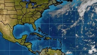
Friday’s outlook from the National Hurricane Center had no storms or areas to watch.
This was the first time the Atlantic Basin outlook map was blank since early August.
There were 14 named storms during that stretch.
There is still about 28 percent of an average hurricane season left.
This includes the recently volatile month of October.
The National Hurricane Center’s Atlantic Basin outlook map was devoid of any active storms or areas to watch for the first time in almost two months as the Atlantic hurricane season finally takes a brief rest after a hectic stretch.
The outlook map on the front page of the National Hurricane Center’s website depicts current active tropical depressions, storms and hurricanes, as well as areas the NHC is monitoring for potential development over the next five days.
In recent weeks, that map has been littered with multiple storms and circles showing areas that could – and in many cases, did – develop.
However, Friday, that map finally went blank.
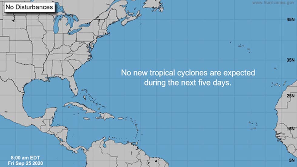
The NHC’s outlook map on Friday, Sept. 25, 2020, had no active storms or areas of potential development for the first time in seven weeks.
(NOAA/NHC)
That was the first time the NHC map was blank since Aug. 7, seven weeks ago.
While August and September are typically the peak months of the Atlantic hurricane season, this seven-week stretch was particularly active.
Fourteen named storms formed during this frenetic stretch, beginning with Tropical Storm Josephine and ending two letters deep into the Greek alphabet with Tropical Storm Beta.

The named storms that formed from Aug. 7 to Sept. 22, 2020, beginning with Josephine and ending with Beta.
Six of those became hurricanes and two of those – Laura and Teddy – reached Category 4 strength.
That’s roughly an entire average season’s worth of storms (13), hurricanes (7) and major hurricanes (3) compressed into seven weeks.
Four of those storms – Laura, Marco, Sally and Beta – made a mainland U.S. landfall.
Contrast the blank NHC map above with what we saw last week.
On Monday, Sept. 14, there were five active named storms at once, plus a couple of other areas the NHC was monitoring that would eventually develop.
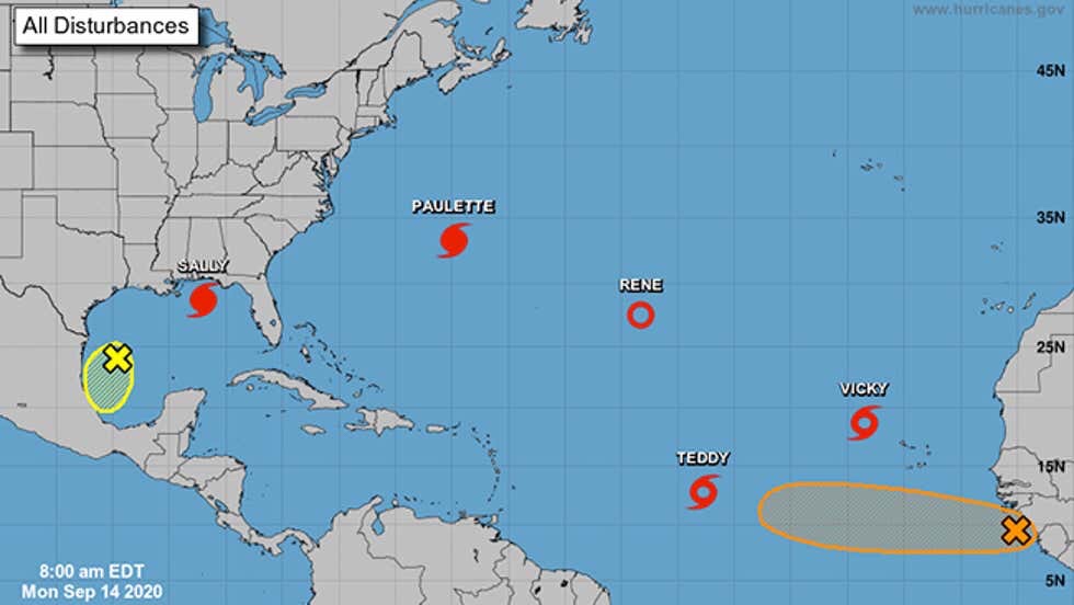
The NHC’s outlook map on Sept. 14, 2020, at 8 a.m. EDT included five active named storms and two areas they were monitoring for development, denoted by X’s with circles.
(NOAA/NHC)
Four days later, only Teddy remained from Monday’s map, but three new storms – Wilfred, Alpha and Beta – formed in just six hours on Sept. 18, and also pushed the names list into the Greek alphabet for the second time ever.
One of the storms – Subtropical Storm Alpha – moved into Portugal. It was so far off the map, only the letter “A” could fit in the extreme northeast corner of the NHC’s map.
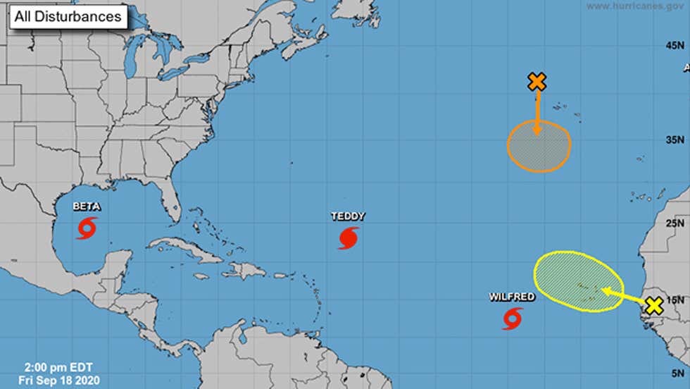
Same as above, but on Sept. 18, 2020, at 2 p.m. EDT. One of the active named storms at the time, Subtropical Storm Alpha, is almost off the map in the upper-right corner, with only the first letter of Alpha – “A” – visible on the map.
(NOAA/NHC)
And here’s the progression of the NHC outlooks during this stretch from Virginia Tech graduate student Tyler Stanfield.
The Lull Won’t Last Long
These quieter periods in the heart of hurricane season are typical.
In this case, an atmospheric oscillation called the Madden-Julian Oscillation (MJO) is moving into a phase to suppress convection in the tropical North Atlantic Ocean through the end of the month. This means relative quiet for tropical storms and hurricanes in the Atlantic Basin.
However, Michael Ventrice, a meteorological scientist with The Weather Company, an IBM Business, noted the MJO is forecast to return to a more supportive phase for tropical storms and hurricanes by mid-October.
While the typical area for development shrinks westward in October compared to September, October’s storms and hurricanes often move north from the deep, warm western Caribbean Sea toward Florida, the eastern Gulf Coast, or the East Coast of the U.S.
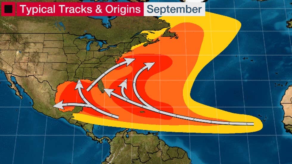
Here are the typical areas for development of Atlantic Basin tropical storms and hurricanes in September (first image) and October (second image).
Recent October hurricanes like this include Michael, Matthew, Sandy and Wilma. All of those hurricanes were so destructive, their names were retired from future use.
In South Florida, October – not September – is the month with the most hurricane direct hits. According to NOAA’s Best Track Database, 26 October hurricanes have passed within 100 nautical miles of Miami since 1851.
An average remainder of the hurricane season would deliver another four to five named storms, two to three of which become hurricanes and one of which strengthens to a major hurricane (Category 3 or stronger), according to statistics compiled by Dr. Phil Klotzbach, a tropical scientist at Colorado State University.
Using a metric called the ACE index, which tracks not only numbers of storms but also how long they last and how strong they become, about 28% of the hurricane season’s activity remains, according to Klotzbach’s statistics.
Enjoy this break while it lasts, but keep hurricane plans ready in case another storm threatens.
The Weather Company’s primary journalistic mission is to report on breaking weather news, the environment and the importance of science to our lives. This story does not necessarily represent the position of our parent company, IBM.
No comments:
Post a Comment