Geography of Disaster
New York News & Pollitics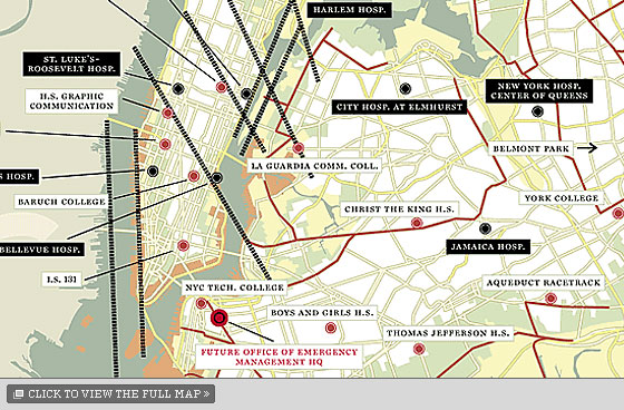
The fault lines shown on this map are mainly in Manhattan because the island’s exposed bedrock makes it most at risk for earthquake damage, explains Charles Merguerian, chairman of Hofstra University’s geology department, who drew them for us. Faults elsewhere in the city are harder to detect because they are buried under hundreds of feet of soil and sediment.
In case of hurricane, up to three zones of the city will be evacuated, depending on the storm’s strength. The city will set up 23 “evacuation reception centers” for those fleeing, though two-thirds of evacuees are expected to shack up with friends and family. The city has mapped out the fastest routes to these reception centers and put up street signs along those roads. There will be extra trains for those leaving the city altogether as well as fuel and tow trucks along major outbound roads, to prevent tie-ups.
No matter which disaster strikes, these seventeen trauma centers are the hospitals best equipped for large numbers of casualties.
No comments:
Post a Comment