
Earthquakes May Endanger New York More Than Thought, Says Study
A study by a group of prominent seismologists suggests that a pattern of subtle but active faults makes the risk of earthquakes to the New York City area substantially greater than formerly believed. Among other things, they say that the controversial Indian Point nuclear power plants, 24 miles north of the city, sit astride the previously unidentified intersection of two active seismic zones. The paper appears in the current issue of the Bulletin of the Seismological Society of America.
Many faults and a few mostly modest quakes have long been known around New York City, but the research casts them in a new light. The scientists say the insight comes from sophisticated analysis of past quakes, plus 34 years of new data on tremors, most of them perceptible only by modern seismic instruments. The evidence charts unseen but potentially powerful structures whose layout and dynamics are only now coming clearer, say the scientists. All are based at Columbia University’s Lamont-Doherty Earth Observatory, which runs the network of seismometers that monitors most of the northeastern United States.
Lead author Lynn R. Sykes said the data show that large quakes are infrequent around New Yorkcompared to more active areas like California and Japan, but that the risk is high, because of the overwhelming concentration of people and infrastructure. “The research raises the perception both of how common these events are, and, specifically, where they may occur,” he said. “It’s an extremely populated area with very large assets.” Sykes, who has studied the region for four decades, is known for his early role in establishing the global theory of plate tectonics.
The authors compiled a catalog of all 383 known earthquakes from 1677 to 2007 in a 15,000-square-mile area around New York City. Coauthor John Armbruster estimated sizes and locations of dozens of events before 1930 by combing newspaper accounts and other records. The researchers say magnitude 5 quakes—strong enough to cause damage–occurred in 1737, 1783 and 1884. There was little settlement around to be hurt by the first two quakes, whose locations are vague due to a lack of good accounts; but the last, thought to be centered under the seabed somewhere between Brooklyn and Sandy Hook, toppled chimneys across the city and New Jersey, and panicked bathers at Coney Island. Based on this, the researchers say such quakes should be routinely expected, on average, about every 100 years. “Today, with so many more buildings and people, a magnitude 5 centered below the city would be extremely attention-getting,” said Armbruster. “We’d see billions in damage, with some brick buildings falling. People would probably be killed.”
Starting in the early 1970s Lamont began collecting data on quakes from dozens of newly deployed seismometers; these have revealed further potential, including distinct zones where earthquakes concentrate, and where larger ones could come. The Lamont network, now led by coauthor Won-Young Kim, has located hundreds of small events, including a magnitude 3 every few years, which can be felt by people at the surface, but is unlikely to cause damage. These small quakes tend to cluster along a series of small, old faults in harder rocks across the region. Many of the faults were discovered decades ago when subways, water tunnels and other excavations intersected them, but conventional wisdom said they were inactive remnants of continental collisions and rifting hundreds of millions of years ago. The results clearly show that they are active, and quite capable of generating damaging quakes, said Sykes.
One major previously known feature, the Ramapo Seismic Zone, runs from eastern Pennsylvania to the mid-Hudson Valley, passing within a mile or two northwest of Indian Point. The researchers found that this system is not so much a single fracture as a braid of smaller ones, where quakes emanate from a set of still ill-defined faults. East and south of the Ramapo zone—and possibly more significant in terms of hazard–is a set of nearly parallel northwest-southeast faults. These include Manhattan’s 125th Street fault, which seems to have generated two small 1981 quakes, and could have been the source of the big 1737 quake; the Dyckman Street fault, which carried a magnitude 2 in 1989; the Mosholu Parkway fault; and the Dobbs Ferry fault in suburban Westchester, which generated the largest recent shock, a surprising magnitude 4.1, in 1985. Fortunately, it did no damage. Given the pattern, Sykes says the big 1884 quake may have hit on a yet-undetected member of this parallel family further south.
The researchers say that frequent small quakes occur in predictable ratios to larger ones, and so can be used to project a rough time scale for damaging events. Based on the lengths of the faults, the detected tremors, and calculations of how stresses build in the crust, the researchers say that magnitude 6 quakes, or even 7—respectively 10 and 100 times bigger than magnitude 5–are quite possible on the active faults they describe. They calculate that magnitude 6 quakes take place in the area about every 670 years, and sevens, every 3,400 years. The corresponding probabilities of occurrence in any 50-year period would be 7% and 1.5%. After less specific hints of these possibilities appeared in previous research, a 2003 analysis by The New York City Area Consortium for Earthquake Loss Mitigation put the cost of quakes this size in the metro New York area at $39 billion to $197 billion. A separate 2001 analysis for northern New Jersey’s Bergen County estimates that a magnitude 7 would destroy 14,000 buildings and damage 180,000 in that area alone. The researchers point out that no one knows when the last such events occurred, and say no one can predict when they next might come.
“We need to step backward from the simple old model, where you worry about one large, obvious fault, like they do in California,” said coauthor Leonardo Seeber. “The problem here comes from many subtle faults. We now see there is earthquake activity on them. Each one is small, but when you add them up, they are probably more dangerous than we thought. We need to take a very close look.” Seeber says that because the faults are mostly invisible at the surface and move infrequently, a big quake could easily hit one not yet identified. “The probability is not zero, and the damage could be great,” he said. “It could be like something out of a Greek myth.”
The researchers found concrete evidence for one significant previously unknown structure: an active seismic zone running at least 25 miles from Stamford, Conn., to the Hudson Valley town of Peekskill, N.Y., where it passes less than a mile north of the Indian Point nuclear power plant. The Stamford-Peekskill line stands out sharply on the researchers’ earthquake map, with small events clustered along its length, and to its immediate southwest. Just to the north, there are no quakes, indicating that it represents some kind of underground boundary. It is parallel to the other faults beginning at 125th Street, so the researchers believe it is a fault in the same family. Like the others, they say it is probably capable of producing at least a magnitude 6 quake. Furthermore, a mile or so on, it intersects the Ramapo seismic zone.
Sykes said the existence of the Stamford-Peekskill line had been suggested before, because the Hudson takes a sudden unexplained bend just ot the north of Indian Point, and definite traces of an old fault can be along the north side of the bend. The seismic evidence confirms it, he said. “Indian Point is situated at the intersection of the two most striking linear features marking the seismicity and also in the midst of a large population that is at risk in case of an accident,” says the paper. “This is clearly one of the least favorable sites in our study area from an earthquake hazard and risk perspective.”
The findings comes at a time when Entergy, the owner of Indian Point, is trying to relicense the two operating plants for an additional 20 years—a move being fought by surrounding communities and the New York State Attorney General. Last fall the attorney general, alerted to the then-unpublished Lamont data, told a Nuclear Regulatory Commission panel in a filing: “New data developed in the last 20 years disclose a substantially higher likelihood of significant earthquake activity in the vicinity of [Indian Point] that could exceed the earthquake design for the facility.” The state alleges that Entergy has not presented new data on earthquakes past 1979. However, in a little-noticed decision this July 31, the panel rejected the argument on procedural grounds. A source at the attorney general’s office said the state is considering its options.
The characteristics of New York’s geology and human footprint may increase the problem. Unlike in California, many New York quakes occur near the surface—in the upper mile or so—and they occur not in the broken-up, more malleable formations common where quakes are frequent, but rather in the extremely hard, rigid rocks underlying Manhattan and much of the lower Hudson Valley. Such rocks can build large stresses, then suddenly and efficiently transmit energy over long distances. “It’s like putting a hard rock in a vise,” said Seeber. “Nothing happens for a while. Then it goes with a bang.” Earthquake-resistant building codes were not introduced to New York City until 1995, and are not in effect at all in many other communities. Sinuous skyscrapers and bridges might get by with minimal damage, said Sykes, but many older, unreinforced three- to six-story brick buildings could crumble.
Art Lerner-Lam, associate director of Lamont for seismology, geology and tectonophysics, pointed out that the region’s major highways including the New York State Thruway, commuter and long-distance rail lines, and the main gas, oil and power transmission lines all cross the parallel active faults, making them particularly vulnerable to being cut. Lerner-Lam, who was not involved in the research, said that the identification of the seismic line near Indian Point “is a major substantiation of a feature that bears on the long-term earthquake risk of the northeastern United States.” He called for policymakers to develop more information on the region’s vulnerability, to take a closer look at land use and development, and to make investments to strengthen critical infrastructure.
“This is a landmark study in many ways,” said Lerner-Lam. “It gives us the best possible evidence that we have an earthquake hazard here that should be a factor in any planning decision. It crystallizes the argument that this hazard is not random. There is a structure to the location and timing of the earthquakes. This enables us to contemplate risk in an entirely different way. And since we are able to do that, we should be required to do that.”
New York Earthquake Briefs and Quotes:
Existing U.S. Geological Survey seismic hazard maps show New York City as facing more hazard than many other eastern U.S. areas. Three areas are somewhat more active—northernmost New York State, New Hampshire and South Carolina—but they have much lower populations and fewer structures. The wider forces at work include pressure exerted from continuing expansion of the mid-Atlantic Ridge thousands of miles to the east; slow westward migration of the North American continent; and the area’s intricate labyrinth of old faults, sutures and zones of weakness caused by past collisions and rifting.
Due to New York’s past history, population density and fragile, interdependent infrastructure, a 2001 analysis by the Federal Emergency Management Agency ranks it the 11th most at-risk U.S. city for earthquake damage. Among those ahead: Los Angeles, San Francisco, Seattle and Portland. Behind: Salt Lake City, Sacramento, Anchorage.
New York’s first seismic station was set up at Fordham University in the 1920s. Lamont-Doherty Earth Observatory, in Palisades, N.Y., has operated stations since 1949, and now coordinates a network of about 40.
Dozens of small quakes have been felt in the New York area. A Jan. 17, 2001 magnitude 2.4, centered in the Upper East Side—the first ever detected in Manhattan itself–may have originated on the 125th Street fault. Some people thought it was an explosion, but no one was harmed.
The most recent felt quake, a magnitude 2.1 on July 28, 2008, was centered near Milford, N.J. Houses shook and a woman at St. Edward’s Church said she felt the building rise up under her feet—but no damage was done.
Questions about the seismic safety of the Indian Point nuclear power plant, which lies amid a metropolitan area of more than 20 million people, were raised in previous scientific papers in 1978 and 1985.
Because the hard rocks under much of New York can build up a lot strain before breaking, researchers believe that modest faults as short as 1 to 10 kilometers can cause magnitude 5 or 6 quakes.
In general, magnitude 3 quakes occur about 10 times more often than magnitude fours; 100 times more than magnitude fives; and so on. This principle is called the Gutenberg-Richter relationship.
Sunday, June 23, 2024
Columbia University Warns Of Sixth Seal (Revelation 6:12)
Thursday, June 20, 2024
Preparing for the Sixth Seal (Revelation 6:12)

NYCEM
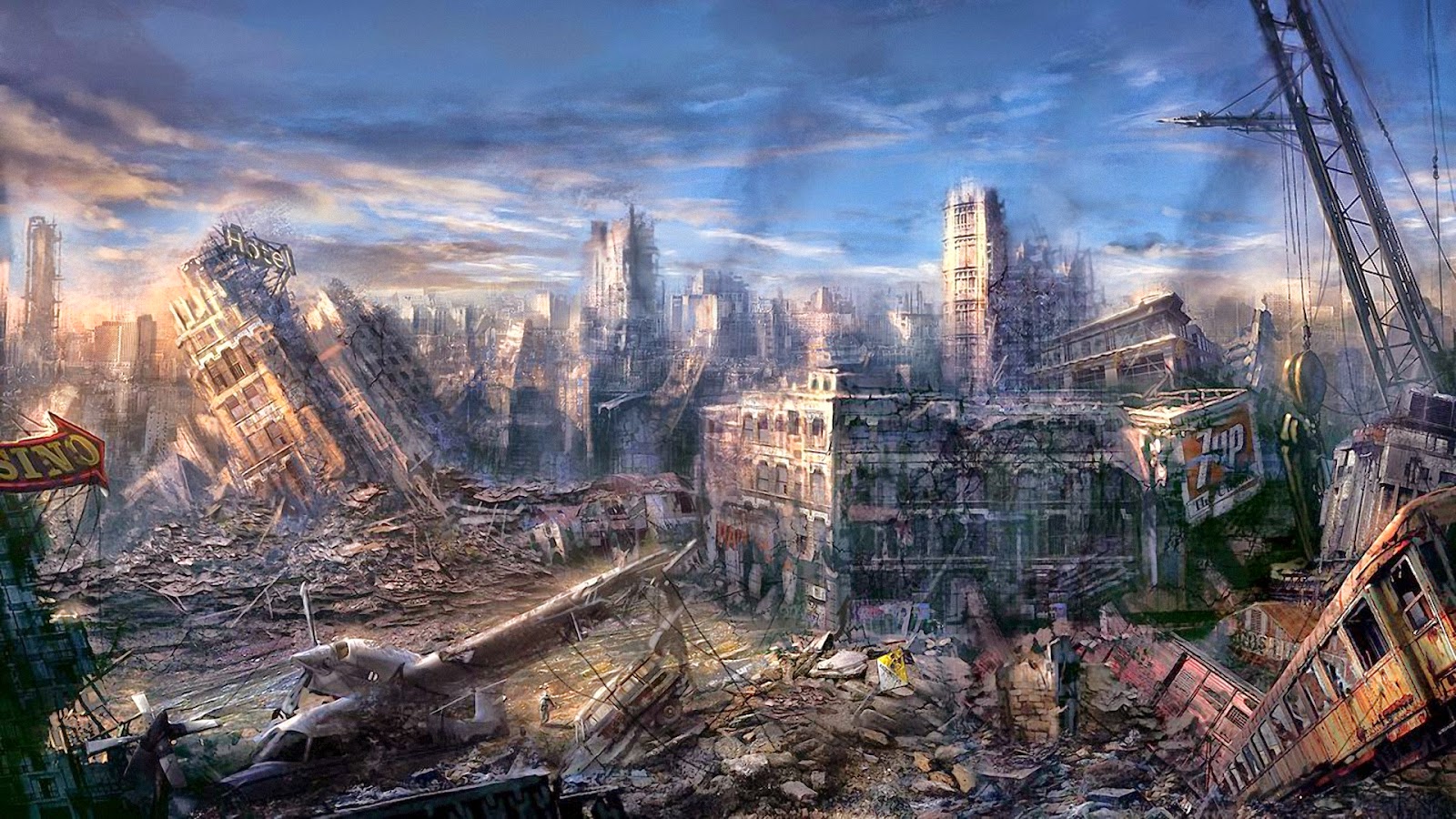
The Sixth Seal: NY City Destroyed
At this time, no satisfactory answers to these questions are available. A few years ago, rudimentary scenario studies were made for Boston and New York with limited scope and uncertain results. For most eastern cities, including Washington D.C., we know even less about the economic, societal and political impacts from significant earthquakes, whatever their rate of occurrence.
Why do we know so little about such vital public issues? Because the public has been lulled into believing that seriously damaging quakes are so unlikely in the east that in essence we do not need to consider them. We shall examine the validity of this widely held opinion.
Is the public’s earthquake awareness (or lack thereof) controlled by perceived low Seismicity, Seismic Hazard, or Seismic Risk? How do these three seismic features differ from, and relate to each other? In many portions of California, earthquake awareness is refreshed in a major way about once every decade (and in some places even more often) by virtually every person experiencing a damaging event. The occurrence of earthquakes of given magnitudes in time and space, not withstanding their effects, are the manifestations of seismicity. Ground shaking, faulting, landslides or soil liquefaction are the manifestations of seismic hazard. Damage to structures, and loss of life, limb, material assets, business and services are the manifestations of seismic risk. By sheer experience, California’s public understands fairly well these three interconnected manifestations of the earthquake phenomenon. This awareness is reflected in public policy, enforcement of seismic regulations, and preparedness in both the public and private sector. In the eastern U.S., the public and its decision makers generally do not understand them because of inexperience. Judging seismic risk by rates of seismicity alone (which are low in the east but high in the west) has undoubtedly contributed to the public’s tendency to belittle the seismic loss potential for eastern urban regions.
Let us compare two hypothetical locations, one in California and one in New York City. Assume the location in California does experience, on average, one M = 6 every 10 years, compared to New York once every 1,000 years. This implies a ratio of rates of seismicity of 100:1. Does that mean the ratio of expected losses (when annualized per year) is also 100:1? Most likely not. That ratio may be closer to 10:1, which seems to imply that taking our clues from seismicity alone may lead to an underestimation of the potential seismic risks in the east. Why should this be so?
To check the assertion, let us make a back-of-the-envelope estimate. The expected seismic risk for a given area is defined as the area-integrated product of: seismic hazard (expected shaking level), assets ($ and people), and the assets’ vulnerabilities (that is, their expected fractional loss given a certain hazard – say, shaking level). Thus, if we have a 100 times lower seismicity rate in New York compared to California, which at any given point from a given quake may yield a 2 times higher shaking level in New York compared to California because ground motions in the east are known to differ from those in the west; and if we have a 2 times higher asset density (a modest assumption for Manhattan!), and a 2 times higher vulnerability (again a modest assumption when considering the large stock of unreinforced masonry buildings and aged infrastructure in New York), then our California/New York ratio for annualized loss potential may be on the order of (100/(2x2x2)):1. That implies about a 12:1 risk ratio between the California and New York location, compared to a 100:1 ratio in seismicity rates.
From this example it appears that seismic awareness in the east may be more controlled by the rate of seismicity than by the less well understood risk potential. This misunderstanding is one of the reasons why earthquake awareness and preparedness in the densely populated east is so disproportionally low relative to its seismic loss potential. Rare but potentially catastrophic losses in the east compete in attention with more frequent moderate losses in the west. New York City is the paramount example of a low-probability, high-impact seismic risk, the sort of risk that is hard to insure against, or mobilize public action to reduce the risks.
There are basically two ways to respond. One is to do little and wait until one or more disastrous events occur. Then react to these – albeit disastrous – “windows of opportunity.” That is, pay after the unmitigated facts, rather than attempt to control their outcome. This is a high-stakes approach, considering the evolved state of the economy. The other approach is to invest in mitigation ahead of time, and use scientific knowledge and inference, education, technology transfer, and combine it with a mixture of regulatory and/or economic incentives to implement earthquake preparedness. The National Earthquake Hazard Reduction Program (NEHRP) has attempted the latter while much of the public tends to cling to the former of the two options. Realistic and reliable quantitative loss estimation techniques are essential to evaluate the relative merits of the two approaches.
The current efforts in the eastern U.S., including New York City, to start the enforcement of seismic building codes for new constructions are important first steps in the right direction. Similarly, the emerging efforts to include seismic rehabilitation strategies in the generally needed overhaul of the cities’ aged infrastructures such as bridges, water, sewer, power and transportation is commendable and needs to be pursued with diligence and persistence. But at the current pace of new construction replacing older buildings and lifelines, it will take many decades or a century before a major fraction of the stock of built assets will become seismically more resilient than the current inventory is. For some time, this leaves society exposed to very high seismic risks. The only consolation is that seismicity on average is low, and, hence with some luck, the earthquakes will not outpace any ongoing efforts to make eastern cities more earthquake resilient gradually. Nevertheless, M = 5 to M = 6 earthquakes at distances of tens of km must be considered a credible risk at almost any time for cities like Boston, New York or Philadelphia. M = 7 events, while possible, are much less likely; and in many respects, even if building codes will have affected the resilience of a future improved building stock, M = 7 events would cause virtually unmanageable situations. Given these bleak prospects, it will be necessary to focus on crucial elements such as maintaining access to cities by strengthening critical bridges, improving the structural and nonstructural performance of hospitals, and having a nationally supported plan how to assist a devastated region in case of a truly severe earthquake. No realistic and coordinated planning of this sort exists at this time for most eastern cities.
The current efforts by the Federal Emergency Management Administration (FEMA) via the National Institute of Building Sciences (NIBS) to provide a standard methodology (RMS, 1994) and planning tools for making systematic, computerized loss estimates for annualized probabilistic calculations as well as for individual scenario events, is commendable. But these new tools provide only a shell with little regional data content. What is needed are the detailed data bases on inventory of buildings and lifelines with their locally specific seismic fragility properties. Similar data are needed for hospitals, shelters, firehouses, police stations and other emergency service providers. Moreover, the soil and rock conditions which control the shaking and soil liquefaction properties for any given event, need to be systematically compiled into Geographical Information System (GIS) data bases so they can be combined with the inventory of built assets for quantitative loss and impact estimates. Even under the best of conceivable funding conditions, it will take years before such data bases can be established so they will be sufficiently reliable and detailed to perform realistic and credible loss scenarios. Without such planning tools, society will remain in the dark as to what it may encounter from a future major eastern earthquake. Given these uncertainties, and despite them, both the public and private sector must develop at least some basic concepts for contingency plans. For instance, the New York City financial service industry, from banks to the stock and bond markets and beyond, ought to consider operational contingency planning, first in terms of strengthening their operational facilities, but also for temporary backup operations until operations in the designated facilities can return to some measure of normalcy. The Federal Reserve in its oversight function for this industry needs to take a hard look at this situation.
A society, whose economy depends increasingly so crucially on rapid exchange of vast quantities of information must become concerned with strengthening its communication facilities together with the facilities into which the information is channeled. In principle, the availability of satellite communication (especially if self-powered) with direct up and down links, provides here an opportunity that is potentially a great advantage over distributed buried networks. Distributed networks for transportation, power, gas, water, sewer and cabled communication will be expensive to harden (or restore after an event).
In all future instances of major capital spending on buildings and urban infrastructures, the incorporation of seismically resilient design principles at all stages of realization will be the most effective way to reduce society’s exposure to high seismic risks. To achieve this, all levels of government need to utilize legislative and regulatory options; insurance industries need to build economic incentives for seismic safety features into their insurance policy offerings; and the private sector, through trade and professional organizations’ planning efforts, needs to develop a healthy self-protective stand. Also, the insurance industry needs to invest more aggressively into broadly based research activities with the objective to quantify the seismic hazards, the exposed assets and their seismic fragilities much more accurately than currently possible. Only together these combined measures may first help to quantify and then reduce our currently untenably large seismic risk exposures in the virtually unprepared eastern cities. Given the low-probability/high-impact situation in this part of the country, seismic safety planning needs to be woven into both the regular capital spending and daily operational procedures. Without it we must be prepared to see little progress. Unless we succeed to build seismic safety considerations into everyday decision making as a normal procedure of doing business, society will lose the race against the unstoppable forces of nature. While we never can entirely win this race, we can succeed in converting unmitigated catastrophes into manageable disasters, or better, tolerable natural events.
Saturday, June 15, 2024
The Sixth Seal Long Overdue (Revelation 6)
The Big One Awaits
By MARGO NASH
Published: March 25, 2001
Alexander Gates, a geology professor at Rutgers-Newark, is co-author of “The Encyclopedia of Earthquakes and Volcanoes,“ which will be published by Facts on File in July. He has been leading a four-year effort to remap an area known as the Sloatsburg Quadrangle, a 5-by-7-mile tract near Mahwah that crosses into New York State. The Ramapo Fault, which runs through it, was responsible for a big earthquake in 1884, and Dr. Gates warns that a recurrence is overdue. He recently talked about his findings.
Q. What have you found?
A. We’re basically looking at a lot more rock, and we’re looking at the fracturing and jointing in the bedrock and putting it on the maps. Any break in the rock is a fracture. If it has movement, then it’s a fault. There are a lot of faults that are offshoots of the Ramapo. Basically when there are faults, it means you had an earthquake that made it. So there was a lot of earthquake activity to produce these features. We are basically not in a period of earthquake activity along the Ramapo Fault now, but we can see that about six or seven times in history, about 250 million years ago, it had major earthquake activity. And because it’s such a fundamental zone of weakness, anytime anything happens, the Ramapo Fault goes.
Q. Where is the Ramapo Fault?
A. The fault line is in western New Jersey and goes through a good chunk of the state, all the way down to Flemington. It goes right along where they put in the new 287. It continues northeast across the Hudson River right under the Indian Point power plant up into Westchester County. There are a lot of earthquakes rumbling around it every year, but not a big one for a while.
Q. Did you find anything that surprised you?
A. I found a lot of faults, splays that offshoot from the Ramapo that go 5 to 10 miles away from the fault. I have looked at the Ramapo Fault in other places too. I have seen splays 5 to 10 miles up into the Hudson Highlands. And you can see them right along the roadsides on 287. There’s been a lot of damage to those rocks, and obviously it was produced by fault activities. All of these faults have earthquake potential.
Q. Describe the 1884 earthquake.
A. It was in the northern part of the state near the Sloatsburg area. They didn’t have precise ways of describing the location then. There was lots of damage. Chimneys toppled over. But in 1884, it was a farming community, and there were not many people to be injured. Nobody appears to have written an account of the numbers who were injured.
Q. What lessons we can learn from previous earthquakes?
A. In 1960, the city of Agadir in Morocco had a 6.2 earthquake that killed 12,000 people, a third of the population, and injured a third more. I think it was because the city was unprepared.There had been an earthquake in the area 200 years before. But people discounted the possibility of a recurrence. Here in New Jersey, we should not make the same mistake. We should not forget that we had a 5.4 earthquake 117 years ago. The recurrence interval for an earthquake of that magnitude is every 50 years, and we are overdue. The Agadir was a 6.2, and a 5.4 to a 6.2 isn’t that big a jump.
Q. What are the dangers of a quake that size?
A. When you’re in a flat area in a wooden house it’s obviously not as dangerous, although it could cut off a gas line that could explode. There’s a real problem with infrastructure that is crumbling, like the bridges with crumbling cement. There’s a real danger we could wind up with our water supplies and electricity cut off if a sizable earthquake goes off. The best thing is to have regular upkeep and keep up new building codes. The new buildings will be O.K. But there is a sense of complacency.
MARGO NASH
Saturday, June 8, 2024
Here is the Sixth Seal Zone (Revelation 6:12)

April 13, 20204 Min Read
Let’s get able to (probably) rumble.
A report this week from the Los Angeles Instances took a have a look at what a devastating earthquake may do to Los Angeles — and the classes to be discovered from the calamitous 6.three magnitude quake in 2011 that every one however flattened Christchurch, New Zealand.
However whereas People are conscious of the San Andreas fault and the seismic exercise in California, which has wreaked havoc in San Francisco and Los Angeles, there are different, lesser-known fault traces in the United States that fly dangerously underneath the radar. These cracks in the crust have prompted appreciable harm in the previous — and scientists say will achieve this once more.
Virginia Seismic Zone
Richmond, VirginiaShutterstock
In 2011, New Yorkers had been jolted by a 5.eight magnitude earthquake that shook the East Coast from New Hampshire all the approach down by means of Chapel Hill, North Carolina. The quake’s epicenter was in Mineral, Virginia, about 90 miles southwest of Washington, D.C., and was so highly effective that Union Station, the Pentagon and the Capitol Constructing had been all evacuated.
The quake woke lots of people in the northeast as much as the Virginia Seismic Zone (VSZ) under the Mason Dixon — and the consequential results it may have on main cities alongside the East Coast. The final time the VSZ prompted a lot chaos was in 1867 when it launched an earthquake of 5.6-magnitude — the strongest in Virginia’s historical past.
Ramapo Fault Zone
Shutterstock
It’s not simply the Virginia Seismic Zone New Yorkers have to fret about. Nearer to house is the Ramapo Fault Zone, which stretches from New York by means of New Jersey to Pennsylvania and was most energetic tens of millions of years in the past throughout the formation of the Appalachian Mountains. It’s answerable for a number of of the fault traces that run by means of New York Metropolis, together with one underneath 125th Avenue. In line with a New York Publish report in 2017, “On common, the area has witnessed a reasonable quake (about a 5.zero on the Richter scale) each hundred years. The final one was in 1884. Seismologists say we will anticipate the subsequent one any day now.” Enjoyable occasions!
The New Madrid Seismic Zone
This 150 mile-long sequence of faults stretches underneath 5 states: Illinois, Missouri, Arkansas, Tennessee and Kentucky, and is answerable for 4 of the largest earthquakes in the historical past of the United States, which befell over three months from December 1811 and February 1812. The quakes had been so robust the mighty Mississippi River flowed backward for 3 days. Fortunately, the space was not as populated as it’s now, so the harm was restricted. Nonetheless, a FEMA report launched in 2008 warned {that a} quake now could be catastrophic and end in “the highest financial losses as a consequence of a pure catastrophe in the United States.”
The Northern Sangre de Cristo Fault
Downtown Trinidad, Colorado Shutterstock
In 2011, a magnitude 5.three quake hit Trinidad, Colorado, one other space that has seen little seismic exercise on such a big scale. In line with the Colorado Division of Homeland Safety and Emergency Administration, The Sangre de Cristo Fault, which lies at the base of the Sangre de Cristo Mountains alongside the japanese fringe of the San Luis Valley, and the Sawatch Fault, which runs alongside the japanese fringe of the Sawatch Vary, are “two of the most distinguished probably energetic faults in Colorado” and that “Seismologists predict that Colorado will once more expertise a magnitude 6.5 earthquake at some unknown level in the future.”
The Cascadia Subduction Zone
One in every of the most probably harmful fault traces lies north of California, stretching between Oregon and Washington. Main cities like Portland, Seattle and Vancouver lie alongside the Cascadia Subduction Zone, which scientists say has the functionality of a 9.zero or 10 magnitude earthquake — 16 occasions extra highly effective than the 1906 quake which ravaged San Francisco. A quake of this magnitude would have devastating penalties on infrastructure and will probably set off large tsunamis. The risk is so nice, the BBC even did a nifty video on the potential MegaQuake risk.Tuesday, June 4, 2024
The Sixth Seal Long Overdue (Revelation 6)
The Big One Awaits
By MARGO NASH
Published: March 25, 2001
Alexander Gates, a geology professor at Rutgers-Newark, is co-author of “The Encyclopedia of Earthquakes and Volcanoes,“ which will be published by Facts on File in July. He has been leading a four-year effort to remap an area known as the Sloatsburg Quadrangle, a 5-by-7-mile tract near Mahwah that crosses into New York State. The Ramapo Fault, which runs through it, was responsible for a big earthquake in 1884, and Dr. Gates warns that a recurrence is overdue. He recently talked about his findings.
Q. What have you found?
A. We’re basically looking at a lot more rock, and we’re looking at the fracturing and jointing in the bedrock and putting it on the maps. Any break in the rock is a fracture. If it has movement, then it’s a fault. There are a lot of faults that are offshoots of the Ramapo. Basically when there are faults, it means you had an earthquake that made it. So there was a lot of earthquake activity to produce these features. We are basically not in a period of earthquake activity along the Ramapo Fault now, but we can see that about six or seven times in history, about 250 million years ago, it had major earthquake activity. And because it’s such a fundamental zone of weakness, anytime anything happens, the Ramapo Fault goes.
Q. Where is the Ramapo Fault?
A. The fault line is in western New Jersey and goes through a good chunk of the state, all the way down to Flemington. It goes right along where they put in the new 287. It continues northeast across the Hudson River right under the Indian Point power plant up into Westchester County. There are a lot of earthquakes rumbling around it every year, but not a big one for a while.
Q. Did you find anything that surprised you?
A. I found a lot of faults, splays that offshoot from the Ramapo that go 5 to 10 miles away from the fault. I have looked at the Ramapo Fault in other places too. I have seen splays 5 to 10 miles up into the Hudson Highlands. And you can see them right along the roadsides on 287. There’s been a lot of damage to those rocks, and obviously it was produced by fault activities. All of these faults have earthquake potential.
Q. Describe the 1884 earthquake.
A. It was in the northern part of the state near the Sloatsburg area. They didn’t have precise ways of describing the location then. There was lots of damage. Chimneys toppled over. But in 1884, it was a farming community, and there were not many people to be injured. Nobody appears to have written an account of the numbers who were injured.
Q. What lessons we can learn from previous earthquakes?
A. In 1960, the city of Agadir in Morocco had a 6.2 earthquake that killed 12,000 people, a third of the population, and injured a third more. I think it was because the city was unprepared.There had been an earthquake in the area 200 years before. But people discounted the possibility of a recurrence. Here in New Jersey, we should not make the same mistake. We should not forget that we had a 5.4 earthquake 117 years ago. The recurrence interval for an earthquake of that magnitude is every 50 years, and we are overdue. The Agadir was a 6.2, and a 5.4 to a 6.2 isn’t that big a jump.
Q. What are the dangers of a quake that size?
A. When you’re in a flat area in a wooden house it’s obviously not as dangerous, although it could cut off a gas line that could explode. There’s a real problem with infrastructure that is crumbling, like the bridges with crumbling cement. There’s a real danger we could wind up with our water supplies and electricity cut off if a sizable earthquake goes off. The best thing is to have regular upkeep and keep up new building codes. The new buildings will be O.K. But there is a sense of complacency.
MARGO NASH
Subscribe to:
Posts (Atom)