Friday, September 8, 2023

The Next Major Quake: The Sixth Seal of NYC


A recent assessment by the USGS determined that the earthquake hazard along the East Coast may previously have been underestimated. The varying risks around the US can be seen above, with New York City in the mid-range (yellow)

New York is OVERDUE an earthquake from a ‚brittle grid‘ of faults under the city, expert warns

  • New York City last experienced a M5 or higher earthquake in 1884, experts say
  • It’s thought that these earthquakes occur on a roughly 150-year periodicity 
  • Based on this, some say the city could be overdue for the next major quake 
Published: 15:50 EDT, 1 September 2017 | Updated: 12:00 EDT, 2 September 2017
When you think of the impending earthquake risk in the United States, it’s likely California or the Pacific Northwest comes to mind.
But, experts warn a system of faults making up a ‘brittle grid’ beneath New York City could also be loading up for a massive temblor.
The city has been hit by major quakes in the past, along what’s thought to be roughly 150-year intervals, and researchers investigating these faults now say the region could be overdue for the next event.
Experts warn a system of faults making up a ‘brittle grid’ beneath New York City could also be loading up for a massive temblor. The city has been hit by major quakes in the past, along what’s thought to be roughly 150-year intervals. A stock image is pictured

THE ‚CONEY ISLAND EARTHQUAKE‘

On August 10, 1884, New York was struck by a magnitude 5.5 earthquake with an epicentre located in Brooklyn.
While there was little damage and few injuries reported, anecdotal accounts of the event reveal the frightening effects of the quake.
One newspaper even reported that it caused someone to die from fright.
According to a New York Times report following the quake, massive buildings, including the Post Office swayed back and forth.
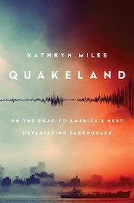
And, police said they felt the Brooklyn Bridge swaying ‘as if struck by a hurricane,’ according to an adaptation of Kathryn Miles’ book Quakeland: On the Road to America’s Next Devastating Earthquake.
The rumbles were felt across a 70,000-square-mile area, causing broken windows and cracked walls as far as Pennsylvania and Connecticut.
The city hasn’t experienced an earthquake this strong since.
According to geologist Dr Charles Merguerian, who has walked the entirety of Manhattan to assess its seismicity, there are a slew of faults running through New York, reports author Kathryn Miles in an adaptation of her new book Quakeland: On the Road to America’s Next Devastating Earthquake.
One such fault passes through 125th street, otherwise known as the Manhattanville Fault.
While there have been smaller quakes in New York’s recent past, including a magnitude 2.6 that struck in October 2001, it’s been decades since the last major tremor of M 5 or more.
And, most worryingly, the expert says there’s no way to predict exactly when a quake will strike.
‘That’s a question you really can’t answer,’ Merguerian has explained in the past.
‘All we can do is look at the record, and the record is that there was a relatively large earthquake here in the city in 1737, and in 1884, and that periodicity is about 150 year heat cycle.
‘So you have 1737, 1884, 20- and, we’re getting there. But statistics can lie.
‘An earthquake could happen any day, or it couldn’t happen for 100 years, and you just don’t know, there’s no way to predict.’
Compared the other parts of the United States, the risk of an earthquake in New York may not seem as pressing.
But, experts explain that a quake could happen anywhere.
According to geologist Dr Charles Merguerian, there are a slew of faults running through NY. One is the Ramapo Fault
‘All states have some potential for damaging earthquake shaking,’ according to the US Geological Survey.
‘Hazard is especially high along the west coast but also in the intermountain west, and in parts of the central and eastern US.’
A recent assessment by the USGS determined that the earthquake hazard along the East Coast may previously have been underestimated.
‘The eastern U.S. has the potential for larger and more damaging earthquakes than considered in previous maps and assessments,’ the USGS report explained.
The experts point to a recent example – the magnitude 5.8 earthquake that hit Virginia in 2011, which was among the largest to occur on the east coast in the last century.
This event suggests the area could be subjected to even larger earthquakes, even raising the risk for Charleston, SC.
It also indicates that New York City may be at higher risk than once thought.
A recent assessment by the USGS determined that the earthquake hazard along the East Coast may previously have been underestimated. The varying risks around the US can be seen above, with New York City in the mid-range (yellow).

Thursday, September 7, 2023

Here is the Sixth Seal Zone (Revelation 6:12)


April 13, 20204 Min Read
Let’s get able to (probably) rumble.
A report this week from the Los Angeles Instances took a have a look at what a devastating earthquake may do to Los Angeles — and the classes to be discovered from the calamitous 6.three magnitude quake in 2011 that every one however flattened Christchurch, New Zealand.
However whereas People are conscious of the San Andreas fault and the seismic exercise in California, which has wreaked havoc in San Francisco and Los Angeles, there are different, lesser-known fault traces in the United States that fly dangerously underneath the radar. These cracks in the crust have prompted appreciable harm in the previous — and scientists say will achieve this once more.
Virginia Seismic Zone
Richmond, VirginiaShutterstock
In 2011, New Yorkers had been jolted by a 5.eight magnitude earthquake that shook the East Coast from New Hampshire all the approach down by means of Chapel Hill, North Carolina. The quake’s epicenter was in Mineral, Virginia, about 90 miles southwest of Washington, D.C., and was so highly effective that Union Station, the Pentagon and the Capitol Constructing had been all evacuated.
The quake woke lots of people in the northeast as much as the Virginia Seismic Zone (VSZ) under the Mason Dixon — and the consequential results it may have on main cities alongside the East Coast. The final time the VSZ prompted a lot chaos was in 1867 when it launched an earthquake of 5.6-magnitude — the strongest in Virginia’s historical past.
Ramapo Fault Zone
Shutterstock
It’s not simply the Virginia Seismic Zone New Yorkers have to fret about. Nearer to house is the Ramapo Fault Zone, which stretches from New York by means of New Jersey to Pennsylvania and was most energetic tens of millions of years in the past throughout the formation of the Appalachian Mountains. It’s answerable for a number of of the fault traces that run by means of New York Metropolis, together with one underneath 125th Avenue. In line with a New York Publish report in 2017, “On common, the area has witnessed a reasonable quake (about a 5.zero on the Richter scale) each hundred years. The final one was in 1884. Seismologists say we will anticipate the subsequent one any day now.” Enjoyable occasions!
The New Madrid Seismic Zone
This 150 mile-long sequence of faults stretches underneath 5 states: Illinois, Missouri, Arkansas, Tennessee and Kentucky, and is answerable for 4 of the largest earthquakes in the historical past of the United States, which befell over three months from December 1811 and February 1812. The quakes had been so robust the mighty Mississippi River flowed backward for 3 days. Fortunately, the space was not as populated as it’s now, so the harm was restricted. Nonetheless, a FEMA report launched in 2008 warned {that a} quake now could be catastrophic and end in “the highest financial losses as a consequence of a pure catastrophe in the United States.”
The Northern Sangre de Cristo Fault
Downtown Trinidad, Colorado Shutterstock
In 2011, a magnitude 5.three quake hit Trinidad, Colorado, one other space that has seen little seismic exercise on such a big scale. In line with the Colorado Division of Homeland Safety and Emergency Administration, The Sangre de Cristo Fault, which lies at the base of the Sangre de Cristo Mountains alongside the japanese fringe of the San Luis Valley, and the Sawatch Fault, which runs alongside the japanese fringe of the Sawatch Vary, are “two of the most distinguished probably energetic faults in Colorado” and that “Seismologists predict that Colorado will once more expertise a magnitude 6.5 earthquake at some unknown level in the future.”
The Cascadia Subduction Zone
One in every of the most probably harmful fault traces lies north of California, stretching between Oregon and Washington. Main cities like Portland, Seattle and Vancouver lie alongside the Cascadia Subduction Zone, which scientists say has the functionality of a 9.zero or 10 magnitude earthquake — 16 occasions extra highly effective than the 1906 quake which ravaged San Francisco. A quake of this magnitude would have devastating penalties on infrastructure and will probably set off large tsunamis. The risk is so nice, the BBC even did a nifty video on the potential MegaQuake risk.

Wednesday, September 6, 2023

Quakeland: On the Road to America’s Next Devastating Earthquake: Revelation 6


Quakeland: On the Road to America’s Next Devastating Earthquake
Roger BilhamQuakeland: New York and the Sixth Seal (Revelation 6:12)
Given recent seismic activity — political as well as geological — it’s perhaps unsurprising that two books on earthquakes have arrived this season. One is as elegant as the score of a Beethoven symphony; the other resembles a diary of conversations overheard during a rock concert. Both are interesting, and both relate recent history to a shaky future.
Journalist Kathryn Miles’s Quakeland is a litany of bad things that happen when you provoke Earth to release its invisible but ubiquitous store of seismic-strain energy, either by removing fluids (oil, water, gas) or by adding them in copious quantities (when extracting shale gas in hydraulic fracturing, also known as fracking, or when injecting contaminated water or building reservoirs). To complete the picture, she describes at length the bad things that happen during unprovoked natural earthquakes. As its subtitle hints, the book takes the form of a road trip to visit seismic disasters both past and potential, and seismologists and earthquake engineers who have first-hand knowledge of them. Their colourful personalities, opinions and prejudices tell a story of scientific discovery and engineering remedy.
Miles poses some important societal questions. Aside from human intervention potentially triggering a really damaging earthquake, what is it actually like to live in neighbourhoods jolted daily by magnitude 1–3 earthquakes, or the occasional magnitude 5? Are these bumps in the night acceptable? And how can industries that perturb the highly stressed rocks beneath our feet deny obvious cause and effect? In 2015, the Oklahoma Geological Survey conceded that a quadrupling of the rate of magnitude-3 or more earthquakes in recent years, coinciding with a rise in fracking, was unlikely to represent a natural process. Miles does not take sides, but it’s difficult for the reader not to.
She visits New York City, marvelling at subway tunnels and unreinforced masonry almost certainly scheduled for destruction by the next moderate earthquake in the vicinity. She considers the perils of nuclear-waste storage in Nevada and Texas, and ponders the risks to Idaho miners of rock bursts — spontaneous fracture of the working face when the restraints of many million years of confinement are mined away. She contemplates the ups and downs of the Yellowstone Caldera — North America’s very own mid-continent supervolcano — and its magnificently uncertain future. Miles also touches on geothermal power plants in southern California’s Salton Sea and elsewhere; the vast US network of crumbling bridges, dams and oil-storage farms; and the magnitude 7–9 earthquakes that could hit California and the Cascadia coastline of Oregon and Washington state this century. Amid all this doom, a new elementary school on the coast near Westport, Washington, vulnerable to inbound tsunamis, is offered as a note of optimism. With foresight and much persuasion from its head teacher, it was engineered to become an elevated safe haven.
Miles briefly discusses earthquake prediction and the perils of getting it wrong (embarrassment in New Madrid, Missouri, where a quake was predicted but never materialized; prison in L’Aquila, Italy, where scientists failed to foresee a devastating seismic event) and the successes of early-warning systems, with which electronic alerts can be issued ahead of damaging seismic waves. Yes, it’s a lot to digest, but most of the book obeys the laws of physics, and it is a engaging read. One just can’t help wishing that Miles’s road trips had taken her somewhere that wasn’t a disaster waiting to happen.
Catastrophic damage in Anchorage, Alaska, in 1964, caused by the second-largest earthquake in the global instrumental record.
In The Great Quake, journalist Henry Fountain provides us with a forthright and timely reminder of the startling historical consequences of North America’s largest known earthquake, which more than half a century ago devastated southern Alaska. With its epicentre in Prince William Sound, the 1964 quake reached magnitude 9.2, the second largest in the global instrumental record. It released more energy than either the 2004 Sumatra–Andaman earthquake or the 2011 Tohoku earthquake off Japan; and it generated almost as many pages of scientific commentary and description as aftershocks. Yet it has been forgotten by many.
The quake was scientifically important because it occurred at a time when plate tectonics was in transition from hypothesis to theory. Fountain expertly traces the theory’s historical development, and how the Alaska earthquake was pivotal in nailing down one of the most important predictions. The earthquake caused a fjordland region larger than England to subside, and a similarly huge region of islands offshore to rise by many metres; but its scientific implications were not obvious at the time. Eminent seismologists thought that a vertical fault had slipped, drowning forests and coastlines to its north and raising beaches and islands to its south. But this kind of fault should have reached the surface, and extended deep into Earth’s mantle. There was no geological evidence of a monster surface fault separating these two regions, nor any evidence for excessively deep aftershocks. The landslides and liquefied soils that collapsed houses, and the tsunami that severely damaged ports and infrastructure, offered no clues to the cause.
“Previous earthquakes provide clear guidance about present-day vulnerability.” The hero of The Great Quake is the geologist George Plafker, who painstakingly mapped the height reached by barnacles lifted out of the intertidal zone along shorelines raised by the earthquake, and documented the depths of drowned forests. He deduced that the region of subsidence was the surface manifestation of previously compressed rocks springing apart, driving parts of Alaska up and southwards over the Pacific Plate. His finding confirmed a prediction of plate tectonics, that the leading edge of the Pacific Plate plunged beneath the southern edge of Alaska along a gently dipping thrust fault. That observation, once fully appreciated, was applauded by the geophysics community.
Fountain tells this story through the testimony of survivors, engineers and scientists, interweaving it with the fascinating history of Alaska, from early discovery by Europeans to purchase from Russia by the United States in 1867, and its recent development. Were the quake to occur now, it is not difficult to envisage that with increased infrastructure and larger populations, the death toll and price tag would be two orders of magnitude larger than the 139 fatalities and US$300-million economic cost recorded in 1964.
What is clear from these two books is that seismicity on the North American continent is guaranteed to deliver surprises, along with unprecedented economic and human losses. Previous earthquakes provide clear guidance about the present-day vulnerability of US infrastructure and populations. Engineers and seismologists know how to mitigate the effects of future earthquakes (and, in mid-continent, would advise against the reckless injection of waste fluids known to trigger earthquakes). It is merely a matter of persuading city planners and politicians that if they are tempted to ignore the certainty of the continent’s seismic past, they should err on the side of caution when considering its seismic future.

Tuesday, September 5, 2023

New York Subways at the Sixth Seal (Revelation 6)

                 How vulnerable are NYC’s underwater subway tunnels to flooding?

Ashley Fetters
New York City is full of peculiar phenomena—rickety fire escapes; 100-year-old subway tunnelsair conditioners propped perilously into window frames—that can strike fear into the heart of even the toughest city denizen. But should they? Every month, writer Ashley Fetters will be exploring—and debunking—these New York-specific fears, letting you know what you should actually worry about, and what anxieties you can simply let slip away.
The 25-minute subway commute from Crown Heights to the Financial District on the 2/3 line is, in my experience, a surprisingly peaceful start to the workday—save for one 3,100-foot stretch between the Clark Street and Wall Street stations, where for three minutes I sit wondering what the probability is that I will soon die a torturous, claustrophobic drowning death right here in this subway car.
The Clark Street Tunnel, opened in 1916, is one of approximately a dozen tunnels that escort MTA passengers from one borough to the next underwater—and just about all of them, with the exception of the 1989 addition of the 63rd Street F train tunnel, were constructed between 1900 and 1936.
Each day, thousands of New Yorkers venture across the East River and back again through these tubes buried deep in the riverbed, some of which are nearing or even past their 100th birthdays. Are they wrong to ponder their own mortality while picturing one of these watery catacombs suddenly springing a leak?
Mostly yes, they are, says Michael Horodniceanu, the former president of MTA Capital Construction and current principal of Urban Advisory Group. First, it’s important to remember that the subway tunnel is built under the riverbed, not just in the river—so what immediately surrounds the tunnel isn’t water but some 25 feet of soil. “There’s a lot of dirt on top of it,” Horodniceanu says. “It’s well into the bed of the bottom of the channel.”
And second, as Angus Kress Gillespie, author of Crossing Under the Hudson: The Story of the Holland and Lincoln Tunnels, points out, New York’s underwater subway tunnels are designed to withstand some leaking. And withstand it they do: Pumps placed below the floor of the tunnel, he says, are always running, always diverting water seepage into the sewers. (Horodniceanu says the amount of water these pumps divert into the sewer system each day numbers in the thousands of gallons.)
Additionally, MTA crews routinely repair the grouting and caulking, and often inject a substance into the walls that creates a waterproof membrane outside the tunnel—which keeps water out of the tunnel and relieves any water pressure acting on its walls. New tunnels, Horodniceanu points out, are even built with an outside waterproofing membrane that works like an umbrella: Water goes around it, it falls to the sides, and then it gets channeled into a pumping station and pumped out.
Of course, the classic New York nightmare scenario isn’t just a cute little trickle finding its way in. The anxiety daydream usually involves something sinister, or seismic. The good news, however, is that while an earthquake or explosion would indeed be bad for many reasons, it likely wouldn’t result in the frantic flooding horror scene that plays out in some commuters’ imaginations.
The Montague Tube, which sustained severe damage during Hurricane Sandy.
MTA New York City Transit / Marc A. Hermann
Horodniceanu assures me that tunnels built more recently are “built to withstand a seismic event.” The older tunnels, however—like, um, the Clark Street Tunnel—“were not seismically retrofitted, let me put it that way,” Horodniceanu says. “But the way they were built is in such a way that I do not believe an earthquake would affect them.” They aren’t deep enough in the ground, anyway, he says, to be too intensely affected by a seismic event. (The MTA did not respond to a request for comment.)
One of the only real threats to tunnel infrastructure, Horodniceanu adds, is extreme weather. Hurricane Sandy, for example, caused flooding in the tunnels, which “created problems with the infrastructure.” He continues, “The tunnels have to be rebuilt as a result of saltwater corroding the infrastructure.”
Still, he points out, hurricanes don’t exactly happen with no warning. So while Hurricane Sandy did cause major trauma to the tunnels, train traffic could be stopped with ample time to keep passengers out of harm’s way. In 2012, Governor Andrew Cuomo directed all the MTA’s mass transit services to shut down at 7 p.m. the night before Hurricane Sandy was expected to hit New York City.
And Gillespie, for his part, doubts even an explosion would result in sudden, dangerous flooding. A subway tunnel is not a closed system, he points out; it’s like a pipe that’s open at both ends. “The force of a blast would go forwards and backwards out the exit,” he says.
So the subway-train version of that terrifying Holland Tunnel flood scene in Sylvester Stallone’s Daylight is … unrealistic, right?
“Yeah,” Gillespie laughs. “Yeah. It is.”
Got a weird New York anxiety that you want explored? E-mail tips@curbed.com, and we may include it in a future column.

Sunday, September 3, 2023

The History Of New York Earthquakes: Before The Sixth Seal (Revelation 6:12)


Historic Earthquakes
Near New York City, New York
1884 08 10 19:07 UTC
Magnitude 5.5The History Of New York Earthquakes: Before The Sixth Seal (Rev 6:12)
Intensity VII
USGS.gov
This severe earthquake affected an area roughly extending along the Atlantic Coast from southern Maine to central Virginia and westward to Cleveland, Ohio. Chimneys were knocked down and walls were cracked in several States, including Connecticut, New Jersey, New York, and Pennsylvania. Many towns from Hartford, Connecticut, to West Chester,Pennsylvania.
Property damage was severe at Amityville and Jamaica, New York, where several chimneys were “overturned” and large cracks formed in walls. Two chimneys were thrown down and bricks were shaken from other chimneys at Stratford (Fairfield County), Conn.; water in the Housatonic River was agitated violently. At Bloomfield, N.J., and Chester, Pa., several chimneys were downed and crockery was broken. Chimneys also were damaged at Mount Vernon, N.Y., and Allentown, Easton, and Philadelphia, Pa. Three shocks occurred, the second of which was most violent. This earthquake also was reported felt in Vermont, Virginia, and Washington, D.C. Several slight aftershocks were reported on August 11.
Teilen mit:
TwitterFacebook

Saturday, September 2, 2023

The Sixth Seal Long Overdue (Revelation 6)


The Big One Awaits
By MARGO NASH
Published: March 25, 2001
Alexander Gates, a geology professor at Rutgers-Newark, is co-author of “The Encyclopedia of Earthquakes and Volcanoes,“ which will be published by Facts on File in July. He has been leading a four-year effort to remap an area known as the Sloatsburg Quadrangle, a 5-by-7-mile tract near Mahwah that crosses into New York State. The Ramapo Fault, which runs through it, was responsible for a big earthquake in 1884, and Dr. Gates warns that a recurrence is overdue. He recently talked about his findings.
Q. What have you found?
A. We’re basically looking at a lot more rock, and we’re looking at the fracturing and jointing in the bedrock and putting it on the maps. Any break in the rock is a fracture. If it has movement, then it’s a fault. There are a lot of faults that are offshoots of the Ramapo. Basically when there are faults, it means you had an earthquake that made it. So there was a lot of earthquake activity to produce these features. We are basically not in a period of earthquake activity along the Ramapo Fault now, but we can see that about six or seven times in history, about 250 million years ago, it had major earthquake activity. And because it’s such a fundamental zone of weakness, anytime anything happens, the Ramapo Fault goes.
Q. Where is the Ramapo Fault?
 A. The fault line is in western New Jersey and goes through a good chunk of the state, all the way down to Flemington. It goes right along where they put in the new 287. It continues northeast across the Hudson River right under the Indian Point power plant up into Westchester County. There are a lot of earthquakes rumbling around it every year, but not a big one for a while.
Q. Did you find anything that surprised you?
A. I found a lot of faults, splays that offshoot from the Ramapo that go 5 to 10 miles away from the fault. I have looked at the Ramapo Fault in other places too. I have seen splays 5 to 10 miles up into the Hudson Highlands. And you can see them right along the roadsides on 287. There’s been a lot of damage to those rocks, and obviously it was produced by fault activities. All of these faults have earthquake potential.
Q. Describe the 1884 earthquake.
A. It was in the northern part of the state near the Sloatsburg area. They didn’t have precise ways of describing the location then. There was lots of damage. Chimneys toppled over. But in 1884, it was a farming community, and there were not many people to be injured. Nobody appears to have written an account of the numbers who were injured.
Q. What lessons we can learn from previous earthquakes?
A. In 1960, the city of Agadir in Morocco had a 6.2 earthquake that killed 12,000 people, a third of the population, and injured a third more. I think it was because the city was unprepared.There had been an earthquake in the area 200 years before. But people discounted the possibility of a recurrence. Here in New Jersey, we should not make the same mistake. We should not forget that we had a 5.4 earthquake 117 years ago. The recurrence interval for an earthquake of that magnitude is every 50 years, and we are overdue. The Agadir was a 6.2, and a 5.4 to a 6.2 isn’t that big a jump.
Q. What are the dangers of a quake that size?
A. When you’re in a flat area in a wooden house it’s obviously not as dangerous, although it could cut off a gas line that could explode. There’s a real problem with infrastructure that is crumbling, like the bridges with crumbling cement. There’s a real danger we could wind up with our water supplies and electricity cut off if a sizable earthquake goes off. The best thing is to have regular upkeep and keep up new building codes. The new buildings will be O.K. But there is a sense of complacency.
MARGO NASH

The Next Major Quake: The Sixth Seal of NYC


A recent assessment by the USGS determined that the earthquake hazard along the East Coast may previously have been underestimated. The varying risks around the US can be seen above, with New York City in the mid-range (yellow)

New York is OVERDUE an earthquake from a ‚brittle grid‘ of faults under the city, expert warns

  • New York City last experienced a M5 or higher earthquake in 1884, experts say
  • It’s thought that these earthquakes occur on a roughly 150-year periodicity 
  • Based on this, some say the city could be overdue for the next major quake 
Published: 15:50 EDT, 1 September 2017 | Updated: 12:00 EDT, 2 September 2017
When you think of the impending earthquake risk in the United States, it’s likely California or the Pacific Northwest comes to mind.
But, experts warn a system of faults making up a ‘brittle grid’ beneath New York City could also be loading up for a massive temblor.
The city has been hit by major quakes in the past, along what’s thought to be roughly 150-year intervals, and researchers investigating these faults now say the region could be overdue for the next event.
Experts warn a system of faults making up a ‘brittle grid’ beneath New York City could also be loading up for a massive temblor. The city has been hit by major quakes in the past, along what’s thought to be roughly 150-year intervals. A stock image is pictured

THE ‚CONEY ISLAND EARTHQUAKE‘

On August 10, 1884, New York was struck by a magnitude 5.5 earthquake with an epicentre located in Brooklyn.
While there was little damage and few injuries reported, anecdotal accounts of the event reveal the frightening effects of the quake.
One newspaper even reported that it caused someone to die from fright.
According to a New York Times report following the quake, massive buildings, including the Post Office swayed back and forth.
And, police said they felt the Brooklyn Bridge swaying ‘as if struck by a hurricane,’ according to an adaptation of Kathryn Miles’ book Quakeland: On the Road to America’s Next Devastating Earthquake.
The rumbles were felt across a 70,000-square-mile area, causing broken windows and cracked walls as far as Pennsylvania and Connecticut.
The city hasn’t experienced an earthquake this strong since.
According to geologist Dr Charles Merguerian, who has walked the entirety of Manhattan to assess its seismicity, there are a slew of faults running through New York, reports author Kathryn Miles in an adaptation of her new book Quakeland: On the Road to America’s Next Devastating Earthquake.
One such fault passes through 125th street, otherwise known as the Manhattanville Fault.
While there have been smaller quakes in New York’s recent past, including a magnitude 2.6 that struck in October 2001, it’s been decades since the last major tremor of M 5 or more.
And, most worryingly, the expert says there’s no way to predict exactly when a quake will strike.
‘That’s a question you really can’t answer,’ Merguerian has explained in the past.
‘All we can do is look at the record, and the record is that there was a relatively large earthquake here in the city in 1737, and in 1884, and that periodicity is about 150 year heat cycle.
‘So you have 1737, 1884, 20- and, we’re getting there. But statistics can lie.
‘An earthquake could happen any day, or it couldn’t happen for 100 years, and you just don’t know, there’s no way to predict.’
Compared the other parts of the United States, the risk of an earthquake in New York may not seem as pressing.
But, experts explain that a quake could happen anywhere.
According to geologist Dr Charles Merguerian, there are a slew of faults running through NY. One is the Ramapo Fault
‘All states have some potential for damaging earthquake shaking,’ according to the US Geological Survey.
‘Hazard is especially high along the west coast but also in the intermountain west, and in parts of the central and eastern US.’
A recent assessment by the USGS determined that the earthquake hazard along the East Coast may previously have been underestimated.
‘The eastern U.S. has the potential for larger and more damaging earthquakes than considered in previous maps and assessments,’ the USGS report explained.
The experts point to a recent example – the magnitude 5.8 earthquake that hit Virginia in 2011, which was among the largest to occur on the east coast in the last century.
This event suggests the area could be subjected to even larger earthquakes, even raising the risk for Charleston, SC.
It also indicates that New York City may be at higher risk than once thought.
A recent assessment by the USGS determined that the earthquake hazard along the East Coast may previously have been underestimated. The varying risks around the US can be seen above, with New York City in the mid-range (yellow).