Friday, January 30, 2026

Wednesday, January 21, 2026

Brace Yourselves, New Yorkers, You’re Due for the Sixth Seal (Revelation 6:12)


A couple of hundred thousand years ago, an M 7.2 earthquake shook what is now New Hampshire. Just a few thousand years ago, an M 7.5 quake ruptured just off the coast of Massachusetts. And then there’s New York.
Since the first western settlers arrived there, the state has witnessed 200 quakes of magnitude 2.0 or greater, making it the third most seismically active state east of the Mississippi (Tennessee and South Carolina are ranked numbers one and two, respectively). About once a century, New York has also experienced an M 5.0 quake capable of doing real damage.
The most recent one near New York City occurred in August of 1884. Centered off Long Island’s Rockaway Beach, it was felt over 70,000 square miles. It also opened enormous crevices near the Brooklyn reservoir and knocked down chimneys and cracked walls in Pennsylvania and Connecticut. Police on the Brooklyn Bridge said it swayed “as if struck by a hurricane” and worried the bridge’s towers would collapse. Meanwhile, residents throughout New York and New Jersey reported sounds that varied from explosions to loud rumblings, sometimes to comic effect. At the funeral of Lewis Ingler, a small group of mourners were watching as the priest began to pray. The quake cracked an enormous mirror behind the casket and knocked off a display of flowers that had been resting on top of it. When it began to shake the casket’s silver handles, the mourners decided the unholy return of Lewis Ingler was more than they could take and began flinging themselves out windows and doors.
Not all stories were so light. Two people died during the quake, both allegedly of fright. Out at sea, the captain of the brig Alice felt a heavy lurch that threw him and his crew, followed by a shaking that lasted nearly a minute. He was certain he had hit a wreck and was taking on water.
A day after the quake, the editors of The New York Times sought to allay readers’ fear. The quake, they said, was an unexpected fluke never to be repeated and not worth anyone’s attention: “History and the researches of scientific men indicate that great seismic disturbances occur only within geographical limits that are now well defined,” they wrote in an editorial. “The northeastern portion of the United States . . . is not within those limits.” The editors then went on to scoff at the histrionics displayed by New York residents when confronted by the quake: “They do not stop to reason or to recall the fact that earthquakes here are harmless phenomena. They only know that the solid earth, to whose immovability they have always turned with confidence when everything else seemed transitory, uncertain, and deceptive, is trembling and in motion, and the tremor ceases long before their disturbed minds become tranquil.”
That’s the kind of thing that drives Columbia’s Heather Savage nuts.
New York, she says, is positively vivisected by faults. Most of them fall into two groups—those running northeast and those running northwest. Combined they create a brittle grid underlying much of Manhattan.
Across town, Charles Merguerian has been studying these faults the old‐fashioned way: by getting down and dirty underground. He’s spent the past forty years sloshing through some of the city’s muckiest places: basements and foundations, sewers and tunnels, sometimes as deep as 750 feet belowground. His tools down there consist primarily of a pair of muck boots, a bright blue hard hat, and a pickax. In public presentations, he claims he is also ably abetted by an assistant hamster named Hammie, who maintains his own website, which includes, among other things, photos of the rodent taking down Godzilla.
That’s just one example why, if you were going to cast a sitcom starring two geophysicists, you’d want Savage and Merguerian to play the leading roles. Merguerian is as eccentric and flamboyant as Savage is earnest and understated. In his press materials, the former promises to arrive at lectures “fully clothed.” Photos of his “lab” depict a dingy porta‐john in an abandoned subway tunnel. He actively maintains an archive of vintage Chinese fireworks labels at least as extensive as his list of publications, and his professional website includes a discography of blues tunes particularly suitable for earthquakes. He calls female science writers “sweetheart” and somehow manages to do so in a way that kind of makes them like it (although they remain nevertheless somewhat embarrassed to admit it).
It’s Merguerian’s boots‐on‐the‐ground approach that has provided much of the information we need to understand just what’s going on underneath Gotham. By his count, Merguerian has walked the entire island of Manhattan: every street, every alley. He’s been in most of the tunnels there, too. His favorite one by far is the newest water tunnel in western Queens. Over the course of 150 days, Merguerian mapped all five miles of it. And that mapping has done much to inform what we know about seismicity in New York.
Most importantly, he says, it provided the first definitive proof of just how many faults really lie below the surface there. And as the city continues to excavate its subterranean limits, Merguerian is committed to following closely behind. It’s a messy business.
Down below the city, Merguerian encounters muck of every flavor and variety. He power‐washes what he can and relies upon a diver’s halogen flashlight and a digital camera with a very, very good flash to make up the difference. And through this process, Merguerian has found thousands of faults, some of which were big enough to alter the course of the Bronx River after the last ice age.
His is a tricky kind of detective work. The center of a fault is primarily pulverized rock. For these New York faults, that gouge was the very first thing to be swept away by passing glaciers. To do his work, then, he’s primarily looking for what geologists call “offsets”—places where the types of rock don’t line up with one another. That kind of irregularity shows signs of movement over time—clear evidence of a fault.
Merguerian has found a lot of them underneath New York City.
These faults, he says, do a lot to explain the geological history of Manhattan and the surrounding area. They were created millions of years ago, when what is now the East Coast was the site of a violent subduction zone not unlike those present now in the Pacific’s Ring of Fire.
Each time that occurred, the land currently known as the Mid‐Atlantic underwent an accordion effect as it was violently folded into itself again and again. The process created immense mountains that have eroded over time and been further scoured by glaciers. What remains is a hodgepodge of geological conditions ranging from solid bedrock to glacial till to brittle rock still bearing the cracks of the collision. And, says Merguerian, any one of them could cause an earthquake.
You don’t have to follow him belowground to find these fractures. Even with all the development in our most built‐up metropolis, evidence of these faults can be found everywhere—from 42nd Street to Greenwich Village. But if you want the starkest example of all, hop the 1 train at Times Square and head uptown to Harlem. Not far from where the Columbia University bus collects people for the trip to the Lamont‐Doherty Earth Observatory, the subway tracks seem to pop out of the ground onto a trestle bridge before dropping back down to earth. That, however, is just an illusion. What actually happens there is that the ground drops out below the train at the site of one of New York’s largest faults. It’s known by geologists in the region as the Manhattanville or 125th Street Fault, and it runs all the way across the top of Central Park and, eventually, underneath Long Island City. Geologists have known about the fault since 1939, when the city undertook a massive subway mapping project, but it wasn’t until recently that they confirmed its potential for a significant quake.
In our lifetimes, a series of small earthquakes have been recorded on the Manhattanville Fault including, most recently, one on October 27, 2001. Its epicenter was located around 55th and 8th—directly beneath the original Original Soupman restaurant, owned by restaurateur Ali Yeganeh, the inspiration for Seinfeld’s Soup Nazi. That fact delighted sitcom fans across the country, though few Manhattanites were in any mood to appreciate it.
The October 2001 quake itself was small—about M 2.6—but the effect on residents there was significant. Just six weeks prior, the city had been rocked by the 9/11 terrorist attacks that brought down the World Trade Center towers. The team at Lamont‐Doherty has maintained a seismic network in the region since the ’70s. They registered the collapse of the first tower at M 2.1. Half an hour later, the second tower crumbled with even more force and registered M 2.3. In a city still shocked by that catastrophe, the early‐morning October quake—several times greater than the collapse of either tower—jolted millions of residents awake with both reminders of the tragedy and fear of yet another attack. 9‐1‐1 calls overwhelmed dispatchers and first responders with reports of shaking buildings and questions about safety in the city. For seismologists, though, that little quake was less about foreign threats to our soil and more about the possibility of larger tremors to come.
Remember: The Big Apple has experienced an M 5.0 quake about every hundred years. The last one was that 1884 event. And that, says Merguerian, means the city is overdue. Just how overdue?
“Gee whiz!” He laughs when I pose this question. “That’s the holy grail of seismicity, isn’t it?”
He says all we can do to answer that question is “take the pulse of what’s gone on in recorded history.” To really have an answer, we’d need to have about ten times as much data as we do today. But from what he’s seen, the faults below New York are very much alive.
“These guys are loaded,” he tells me.
He says he is also concerned about new studies of a previously unknown fault zone known as the Ramapo that runs not far from the city. Savage shares his concerns. They both think it’s capable of an M 6.0 quake or even higher—maybe even a 7.0. If and when, though, is really anybody’s guess.
“We literally have no idea what’s happening in our backyard,” says Savage.
What we do know is that these quakes have the potential to do more damage than similar ones out West, mostly because they are occurring on far harder rock capable of propagating waves much farther. And because these quakes occur in places with higher population densities, these eastern events can affect a lot more people. Take the 2011 Virginia quake: Although it was only a moderate one, more Americans felt it than any other one in our nation’s history.
That’s the thing about the East Coast: Its earthquake hazard may be lower than that of the West Coast, but the total effect of any given quake is much higher. Disaster specialists talk about this in terms of risk, and they make sense of it with an equation that multiplies the potential hazard of an event by the cost of damage and the number of people harmed. When you take all of those factors into account, the earthquake risk in New York is much greater than, say, that in Alaska or Hawaii or even a lot of the area around the San Andreas Fault.
Merguerian has been sounding the alarm about earthquake risk in the city since the ’90s. He admits he hasn’t gotten much of a response. He says that when he first proposed the idea of seismic risk in New York City, his fellow scientists “booed and threw vegetables” at him. He volunteered his services to the city’s Office of Emergency Management but says his original offer also fell on deaf ears.
“So I backed away gently and went back to academia.”
Today, he says, the city isn’t much more responsive, but he’s getting a much better response from his peers.
He’s glad for that, he says, but it’s not enough. If anything, the events of 9/11, along with the devastation caused in 2012 by Superstorm Sandy, should tell us just how bad it could be there.
He and Savage agree that what makes the risk most troubling is just how little we know about it. When it comes right down to it, intraplate faults are the least understood. Some scientists think they might be caused by mantle flow deep below the earth’s crust. Others think they might be related to gravitational energy. Still others think quakes occurring there might be caused by the force of the Atlantic ridge as it pushes outward. Then again, it could be because the land is springing back after being compressed thousands of years ago by glaciers (a phenomenon geologists refer to as seismic rebound).
“We just have no consciousness towards earthquakes in the eastern United States,” says Merguerian. “And that’s a big mistake.”
Adapted from Quakeland: On the Road to America’s Next Devastating Earthquake by Kathryn Miles, published by Dutton, an imprint of Penguin Publishing Group, a division of Penguin Random House, LLC. Copyright © 2017 by Kathryn Miles. Thanks

Tuesday, January 20, 2026

Don’t Forget About the Sixth Seal in NYC (Revelation 6:12)


Don’t forget about earthquakes, feds tell city

Although New York’s modern skyscrapers are less likely to be damaged in an earthquake than shorter structures, a new study suggests the East Coast is more vulnerable than previously thought. The new findings will help alter building codes.
By Mark Fahey
July 18, 2014 10:03 a.m.
The 2014 maps were created with input from hundreds of experts from across the country and are based on much stronger data than the 2008 maps, said Mark Petersen, chief of the USGS National Seismic Hazard Mapping Project. The bottom line for the nation’s largest city is that the area is at a slightly lower risk for the types of slow-shaking earthquakes that are especially damaging to tall spires of which New York has more than most places, but the city is still at high risk due to its population density and aging structures, said Mr. Petersen.
“Many of the overall patterns are the same in this map as in previous maps,” said Mr. Petersen. “There are large uncertainties in seismic hazards in the eastern United States. [New York City] has a lot of exposure and some vulnerability, but people forget about earthquakes because you don’t see damage from ground shaking happening very often.”
Just because they’re infrequent doesn’t mean that large and potentially disastrous earthquakes can’t occur in the area. The new maps put the largest expected magnitude at 8, significantly higher than the 2008 peak of 7.7 on a logarithmic scale.The scientific understanding of East Coast earthquakes has expanded in recent years thanks to a magnitude 5.8 earthquake in Virginia in 2011 that was felt by tens of millions of people across the eastern U.S. New data compiled by the nuclear power industry has also helped experts understand quakes.
Oddly enough, it’s not the modern tall towers that are most at risk. Those buildings become like inverted pendulums in the high frequency shakes that are more common on the East Coast than in the West. But the city’s old eight- and 10-story masonry structures could suffer in a large quake, said Mr. Lerner-Lam. Engineers use maps like those released on Thursday to evaluate the minimum structural requirements at building sites, he said. The risk of an earthquake has to be determined over the building’s life span, not year-to-year.
“If a structure is going to exist for 100 years, frankly, it’s more than likely it’s going to see an earthquake over that time,” said Mr. Lerner-Lam. “You have to design for that event.”
The new USGS maps will feed into the city’s building-code review process, said a spokesman for the New York City Department of Buildings. Design provisions based on the maps are incorporated into a standard by the American Society of Civil Engineers, which is then adopted by the International Building Code and local jurisdictions like New York City. New York’s current provisions are based on the 2010 standards, but a new edition based on the just-released 2014 maps is due around 2016, he said.
“The standards for seismic safety in building codes are directly based upon USGS assessments of potential ground shaking from earthquakes, and have been for years,” said Jim Harris, a member and former chair of the Provisions Update Committee of the Building Seismic Safety Council, in a statement.
The seismic hazard model also feeds into risk assessment and insurance policies, according to Nilesh Shome, senior director of Risk Management Solutions, the largest insurance modeler in the industry. The new maps will help the insurance industry as a whole price earthquake insurance and manage catastrophic risk, said Mr. Shome. The industry collects more than $2.5 billion in premiums for earthquake insurance each year and underwrites more than $10 trillion in building risk, he said.
“People forget about history, that earthquakes have occurred in these regions in the past, and that they will occur in the future,” said Mr. Petersen. “They don’t occur very often, but the consequences and the costs can be high.”

Wednesday, January 14, 2026

The Sixth Seal of NYC Long Overdue (Revelation 6)


The Big One Awaits
By MARGO NASH
Published: March 25, 2001
Alexander Gates, a geology professor at Rutgers-Newark, is co-author of “The Encyclopedia of Earthquakes and Volcanoes,“ which will be published by Facts on File in July. He has been leading a four-year effort to remap an area known as the Sloatsburg Quadrangle, a 5-by-7-mile tract near Mahwah that crosses into New York State. The Ramapo Fault, which runs through it, was responsible for a big earthquake in 1884, and Dr. Gates warns that a recurrence is overdue. He recently talked about his findings.
Q. What have you found?
A. We’re basically looking at a lot more rock, and we’re looking at the fracturing and jointing in the bedrock and putting it on the maps. Any break in the rock is a fracture. If it has movement, then it’s a fault. There are a lot of faults that are offshoots of the Ramapo. Basically when there are faults, it means you had an earthquake that made it. So there was a lot of earthquake activity to produce these features. We are basically not in a period of earthquake activity along the Ramapo Fault now, but we can see that about six or seven times in history, about 250 million years ago, it had major earthquake activity. And because it’s such a fundamental zone of weakness, anytime anything happens, the Ramapo Fault goes.
Q. Where is the Ramapo Fault?
 A. The fault line is in western New Jersey and goes through a good chunk of the state, all the way down to Flemington. It goes right along where they put in the new 287. It continues northeast across the Hudson River right under the Indian Point power plant up into Westchester County. There are a lot of earthquakes rumbling around it every year, but not a big one for a while.
Q. Did you find anything that surprised you?
A. I found a lot of faults, splays that offshoot from the Ramapo that go 5 to 10 miles away from the fault. I have looked at the Ramapo Fault in other places too. I have seen splays 5 to 10 miles up into the Hudson Highlands. And you can see them right along the roadsides on 287. There’s been a lot of damage to those rocks, and obviously it was produced by fault activities. All of these faults have earthquake potential.
Q. Describe the 1884 earthquake.
A. It was in the northern part of the state near the Sloatsburg area. They didn’t have precise ways of describing the location then. There was lots of damage. Chimneys toppled over. But in 1884, it was a farming community, and there were not many people to be injured. Nobody appears to have written an account of the numbers who were injured.
Q. What lessons we can learn from previous earthquakes?
A. In 1960, the city of Agadir in Morocco had a 6.2 earthquake that killed 12,000 people, a third of the population, and injured a third more. I think it was because the city was unprepared.There had been an earthquake in the area 200 years before. But people discounted the possibility of a recurrence. Here in New Jersey, we should not make the same mistake. We should not forget that we had a 5.4 earthquake 117 years ago. The recurrence interval for an earthquake of that magnitude is every 50 years, and we are overdue. The Agadir was a 6.2, and a 5.4 to a 6.2 isn’t that big a jump.
Q. What are the dangers of a quake that size?
A. When you’re in a flat area in a wooden house it’s obviously not as dangerous, although it could cut off a gas line that could explode. There’s a real problem with infrastructure that is crumbling, like the bridges with crumbling cement. There’s a real danger we could wind up with our water supplies and electricity cut off if a sizable earthquake goes off. The best thing is to have regular upkeep and keep up new building codes. The new buildings will be O.K. But there is a sense of complacency.
MARGO NASH

Saturday, January 10, 2026

The Sixth Seal of NYC by Nostradamus (Revelation 6:12)


The Sixth Seal by Nostradamus
To Andrew the Prophet
Completed February 5, 2008
Nostradamus and the New City
Les Propheties
(Century 1 Quatrain 27)
Michel de Nostredame Earth-shaking fire from the center of the earth.Will cause the towers around the New City to shake,Two great rocks for a long time will make war, And then Arethusa will color a new river red.(And then areth USA will color a new river red.) Earth-shaking fire from the center of the earth.Will cause the towers around the New City to shake,Two great rocks for a long time will make war
There is recent scientific evidence from drill core sampling in Manhattan, that the southern peninsula is overlapped by several tectonic plates. Drill core sampling has been taken from regions south of Canal Street including the Trade Towers’ site. Of particular concern is that similar core samples have been found across the East River in Brooklyn. There are also multiple fault lines along Manhattan correlating with north-northwest and northwest trending neo-tectonic activity. And as recently as January and October of 2001, New York City has sustained earthquakes along these plates. For there are “two great rocks” or tectonic plates that shear across Manhattan in a northwestern pattern. And these plates “for a longtime will make war”, for they have been shearing against one other for millions of years. And on January 3 of 2010, when they makewar with each other one last time, the sixth seal shall be opened, and all will know that the end is near.
And then Arethusa will color a new river red.
Arethusa is a Greek mythological figure, a beautiful huntress and afollower of the goddess Artemis. And like Artemis, Arethusa would have nothing to do with me; rather she loved to run and hunt in the forest. But one day after an exhausting hunt, she came to a clear crystal stream and went in it to take a swim. She felt something from beneath her, and frightened she scampered out of the water. A voice came from the water, “Why are you leaving fair maiden?” She ran into the forest to escape, for the voice was from Alpheus, the god of the river. For he had fallen in love with her and became a human to give chase after her. Arethusa in exhaustion called out to Artemis for help, and the goddess hid her by changing her into a spring.But not into an ordinary spring, but an underground channel that traveled under the ocean from Greece to Sicily. But Alpheus being the god of the river, converted back into water and plunged downthe same channel after Arethusa. And thus Arethusa was captured by Artemis, and their waters would mingle together forever. And of great concern is that core samples found in train tunnels beneath the Hudson River are identical to those taken from southern Manhattan. Furthermore, several fault lines from the 2001 earthquakes were discovered in the Queen’s Tunnel Complex, NYC Water Tunnel #3. And a few years ago, a map of Manhattan drawn up in 1874 was discovered, showing a maze of underground waterways and lakes. For Manhattan was once a marshland and labyrinth of underground streams. Thus when the sixth seal is broken, the subways of the New City shall be flooded be Arethusa:the waters from the underground streams and the waters from the sea. And Arethusa shall be broken into two. And then Arethusa will color a new river red.
And then areth USA will color a new river red.
For Arethusa broken into two is areth USA. For areth (αρετη) is the Greek word for values. But the values of the USA are not based on morality, but on materialism and on wealth. Thus when the sixth seal is opened, Wall Street and our economy shall crash and “arethUSA”, the values of our economy shall fall “into the red.” “Then the kings of the earth and the great men and the commanders and the rich and the strong and every slave and free man hid themselves in the caves and among the rocks of the mountains; and they said to the mountains and to the rocks, ‘Fall on us and hide us from the presence of Him who sits on the throne, and from the wrath of the Lamb; for the great day of their wrath has come, and who is able to stand?’” (Revelation 6:15-17)

Thursday, January 8, 2026

Brace Yourselves for the Sixth Seal of NYC (Revelation 6)


A couple of hundred thousand years ago, an M 7.2 earthquake shook what is now New Hampshire. Just a few thousand years ago, an M 7.5 quake ruptured just off the coast of Massachusetts. And then there’s New York.
Since the first western settlers arrived there, the state has witnessed 200 quakes of magnitude 2.0 or greater, making it the third most seismically active state east of the Mississippi (Tennessee and South Carolina are ranked numbers one and two, respectively). About once a century, New York has also experienced an M 5.0 quake capable of doing real damage.
The most recent one near New York City occurred in August of 1884. Centered off Long Island’s Rockaway Beach, it was felt over 70,000 square miles. It also opened enormous crevices near the Brooklyn reservoir and knocked down chimneys and cracked walls in Pennsylvania and Connecticut. Police on the Brooklyn Bridge said it swayed “as if struck by a hurricane” and worried the bridge’s towers would collapse. Meanwhile, residents throughout New York and New Jersey reported sounds that varied from explosions to loud rumblings, sometimes to comic effect. At the funeral of Lewis Ingler, a small group of mourners were watching as the priest began to pray. The quake cracked an enormous mirror behind the casket and knocked off a display of flowers that had been resting on top of it. When it began to shake the casket’s silver handles, the mourners decided the unholy return of Lewis Ingler was more than they could take and began flinging themselves out windows and doors.
Not all stories were so light. Two people died during the quake, both allegedly of fright. Out at sea, the captain of the brig Alice felt a heavy lurch that threw him and his crew, followed by a shaking that lasted nearly a minute. He was certain he had hit a wreck and was taking on water.
A day after the quake, the editors of The New York Times sought to allay readers’ fear. The quake, they said, was an unexpected fluke never to be repeated and not worth anyone’s attention: “History and the researches of scientific men indicate that great seismic disturbances occur only within geographical limits that are now well defined,” they wrote in an editorial. “The northeastern portion of the United States . . . is not within those limits.” The editors then went on to scoff at the histrionics displayed by New York residents when confronted by the quake: “They do not stop to reason or to recall the fact that earthquakes here are harmless phenomena. They only know that the solid earth, to whose immovability they have always turned with confidence when everything else seemed transitory, uncertain, and deceptive, is trembling and in motion, and the tremor ceases long before their disturbed minds become tranquil.”
That’s the kind of thing that drives Columbia’s Heather Savage nuts.
Across town, Charles Merguerian has been studying these faults the old‐fashioned way: by getting down and dirty underground. He’s spent the past forty years sloshing through some of the city’s muckiest places: basements and foundations, sewers and tunnels, sometimes as deep as 750 feet belowground. His tools down there consist primarily of a pair of muck boots, a bright blue hard hat, and a pickax. In public presentations, he claims he is also ably abetted by an assistant hamster named Hammie, who maintains his own website, which includes, among other things, photos of the rodent taking down Godzilla.
That’s just one example why, if you were going to cast a sitcom starring two geophysicists, you’d want Savage and Merguerian to play the leading roles. Merguerian is as eccentric and flamboyant as Savage is earnest and understated. In his press materials, the former promises to arrive at lectures “fully clothed.” Photos of his “lab” depict a dingy porta‐john in an abandoned subway tunnel. He actively maintains an archive of vintage Chinese fireworks labels at least as extensive as his list of publications, and his professional website includes a discography of blues tunes particularly suitable for earthquakes. He calls female science writers “sweetheart” and somehow manages to do so in a way that kind of makes them like it (although they remain nevertheless somewhat embarrassed to admit it).
It’s Merguerian’s boots‐on‐the‐ground approach that has provided much of the information we need to understand just what’s going on underneath Gotham. By his count, Merguerian has walked the entire island of Manhattan: every street, every alley. He’s been in most of the tunnels there, too. His favorite one by far is the newest water tunnel in western Queens. Over the course of 150 days, Merguerian mapped all five miles of it. And that mapping has done much to inform what we know about seismicity in New York.
Most importantly, he says, it provided the first definitive proof of just how many faults really lie below the surface there. And as the city continues to excavate its subterranean limits, Merguerian is committed to following closely behind. It’s a messy business.
Down below the city, Merguerian encounters muck of every flavor and variety. He power‐washes what he can and relies upon a diver’s halogen flashlight and a digital camera with a very, very good flash to make up the difference. And through this process, Merguerian has found thousands of faults, some of which were big enough to alter the course of the Bronx River after the last ice age.
His is a tricky kind of detective work. The center of a fault is primarily pulverized rock. For these New York faults, that gouge was the very first thing to be swept away by passing glaciers. To do his work, then, he’s primarily looking for what geologists call “offsets”—places where the types of rock don’t line up with one another. That kind of irregularity shows signs of movement over time—clear evidence of a fault.
Merguerian has found a lot of them underneath New York City.
Each time that occurred, the land currently known as the Mid‐Atlantic underwent an accordion effect as it was violently folded into itself again and again. The process created immense mountains that have eroded over time and been further scoured by glaciers. What remains is a hodgepodge of geological conditions ranging from solid bedrock to glacial till to brittle rock still bearing the cracks of the collision. And, says Merguerian, any one of them could cause an earthquake.
You don’t have to follow him belowground to find these fractures. Even with all the development in our most built‐up metropolis, evidence of these faults can be found everywhere—from 42nd Street to Greenwich VillageBut if you want the starkest example of all, hop the 1 train at Times Square and head uptown to Harlem. Not far from where the Columbia University bus collects people for the trip to the Lamont‐Doherty Earth Observatory, the subway tracks seem to pop out of the ground onto a trestle bridge before dropping back down to earth. That, however, is just an illusion. What actually happens there is that the ground drops out below the train at the site of one of New York’s largest faults. It’s known by geologists in the region as the Manhattanville or 125th Street Fault, and it runs all the way across the top of Central Park and, eventually, underneath Long Island City. Geologists have known about the fault since 1939, when the city undertook a massive subway mapping project, but it wasn’t until recently that they confirmed its potential for a significant quake.
In our lifetimes, a series of small earthquakes have been recorded on the Manhattanville Fault including, most recently, one on October 27, 2001. Its epicenter was located around 55th and 8th—directly beneath the original Original Soupman restaurant, owned by restaurateur Ali Yeganeh, the inspiration for Seinfeld’s Soup Nazi. That fact delighted sitcom fans across the country, though few Manhattanites were in any mood to appreciate it.
The October 2001 quake itself was small—about M 2.6—but the effect on residents there was significant. Just six weeks prior, the city had been rocked by the 9/11 terrorist attacks that brought down the World Trade Center towers. The team at Lamont‐Doherty has maintained a seismic network in the region since the ’70s. They registered the collapse of the first tower at M 2.1. Half an hour later, the second tower crumbled with even more force and registered M 2.3. In a city still shocked by that catastrophe, the early‐morning October quake—several times greater than the collapse of either tower—jolted millions of residents awake with both reminders of the tragedy and fear of yet another attack. 9‐1‐1 calls overwhelmed dispatchers and first responders with reports of shaking buildings and questions about safety in the city. For seismologists, though, that little quake was less about foreign threats to our soil and more about the possibility of larger tremors to come.
“Gee whiz!” He laughs when I pose this question. “That’s the holy grail of seismicity, isn’t it?”
He says all we can do to answer that question is “take the pulse of what’s gone on in recorded history.” To really have an answer, we’d need to have about ten times as much data as we do today. But from what he’s seen, the faults below New York are very much alive.
“These guys are loaded,” he tells me.
He says he is also concerned about new studies of a previously unknown fault zone known as the Ramapo that runs not far from the city. Savage shares his concerns. They both think it’s capable of an M 6.0 quake or even higher—maybe even a 7.0. If and when, though, is really anybody’s guess.
“We literally have no idea what’s happening in our backyard,” says Savage.
What we do know is that these quakes have the potential to do more damage than similar ones out West, mostly because they are occurring on far harder rock capable of propagating waves much farther. And because these quakes occur in places with higher population densities, these eastern events can affect a lot more people. Take the 2011 Virginia quake: Although it was only a moderate one, more Americans felt it than any other one in our nation’s history.
That’s the thing about the East Coast: Its earthquake hazard may be lower than that of the West Coast, but the total effect of any given quake is much higher. Disaster specialists talk about this in terms of risk, and they make sense of it with an equation that multiplies the potential hazard of an event by the cost of damage and the number of people harmed. When you take all of those factors into account, the earthquake risk in New York is much greater than, say, that in Alaska or Hawaii or even a lot of the area around the San Andreas Fault.
Merguerian has been sounding the alarm about earthquake risk in the city since the ’90s. He admits he hasn’t gotten much of a response. He says that when he first proposed the idea of seismic risk in New York City, his fellow scientists “booed and threw vegetables” at him. He volunteered his services to the city’s Office of Emergency Management but says his original offer also fell on deaf ears.
“So I backed away gently and went back to academia.”
Today, he says, the city isn’t much more responsive, but he’s getting a much better response from his peers.
He’s glad for that, he says, but it’s not enough. If anything, the events of 9/11, along with the devastation caused in 2012 by Superstorm Sandy, should tell us just how bad it could be there.
He and Savage agree that what makes the risk most troubling is just how little we know about it. When it comes right down to it, intraplate faults are the least understood. Some scientists think they might be caused by mantle flow deep below the earth’s crust. Others think they might be related to gravitational energy. Still others think quakes occurring there might be caused by the force of the Atlantic ridge as it pushes outward. Then again, it could be because the land is springing back after being compressed thousands of years ago by glaciers (a phenomenon geologists refer to as seismic rebound).
Adapted from Quakeland: On the Road to America’s Next Devastating Earthquake by Kathryn Miles, published by Dutton, an imprint of Penguin Publishing Group, a division of Penguin Random House, LLC. Copyright © 2017 by Kathryn Miles.

Tuesday, January 6, 2026

The Sixth Seal Will be in New York (Revelation 6:12)


By Simon Worrall
PUBLISHED AUGUST 26, 2017
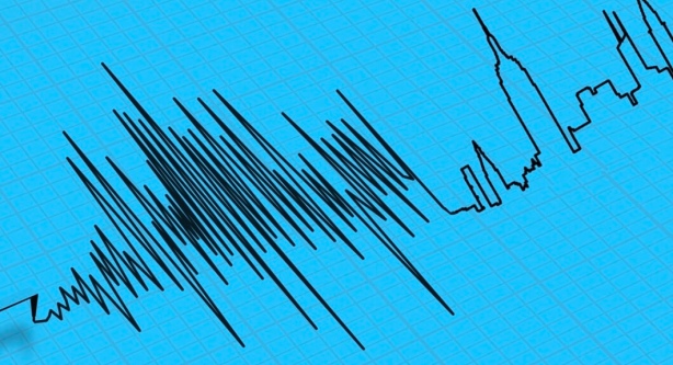
Half a million earthquakes occur worldwide each year, according to an estimate by the U.S. Geological Survey (USGS). Most are too small to rattle your teacup. But some, like the 2011 quake off the coast of Japan or last year’s disaster in Italy, can level high-rise buildings, knock out power, water and communications, and leave a lifelong legacy of trauma for those unlucky enough to be caught in them.
In the U.S., the focus is on California’s San Andreas fault, which geologists suggest has a nearly one-in-five chance of causing a major earthquake in the next three decades. But it’s not just the faults we know about that should concern us, says Kathryn Miles, author of Quakeland: On the Road to America’s Next Devastating Earthquake. As she explained when National Geographic caught up with her at her home in Portland, Maine, there’s a much larger number of faults we don’t know about—and fracking is only adding to the risks.
When it comes to earthquakes, there is really only one question everyone wants to know: When will the big one hit California?
That’s the question seismologists wish they could answer, too! One of the most shocking and surprising things for me is just how little is actually known about this natural phenomenon. The geophysicists, seismologists, and emergency managers that I spoke with are the first to say, “We just don’t know!”
What we can say is that it is relatively certain that a major earthquake will happen in California in our lifetime. We don’t know where or when. An earthquake happening east of San Diego out in the desert is going to have hugely different effects than that same earthquake happening in, say, Los Angeles. They’re both possible, both likely, but we just don’t know.
One of the things that’s important to understand about San Andreas is that it’s a fault zone. As laypeople we tend to think about it as this single crack that runs through California and if it cracks enough it’s going to dump the state into the ocean. But that’s not what’s happening here. San Andreas is a huge fault zone, which goes through very different types of geological features. As a result, very different types of earthquakes can happen in different places.
As Charles Richter, inventor of the Richter Scale, famously said, “Only fools, liars and charlatans predict earthquakes.” Why are earthquakes so hard to predict? After all, we have sent rockets into space and plumbed the depths of the ocean.
You’re right: We know far more about distant galaxies than we do about the inner workings of our planet. The problem is that seismologists can’t study an earthquake because they don’t know when or where it’s going to happen. It could happen six miles underground or six miles under the ocean, in which case they can’t even witness it. They can go back and do forensic, post-mortem work. But we still don’t know where most faults lie. We only know where a fault is after an earthquake has occurred. If you look at the last 100 years of major earthquakes in the U.S., they’ve all happened on faults we didn’t even know existed.
Earthquakes 101
Earthquakes are unpredictable and can strike with enough force to bring buildings down. Find out what causes earthquakes, why they’re so deadly, and what’s being done to help buildings sustain their hits.
Fracking is a relatively new industry. Many people believe that it can cause what are known as induced earthquakes. What’s the scientific consensus?
The scientific consensus is that a practice known as wastewater injection undeniably causes earthquakes when the geological features are conducive. In the fracking process, water and lubricants are injected into the earth to split open the rock, so oil and natural gas can be retrieved. As this happens, wastewater is also retrieved and brought back to the surface.
You Might Also Like
Different states deal with this in different ways. Some states, like Pennsylvania, favor letting the wastewater settle in aboveground pools, which can cause run-off contamination of drinking supplies. Other states, like Oklahoma, have chosen to re-inject the water into the ground. And what we’re seeing in Oklahoma is that this injection is enough to shift the pressure inside the earth’s core, so that daily earthquakes are happening in communities like Stillwater. As our technology improves, and both our ability and need to extract more resources from the earth increases, our risk of causing earthquakes will also rise exponentially.
After Fukushima, the idea of storing nuclear waste underground cannot be guaranteed to be safe. Yet President Trump has recently green-lighted new funds for the Yucca Mountain site in Nevada. Is that wise?
The issue with Fukushima was not about underground nuclear storage but it is relevant. The Tohoku earthquake, off the coast of Japan, was a massive, 9.0 earthquake—so big that it shifted the axis of the earth and moved the entire island of Japan some eight centimeters! It also created a series of tsunamis, which swamped the Fukushima nuclear power plant to a degree the designers did not believe was possible.
Here in the U.S., we have nuclear plants that are also potentially vulnerable to earthquakes and tsunamis, above all on the East Coast, like Pilgrim Nuclear, south of Boston, or Indian Point, north of New York City. Both of these have been deemed by the USGS to have an unacceptable level of seismic risk. [Both are scheduled to close in the next few years.]
Yucca Mountain is meant to address our need to store the huge amounts of nuclear waste that have been accumulating for more than 40 years. Problem number one is getting it out of these plants. We are going to have to somehow truck or train these spent fuel rods from, say, Boston, to a place like Yucca Mountain, in Nevada. On the way it will have to go through multiple earthquake zones, including New Madrid, which is widely considered to be one of the country’s most dangerous earthquake zones.
Yucca Mountain itself has had seismic activity. Ultimately, there’s no great place to put nuclear waste—and there’s no guarantee that where we do put it is going to be safe.
The psychological and emotional effects of an earthquake are especially harrowing. Why is that?
This is a fascinating and newly emerging subfield within psychology, which looks at the effects of natural disasters on both our individual and collective psyches. Whenever you experience significant trauma, you’re going to see a huge increase in PTSD, anxiety, depression, suicide, and even violent behaviors.
What seems to make earthquakes particularly pernicious is the surprise factor. A tornado will usually give people a few minutes, if not longer, to prepare; same thing with hurricanes. But that doesn’t happen with an earthquake. There is nothing but profound surprise. And the idea that the bedrock we walk and sleep upon can somehow become liquid and mobile seems to be really difficult for us to get our heads around.
Psychologists think that there are two things happening. One is a PTSD-type loop where our brain replays the trauma again and again, manifesting itself in dreams or panic attacks during the day. But there also appears to be a physiological effect as well as a psychological one. If your readers have ever been at sea for some time and then get off the ship and try to walk on dry land, they know they will look like drunkards. [Laughs] The reason for this is that the inner ear has habituated itself to the motion of the ship. We think the inner ear does something similar in the case of earthquakes, in an attempt to make sense of this strange, jarring movement.
After the Abruzzo quake in Italy, seven seismologists were actually tried and sentenced to six years in jail for failing to predict the disaster. Wouldn’t a similar threat help improve the prediction skills of American seismologists?
[Laughs] The scientific community was uniform in denouncing that action by the Italian government because, right now, earthquakes are impossible to predict. But the question of culpability is an important one. To what degree do we want to hold anyone responsible? Do we want to hold the local meteorologist responsible if he gets the weather forecast wrong? [Laughs]
What scientists say—and I don’t think this is a dodge on their parts—is, “Predicting earthquakes is the Holy Grail; it’s not going to happen in our lifetime. It may never happen.” What we can do is work on early warning systems, where we can at least give people 30 or 90 seconds to make a few quick decisive moves that could well save your life. We have failed to do that. But Mexico has had one in place for years!
There is some evidence that animals can predict earthquakes. Is there any truth to these theories?
All we know right now is anecdotal information because this is so hard to test for. We don’t know where the next earthquake is going to be so we can’t necessarily set up cameras and observe the animals there. So we have to rely on these anecdotal reports, say, of reptiles coming out of the ground prior to a quake. The one thing that was recorded here in the U.S. recently was that in the seconds before an earthquake in Oklahoma huge flocks of birds took flight. Was that coincidence? Related? We can’t draw that correlation yet.
One of the fascinating new approaches to prediction is the MyQuake app. Tell us how it works—and why it could be an especially good solution for Third World countries.
The USGS desperately wants to have it funded. The reluctance appears to be from Congress. A consortium of universities, in conjunction with the USGS, has been working on some fascinating tools. One is a dense network of seismographs that feed into a mainframe computer, which can take all the information and within nanoseconds understand that an earthquake is starting.
MyQuake is an app where you can get up to date information on what’s happening around the world. What’s fascinating is that our phones can also serve as seismographs. The same technology that knows which way your phone is facing, and whether it should show us an image in portrait or landscape, registers other kinds of movement. Scientists at UC Berkeley are looking to see if they can crowd source that information so that in places where we don’t have a lot of seismographs or measuring instruments, like New York City or Chicago or developing countries like Nepal, we can use smart phones both to record quakes and to send out early warning notices to people.
You traveled all over the U.S. for your research. Did you return home feeling safer?
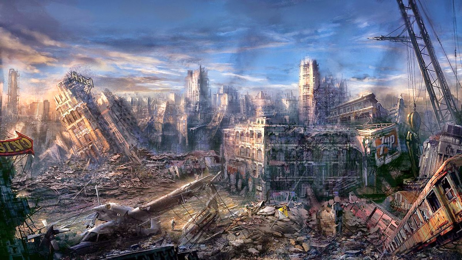
I do not feel safer in the sense that I had no idea just how much risk regions of this country face on a daily basis when it comes to seismic hazards. We tend to think of this as a West Coast problem but it’s not! It’s a New York, Memphis, Seattle, or Phoenix problem. Nearly every major urban center in this country is at risk of a measurable earthquake.
What I do feel safer about is knowing what I can do as an individual. I hope that is a major take-home message for people who read the book. There are so many things we should be doing as individuals, family members, or communities to minimize this risk: simple things from having a go-bag and an emergency plan amongst the family to larger things like building codes.
We know that a major earthquake is going to happen. It’s probably going to knock out our communications lines. Phones aren’t going to work, Wi-Fi is going to go down, first responders are not going to be able to get to people for quite some time. So it is beholden on all of us to make sure we can survive until help can get to us.
This interview was edited for length and clarity.

New York is Overdue for a Major Earthquake: The Revelation 6 Prophecy

 NEW YORK IS 40 YEARS OVERDUE A MAJOR EARTHQUAKE AND AMERICA ISN'T PROPERLY PREPARED, 'QUAKELAND' AUTHOR KATHRYN MILES TELLS TREVOR NOAH

BY TUFAYEL AHMED ON 9/27/17 AT 9:28 AM
Updated | An earthquake is long overdue to hit New York and America isn’t prepared, author and environmental theorist Kathryn Miles told Trevor Noah on Tuesday’s Daily Show.
Miles is the author of a new book, Quakeland, which investigates how imminently an earthquake is expected in the U.S. and how well-prepared the country is to handle it. The answer to those questions: Very soon and not very well.
“We know it will, that’s inevitable, but we don’t know when,” said Miles when asked when to expect another earthquake in the U.S.
She warned that New York is in serious danger of being the site of the next one, surprising considering that the West Coast sits along the San Andreas fault line.
“New York is 40 years overdue for a significant earthquake...Memphis, Seattle, Washington D.C.—it’s a national problem,” said Miles.
Miles told Noah that though the U.S. is “really good at responding to natural disasters,” like the rapid response to the hurricanes in Texas and Florida, the country and its government is, in fact, lagging behind in its ability to safeguard citizens before an earthquake hits.
“We’re really bad at the preparedness side,” Miles responded when Noah asked how the infrastructure in the U.S. compares to Mexico’s national warning system, for example.
“Whether it’s the literal infrastructure, like our roads and bridges, or the metaphoric infrastructure, like forecasting, prediction, early warning systems. Historically, we’ve underfunded those and as a result we’re way behind even developing nations on those fronts.”
Part of the problem, Miles says, is that President Donald Trump and his White House are not concerned with warning systems that could prevent the devastation of natural disasters.
“We can invest in an early warning system. That’s one thing we can definitely do. We can invest in better infrastructures, so that when the quake happens, the damage is less,” said the author.
“The scientists, the emergency managers, they have great plans in place. We have the technology for an early warning system, we have the technology for tsunami monitoring. But we don’t have a president that is currently interested in funding that, and that’s a problem.”
This article has been updated to reflect that Miles said New York is the possible site of an upcoming earthquake, and not the likeliest place to be next hit by one.

Monday, January 5, 2026

New York City Still Unprepared For The Sixth Seal (Revelation 6:12)


East Coast Earthquake Preparedness
By By BEN NUCKOLS
Posted: 08/25/2011 8:43 am EDT
WASHINGTON — There were cracks in the Washington Monument and broken capstones at the National Cathedral. In the District of Columbia suburbs, some people stayed in shelters because of structural concerns at their apartment buildings.
A day after the East Coast’s strongest earthquake in 67 years, inspectors assessed the damage and found that most problems were minor. But the shaking raised questions about whether this part of the country, with its older architecture and inexperience with seismic activity, is prepared for a truly powerful quake.
The 5.8 magnitude quake felt from Georgia north to Canada prompted swift inspections of many structures Wednesday, including bridges and nuclear plants. An accurate damage estimate could take weeks, if not longer. And many people will not be covered by insurance.
In a small Virginia city near the epicenter, the entire downtown business district was closed. School was canceled for two weeks to give engineers time to check out cracks in several buildings.
At the 555-foot Washington Monument, inspectors found several cracks in the pyramidion – the section at the top of the obelisk where it begins narrowing to a point.
A 4-foot crack was discovered Tuesday during a visual inspection by helicopter. It cannot be seen from the ground. Late Wednesday, the National Park Service announced that structural engineers had found several additional cracks inside the top of the monument.
Carol Johnson, a park service spokeswoman, could not say how many cracks were found but said three or four of them were “significant.” Two structural engineering firms that specialize in assessing earthquake damage were being brought in to conduct a more thorough inspection on Thursday.
The monument, by far the tallest structure in the nation’s capital, was to remain closed indefinitely, and Johnson said the additional cracks mean repairs are likely to take longer. It has never been damaged by a natural disaster, including earthquakes in Virginia in 1897 and New York in 1944.
Tourists arrived at the monument Wednesday morning only to find out they couldn’t get near it. A temporary fence was erected in a wide circle about 120 feet from the flags that surround its base. Walkways were blocked by metal barriers manned by security guards.
“Is it really closed?” a man asked the clerk at the site’s bookstore.
“It’s really closed,” said the clerk, Erin Nolan. Advance tickets were available for purchase, but she cautioned against buying them because it’s not clear when the monument will open.
“This is pretty much all I’m going to be doing today,” Nolan said.
Tuesday’s quake was centered about 40 miles northwest of Richmond, 90 miles south of Washington and 3.7 miles underground. In the nearby town of Mineral, Va., Michael Leman knew his Main Street Plumbing & Electrical Supply business would need – at best – serious and expensive repairs.
At worst, it could be condemned. The facade had become detached from the rest of the building, and daylight was visible through a 4- to 6-inch gap that opened between the front wall and ceiling.
“We’re definitely going to open back up,” Leman said. “I’ve got people’s jobs to look out for.”
Leman said he is insured, but some property owners might not be so lucky.
The Insurance Information Institute said earthquakes are not covered under standard U.S. homeowners or business insurance policies, although supplemental coverage is usually available.
The institute says coverage for other damage that may result from earthquakes, such as fire and water damage from burst gas or water pipes, is provided by standard homeowners and business insurance policies in most states. Cars and other vehicles with comprehensive insurance would also be protected.
The U.S. Geological Survey classified the quake as Alert Level Orange, the second-most serious category on its four-level scale. Earthquakes in that range lead to estimated losses between $100 million and $1 billion.
In Culpeper, Va., about 35 miles from the epicenter, walls had buckled at the old sanctuary at St. Stephen’s Episcopal Church, which was constructed in 1821 and drew worshippers including Confederate Gens. Robert E. Lee and J.E.B. Stuart. Heavy stone ornaments atop a pillar at the gate were shaken to the ground. A chimney from the old Culpeper Baptist Church built in 1894 also tumbled down.
At the Washington National Cathedral, spokesman Richard Weinberg said the building’s overall structure remains sound and damage was limited to “decorative elements.”
Massive stones atop three of the four spires on the building’s central tower broke off, crashing onto the roof. At least one of the spires is teetering badly, and cracks have appeared in some flying buttresses.
Repairs were expected to cost millions of dollars – an expense not covered by insurance.
“Every single portion of the exterior is carved by hand, so everything broken off is a piece of art,” Weinberg said. “It’s not just the labor, but the artistry of replicating what was once there.”
The building will remain closed as a precaution. Services to dedicate the memorial honoring Rev. Martin Luther King Jr. were moved.
Other major cities along the East Coast that felt the shaking tried to gauge the risk from another quake.
A few hours after briefly evacuating New York City Hall, Mayor Michael Bloomberg said the city’s newer buildings could withstand a more serious earthquake. But, he added, questions remain about the older buildings that are common in a metropolis founded hundreds of years ago.
“We think that the design standards of today are sufficient against any eventuality,” he said. But “there are questions always about some very old buildings. … Fortunately those tend to be low buildings, so there’s not great danger.”
An earthquake similar to the one in Virginia could do billions of dollars of damage if it were centered in New York, said Barbara Nadel, an architect who specializes in securing buildings against natural disasters and terrorism.
The city’s 49-page seismic code requires builders to prepare for significant shifting of the earth. High-rises must be built with certain kinds of bracing, and they must be able to safely sway at least somewhat to accommodate for wind and even shaking from the ground, Nadel said.
Buildings constructed in Boston in recent decades had to follow stringent codes comparable to anything in California, said Vernon Woodworth, an architect and faculty member at the Boston Architectural College. New construction on older structures also must meet tough standards to withstand severe tremors, he said.
It’s a different story with the city’s older buildings. The 18th- and 19th-century structures in Boston’s Back Bay, for instance, were often built on fill, which can liquefy in a strong quake, Woodworth said. Still, there just aren’t many strong quakes in New England.
The last time the Boston area saw a quake as powerful as the one that hit Virginia on Tuesday was in 1755, off Cape Ann, to the north. A repeat of that quake would likely cause deaths, Woodworth said. Still, the quakes are so infrequent that it’s difficult to weigh the risks versus the costs of enacting tougher building standards regionally, he said.
People in several of the affected states won’t have much time to reflect before confronting another potential emergency. Hurricane Irene is approaching the East Coast and could skirt the Mid-Atlantic region by the weekend and make landfall in New England after that.
In North Carolina, officials were inspecting an aging bridge that is a vital evacuation route for people escaping the coastal barrier islands as the storm approaches.
Speaking at an earthquake briefing Wednesday, Washington Mayor Vincent Gray inadvertently mixed up his disasters.
“Everyone knows, obviously, that we had a hurricane,” he said before realizing his mistake.
“Hurricane,” he repeated sheepishly as reporters and staffers burst into laughter. “I’m getting ahead of myself!”
___
Associated Press writers Sam Hananel in Washington; Alex Dominguez in Baltimore; Bob Lewis in Mineral, Va.; Samantha Gross in New York City; and Jay Lindsay in Boston contributed to this report.

Sunday, January 4, 2026

The History Of New York Earthquakes: Before The Sixth Seal (Revelation 6:12)


Historic Earthquakes
Near New York City, New York
1884 08 10 19:07 UTC
Magnitude 5.5The History Of New York Earthquakes: Before The Sixth Seal (Rev 6:12)
Intensity VII
USGS.gov
This severe earthquake affected an area roughly extending along the Atlantic Coast from southern Maine to central Virginia and westward to Cleveland, Ohio. Chimneys were knocked down and walls were cracked in several States, including Connecticut, New Jersey, New York, and Pennsylvania. Many towns from Hartford, Connecticut, to West Chester,Pennsylvania.
Property damage was severe at Amityville and Jamaica, New York, where several chimneys were “overturned” and large cracks formed in walls. Two chimneys were thrown down and bricks were shaken from other chimneys at Stratford (Fairfield County), Conn.; water in the Housatonic River was agitated violently. At Bloomfield, N.J., and Chester, Pa., several chimneys were downed and crockery was broken. Chimneys also were damaged at Mount Vernon, N.Y., and Allentown, Easton, and Philadelphia, Pa. Three shocks occurred, the second of which was most violent. This earthquake also was reported felt in Vermont, Virginia, and Washington, D.C. Several slight aftershocks were reported on August 11.
Teilen mit:
TwitterFacebook